< STS086-705-29 >
| NASA Photo ID | STS086-705-29 |
| Focal Length | 100mm |
| Date taken | 1997.10.02 |
| Time taken | 02:20:48 GMT |
Cloud masks available for this image:
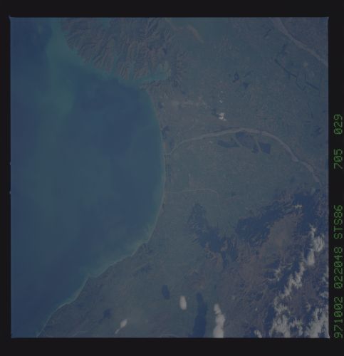
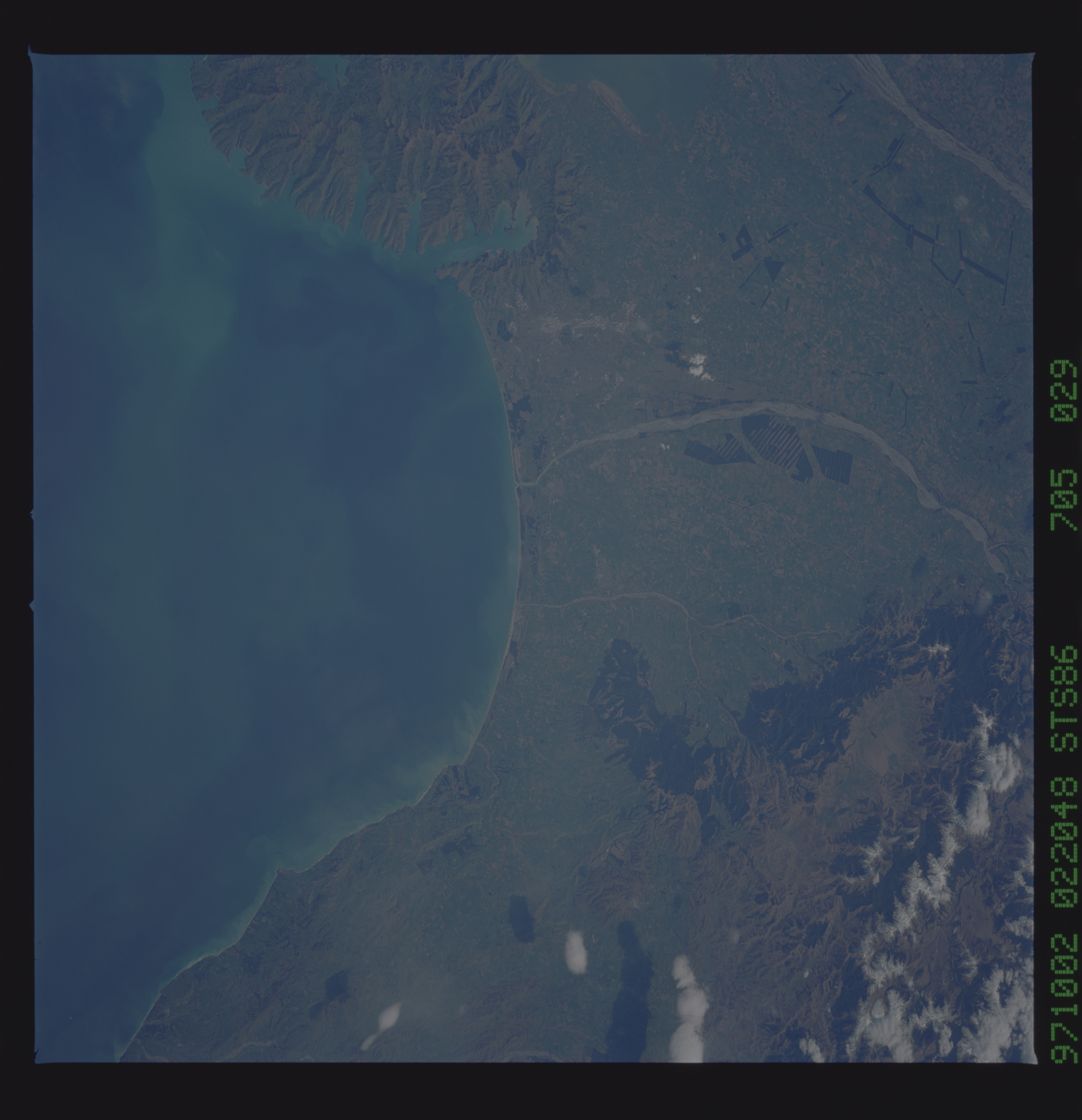
Spacecraft nadir point: 43.0° S, 175.4° E
Photo center point: 43.5° S, 173.0° E
Photo center point by machine learning:
Photo center point: 43.5° S, 173.0° E
Photo center point by machine learning:
Nadir to Photo Center: West
Spacecraft Altitude: 212 nautical miles (393km)
Country or Geographic Name: | NEW ZEALAND-SI |
Features: | PEGASUS BAY |
| Features Found Using Machine Learning: | |
Cloud Cover Percentage: | 5 (1-10)% |
Sun Elevation Angle: | 41° |
Sun Azimuth: | 314° |
Camera: | Hasselblad |
Focal Length: | 100mm |
Camera Tilt: | 35 degrees |
Format: | 5069: Kodak Elite 100S, E6 Reversal, Replaces Lumiere, Warmer in tone vs. Lumiere |
Film Exposure: | Normal |
| Additional Information | |
| Width | Height | Annotated | Cropped | Purpose | Links |
|---|---|---|---|---|---|
| 5700 pixels | 5900 pixels | No | No | Download Image Download Color Calibration Image for this Image |
|
| 483 pixels | 500 pixels | No | No | Download Image Download Color Calibration Image for this Image |
Download Packaged File
Download a Google Earth KML for this Image
View photo footprint information
No GeoTIFF is available for this photo.Image Caption: Canterbury Plain, spreading out from Christchurch. In this excellent detailed view uplifted shoreline deposits can be seen to line the coast, testifying to ongoing tectonic activity in the region. The Waimakariri and Ashley Rivers carry sediments eroded from the Southern Alps; the rate of erosion keeps pace with the rate of alpine uplift--about 10 mm per year.
