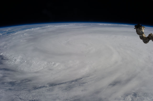
< ISS037-E-28930 >
| NASA Photo ID | ISS037-E-28930 |
| Focal Length | 50mm |
| Date taken | 2013.11.09 |
| Time taken | 07:35:10 GMT |
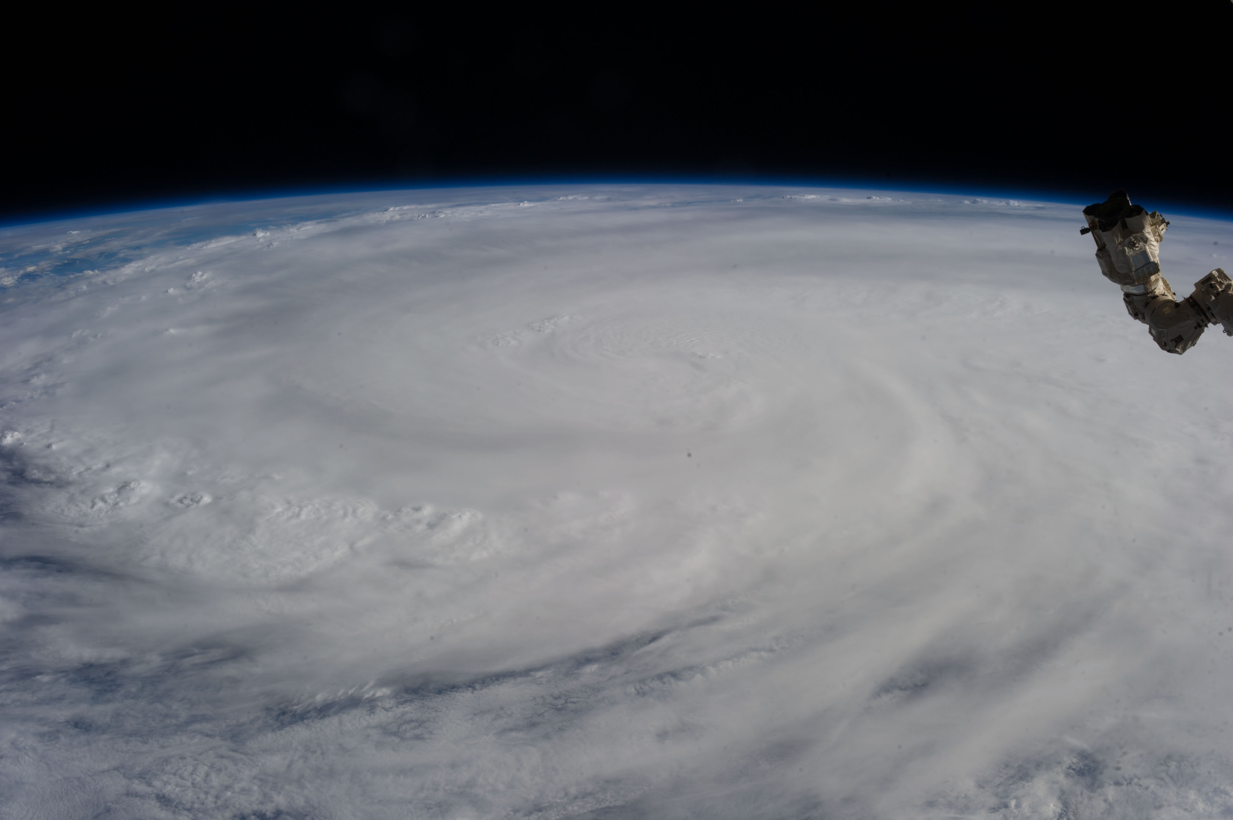

Spacecraft nadir point: 21.5° N, 108.8° E
Photo center point:
Photo center point by machine learning:
Photo center point:
Photo center point by machine learning:
Nadir to Photo Center:
Spacecraft Altitude: 223 nautical miles (413km)
Country or Geographic Name: | |
Features: | |
| Features Found Using Machine Learning: | PAN- |
Cloud Cover Percentage: | 95 (76-100)% |
Sun Elevation Angle: | 30° |
Sun Azimuth: | 234° |
Camera: | NIKON D3S S/N: 2007931 |
Focal Length: | 50mm |
Camera Tilt: | |
Format: | |
Film Exposure: | |
| Additional Information | |
| Width | Height | Annotated | Cropped | Purpose | Links |
|---|---|---|---|---|---|
| 4256 pixels | 2832 pixels | No | No | Download Image | |
| 640 pixels | 426 pixels | No | No | Download Image |
Download Packaged File
Download a Google Earth KML for this Image
View photo footprint information
No GeoTIFF is available for this photo.Image Caption: ISS037-E-028930 (9 Nov. 2013) --- When one of the Expedition 37 crew members aboard the International Space Station took this photograph on Nov. 9, 2013, Typhoon Haiyan had already made landfall and was rapidly weakening over the west-central Philippines, with winds estimated at 110 miles per hour and estimated position near 15.0 degrees north latitude and 112.3 degrees east longitude.
