< STS087-722-27 >

| NASA Photo ID | STS087-722-27 |
| Focal Length | 100mm |
| Date taken | 1997.11.27 |
| Time taken | 07:44:21 GMT |
Cloud masks available for this image:
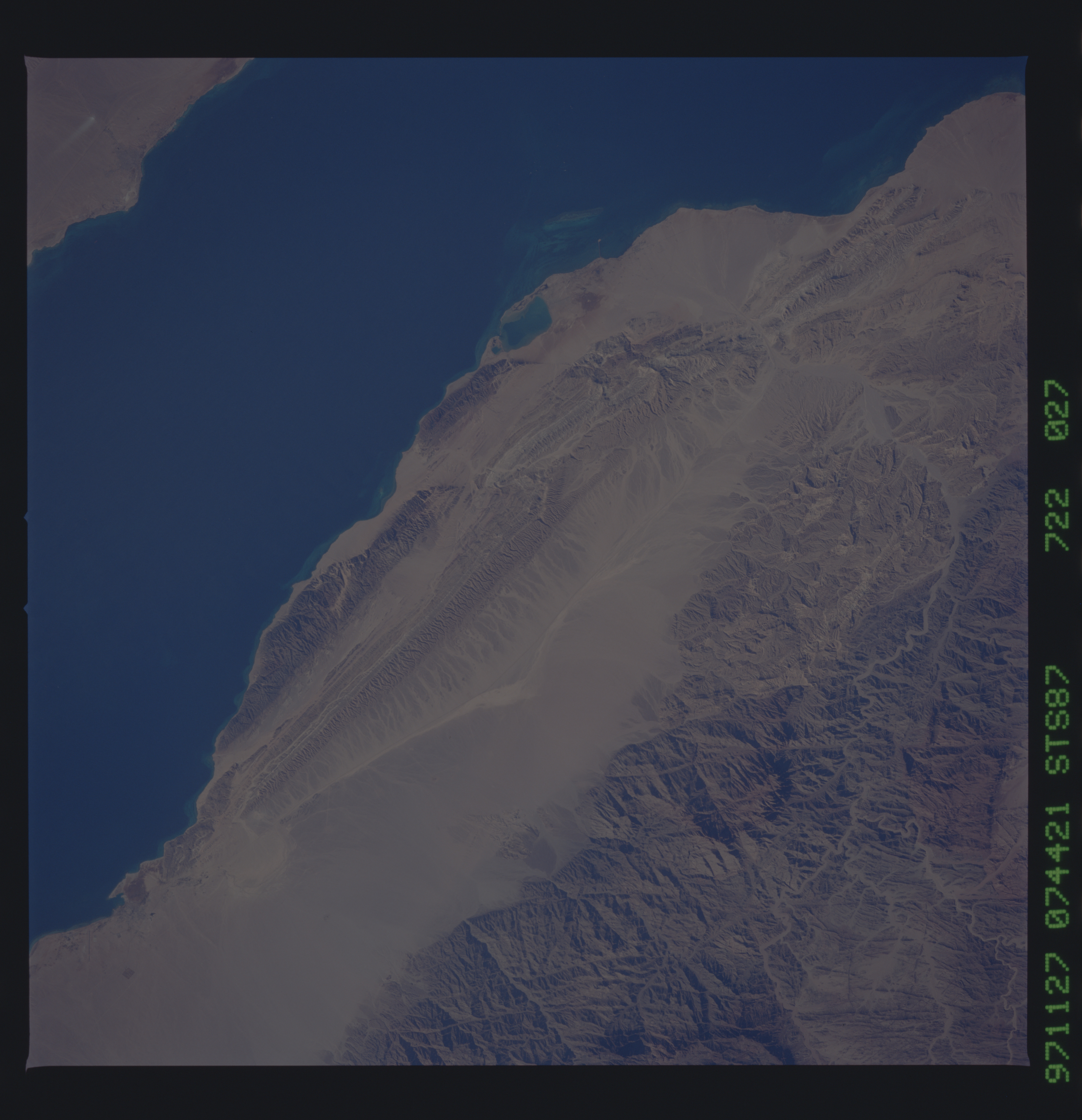
Spacecraft nadir point: 28.5° N, 31.2° E
Photo center point: 28.5° N, 33.5° E
Photo center point by machine learning:
Photo center point: 28.5° N, 33.5° E
Photo center point by machine learning:
Nadir to Photo Center: East
Spacecraft Altitude: 150 nautical miles (278km)
Country or Geographic Name: | EGYPT |
Features: | GULF OF SUEZ |
| Features Found Using Machine Learning: | |
Cloud Cover Percentage: | 0 (no clouds present) |
Sun Elevation Angle: | 33° |
Sun Azimuth: | 147° |
Camera: | Hasselblad |
Focal Length: | 100mm |
Camera Tilt: | 43 degrees |
Format: | 5069: Kodak Elite 100S, E6 Reversal, Replaces Lumiere, Warmer in tone vs. Lumiere |
Film Exposure: | Normal |
| Additional Information | |
| Width | Height | Annotated | Cropped | Purpose | Links |
|---|---|---|---|---|---|
| 5700 pixels | 5900 pixels | No | No | Download Image Download Color Calibration Image for this Image |
|
| 483 pixels | 500 pixels | No | No | Download Image Download Color Calibration Image for this Image |
Download Packaged File
Download a Google Earth KML for this Image
View photo footprint information
No GeoTIFF is available for this photo.Image Caption: Red Sea coast, Sinai Peninsula. Fine photo of the fault-bounded block that extends from Gebel Ikma to Gebel Abu Huswa, along the western margin of the Sinai Peninsula. The dominant north-northwesterly faults related to opening of the Gulf of Suez are clearly displayed, as are other fault sets trending north and west, which appear to be truncated by the NNW rift faults.
