< STS080-733-27 >
| NASA Photo ID | STS080-733-27 |
| Focal Length | 250mm |
| Date taken | 1996.11.30 |
| Time taken | 05:51:43 GMT |

Cloud masks available for this image:
Spacecraft nadir point: 28.4° N, 53.5° E
Photo center point: 29.0° N, 53.5° E
Photo center point by machine learning:
Photo center point: 29.0° N, 53.5° E
Photo center point by machine learning:
Nadir to Photo Center: North
Spacecraft Altitude: 186 nautical miles (344km)
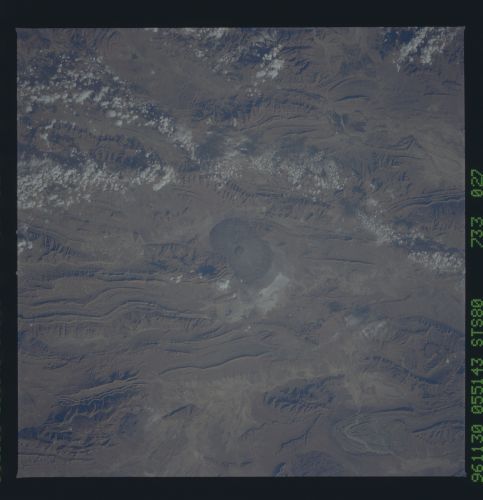
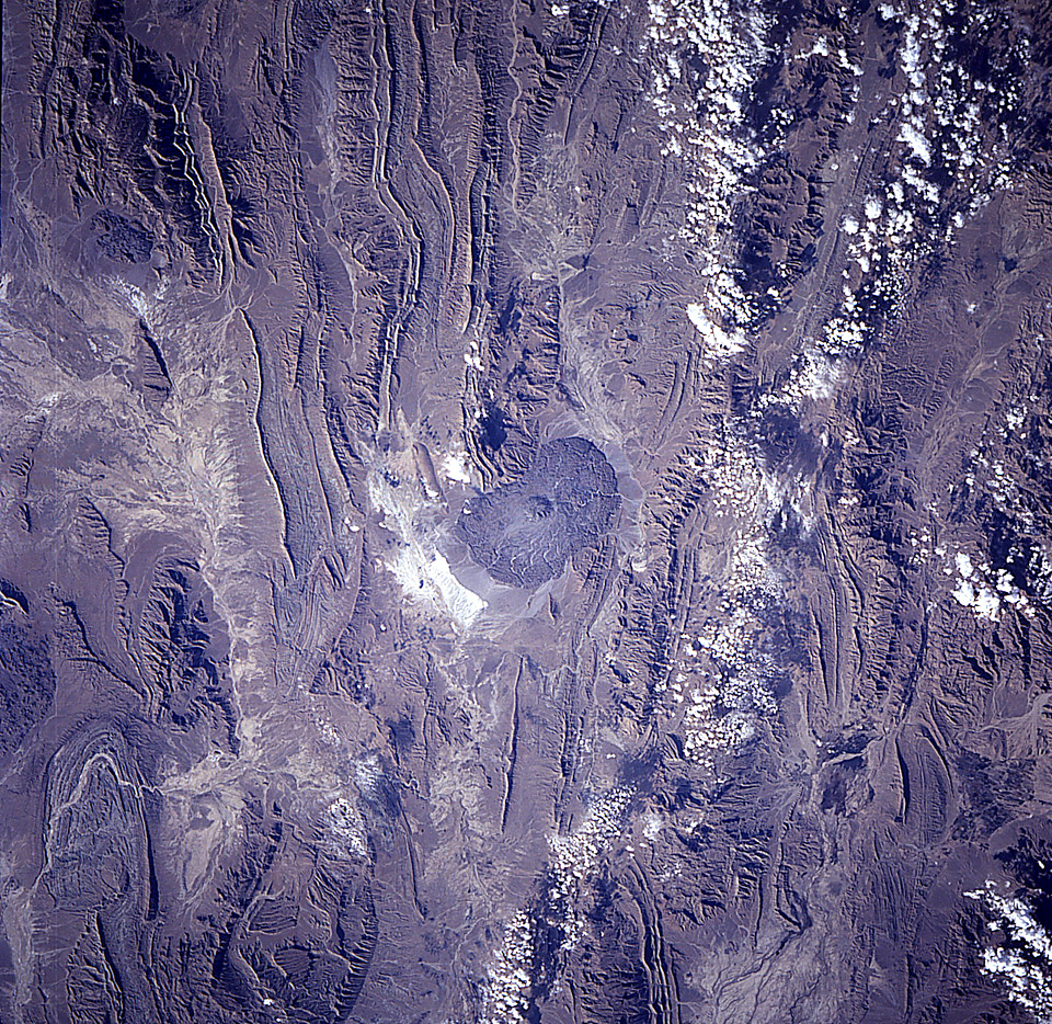
Country or Geographic Name: | IRAN |
Features: | KHARMAN MOUNTAIN |
| Features Found Using Machine Learning: | |
Cloud Cover Percentage: | 10 (1-10)% |
Sun Elevation Angle: | 29° |
Sun Azimuth: | 141° |
Camera: | Hasselblad |
Focal Length: | 250mm |
Camera Tilt: | 11 degrees |
Format: | 5046: Kodak, natural color positive, Lumiere 100/5046, ASA 100, standard base |
Film Exposure: | Normal |
| Additional Information | |
| Width | Height | Annotated | Cropped | Purpose | Links |
|---|---|---|---|---|---|
| 5700 pixels | 5900 pixels | No | No | Download Image Download Color Calibration Image for this Image |
|
| 483 pixels | 500 pixels | No | No | Download Image Download Color Calibration Image for this Image |
|
| 960 pixels | 934 pixels | No | No | Download Image |
Download Packaged File
Download a Google Earth KML for this Image
View photo footprint information
No GeoTIFF is available for this photo.Image Caption: Salt dome and glacier, southern Iran. With a slab of caprock preserved on top, this salt dome has breached the land surface. Gravitational force is sufficient to induce downslope flow of rock salt to produce salt glaciers, such as that seen here.
