< STS068-150-27 >
| NASA Photo ID | STS068-150-27 |
| Focal Length | 250mm |
| Date taken | 1994.09.30 |
| Time taken | 22:08:13 GMT |
Cloud masks available for this image:
Spacecraft nadir point: 35.9° N, 113.3° W
Photo center point: 34.5° N, 114.5° W
Photo center point by machine learning:
Photo center point: 34.5° N, 114.5° W
Photo center point by machine learning:
Nadir to Photo Center: Southwest
Spacecraft Altitude: 118 nautical miles (219km)
Country or Geographic Name: | USA-CALIFORNIA |
Features: | COLORADO R, LAKE HAVASU |
| Features Found Using Machine Learning: | |
Cloud Cover Percentage: | 0 (no clouds present) |
Sun Elevation Angle: | 35° |
Sun Azimuth: | 234° |
Camera: | Hasselblad |
Focal Length: | 250mm |
Camera Tilt: | 43 degrees |
Format: | 5046: Kodak, natural color positive, Lumiere 100/5046, ASA 100, standard base |
Film Exposure: | Normal |
| Additional Information | |
| Width | Height | Annotated | Cropped | Purpose | Links |
|---|---|---|---|---|---|
| 5184 pixels | 4096 pixels | No | No | Earth From Space collection | Download Image |
| 640 pixels | 505 pixels | No | No | Earth From Space collection | Download Image |
| 640 pixels | 480 pixels | No | No | ISD 1 | Download Image |
Download Packaged File
Download a Google Earth KML for this Image
View photo footprint information
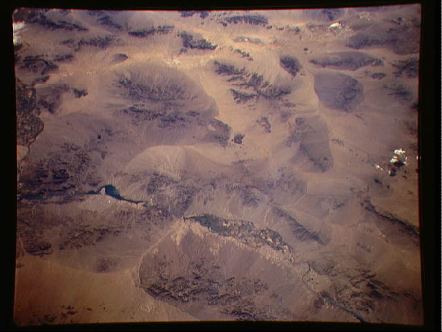
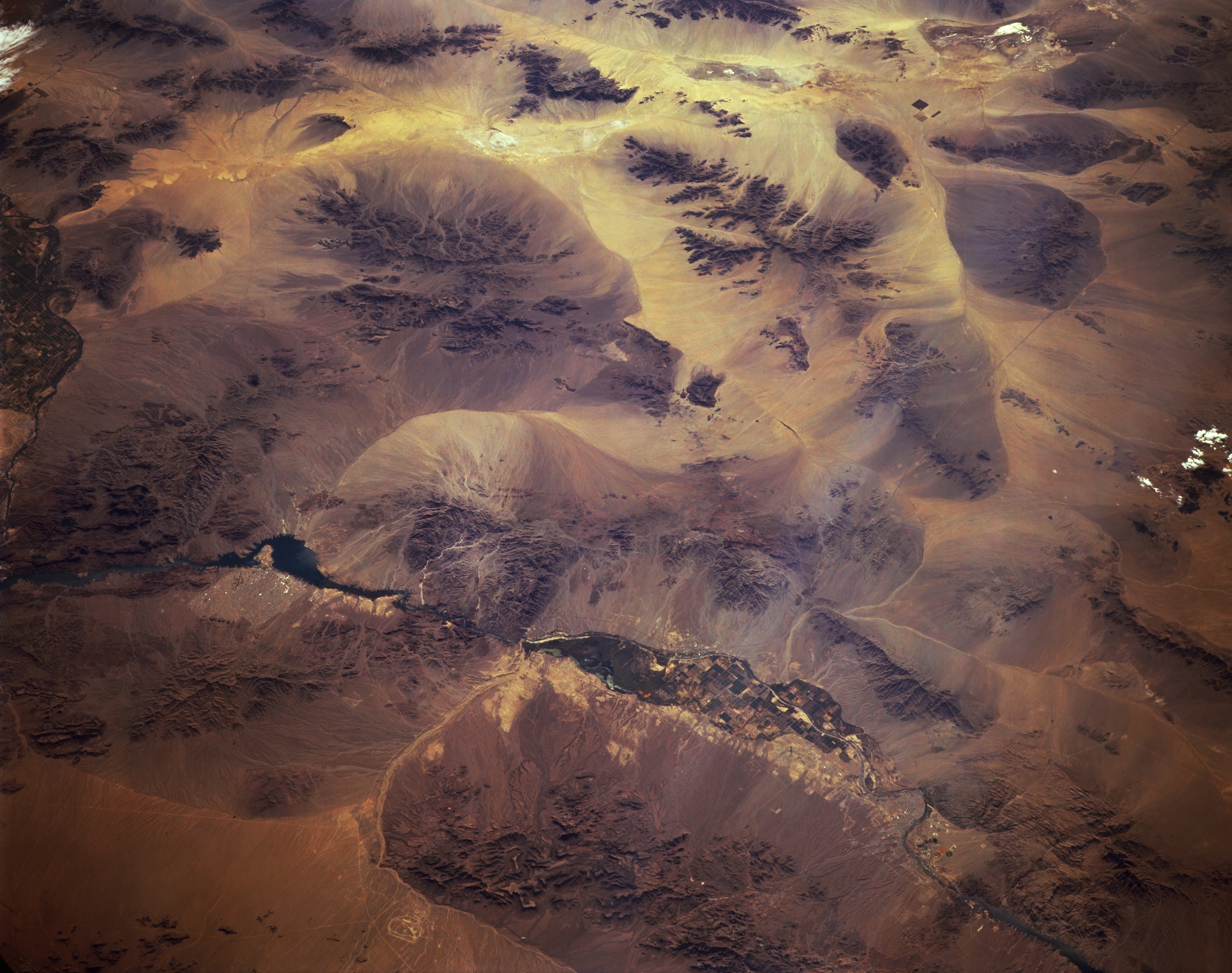
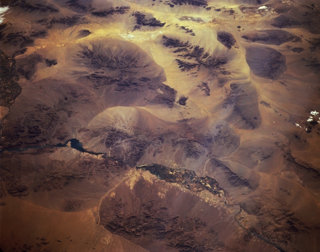
No GeoTIFF is available for this photo.Image Caption: STS068-150-027 Colorado River, Arizona, U.S.A. October 1994
A section of the Colorado River from north of Davis Dam to southwest of Parker Dam, an extensive area of the southwestern United States desert for which the Colorado River supplies much moisture, is featured in this photograph. Cultivated field patterns are visible north of Lake Havasu, where the width of the Colorado River floodplain is sufficient for agriculture. The two imposing mountain ranges on the California side of the Colorado River are the Whipple Mountains and Turtle Mountains. The Black Mountains, visible at the bottom center of the photograph, presented a highway engineering obstacle: Interstate Highway 40, which follows the route of the light, narrow, linear valley between the Black Mountains and the Mohave Mountains to the south, was required to make a loop around the southern end of the mountains. Three distinctive dry lakes near the top of the photograph are, from east to west, Danby, Cadiz, and Bristol.
A section of the Colorado River from north of Davis Dam to southwest of Parker Dam, an extensive area of the southwestern United States desert for which the Colorado River supplies much moisture, is featured in this photograph. Cultivated field patterns are visible north of Lake Havasu, where the width of the Colorado River floodplain is sufficient for agriculture. The two imposing mountain ranges on the California side of the Colorado River are the Whipple Mountains and Turtle Mountains. The Black Mountains, visible at the bottom center of the photograph, presented a highway engineering obstacle: Interstate Highway 40, which follows the route of the light, narrow, linear valley between the Black Mountains and the Mohave Mountains to the south, was required to make a loop around the southern end of the mountains. Three distinctive dry lakes near the top of the photograph are, from east to west, Danby, Cadiz, and Bristol.
