< STS047-74-27 >
| NASA Photo ID | STS047-74-27 |
| Focal Length | 250mm |
| Date taken | 1992.09.18 |
| Time taken | 07:56:22 GMT |
Resolutions offered for this image:
4096 x 4096 pixels 640 x 640 pixels 5700 x 6000 pixels 500 x 526 pixels 640 x 480 pixels 516 x 515 pixels
4096 x 4096 pixels 640 x 640 pixels 5700 x 6000 pixels 500 x 526 pixels 640 x 480 pixels 516 x 515 pixels

Cloud masks available for this image:
Spacecraft nadir point: 48.6° N, 11.8° E
Photo center point: 47.5° N, 11.5° E
Photo center point by machine learning:
Photo center point: 47.5° N, 11.5° E
Photo center point by machine learning:
Nadir to Photo Center: South
Spacecraft Altitude: 168 nautical miles (311km)
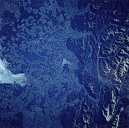
Country or Geographic Name: | GERMANY |
Features: | STARNBERGER LAKE, ALPS |
| Features Found Using Machine Learning: | |
Cloud Cover Percentage: | 10 (1-10)% |
Sun Elevation Angle: | 29° |
Sun Azimuth: | 123° |
Camera: | Hasselblad |
Focal Length: | 250mm |
Camera Tilt: | 22 degrees |
Format: | VELVI: Fuji, natural color positive, Velvia 50, CS 135-36, ASA 32, standard base |
Film Exposure: | Under Exposed |
| Additional Information | |
| Width | Height | Annotated | Cropped | Purpose | Links |
|---|---|---|---|---|---|
| 4096 pixels | 4096 pixels | No | No | Earth From Space collection | Download Image |
| 640 pixels | 640 pixels | No | No | Earth From Space collection | Download Image |
| 5700 pixels | 6000 pixels | No | No | Download Image Download Color Calibration Image for this Image |
|
| 500 pixels | 526 pixels | No | No | Download Image Download Color Calibration Image for this Image |
|
| 640 pixels | 480 pixels | No | No | Download Image | |
| 516 pixels | 515 pixels | No | No | Download Image |
Download Packaged File
Download a Google Earth KML for this Image
View photo footprint information
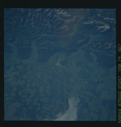
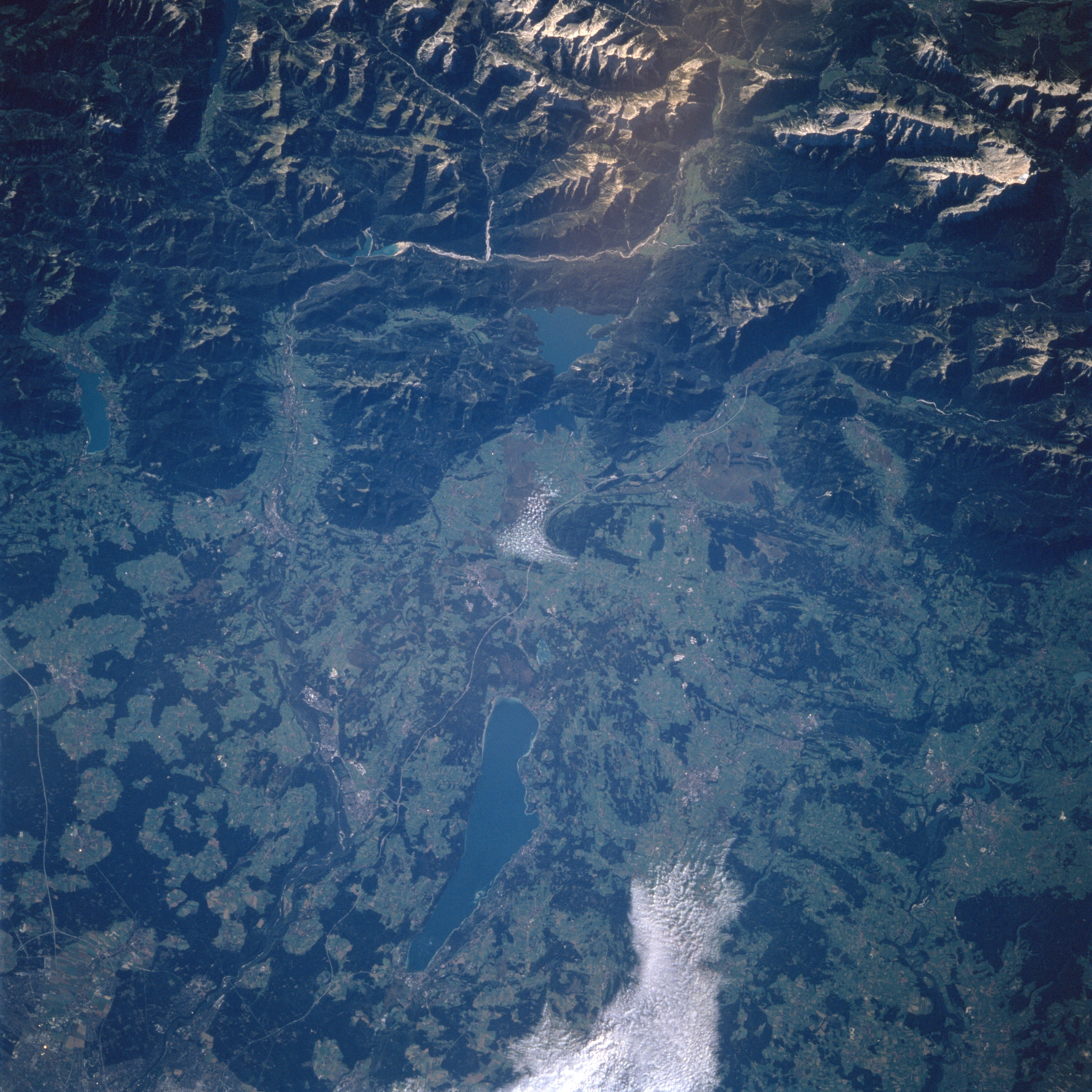
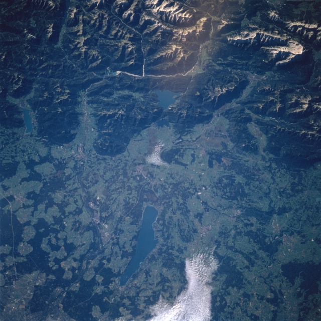
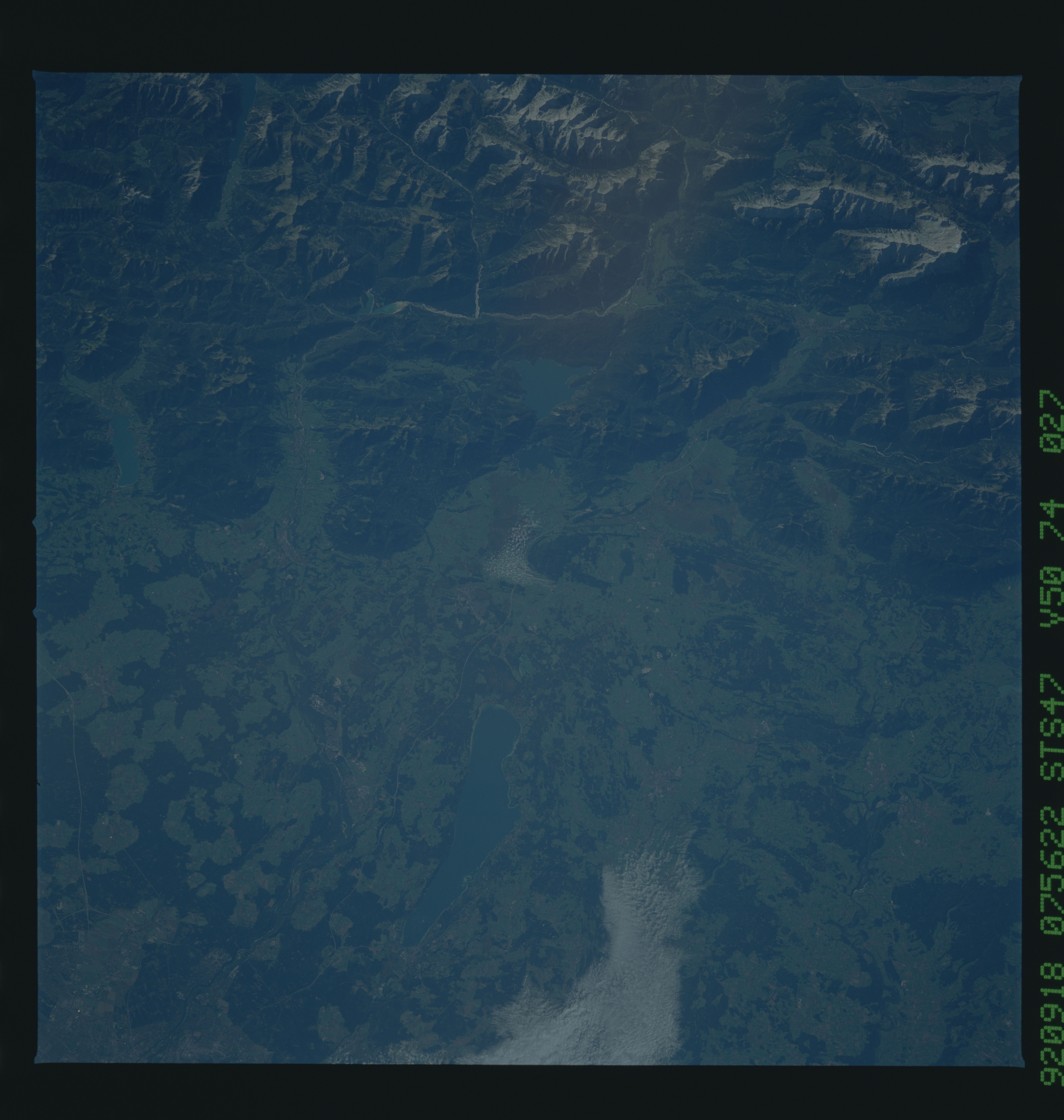
No GeoTIFF is available for this photo.Image Caption: STS047-074-027 Starnberger Lake, Bavarian Alps, Germany September 1992
Located midway between the bottom center and center of the image in the rolling landscape of southern Bavaria, is Starnberger Lake. The recreational lake is 15 miles (24 km) south-southwest of Munich (lower left on the image), and is 12 miles (19 km) long with a maximum width of 3 miles (5 km). To the lake's south are the rugged and beautiful snow-capped Bavarian Alps (top portion of the image).
Located midway between the bottom center and center of the image in the rolling landscape of southern Bavaria, is Starnberger Lake. The recreational lake is 15 miles (24 km) south-southwest of Munich (lower left on the image), and is 12 miles (19 km) long with a maximum width of 3 miles (5 km). To the lake's south are the rugged and beautiful snow-capped Bavarian Alps (top portion of the image).
