STS044-75-27

| NASA Photo ID | STS044-75-27 |
| Focal Length | 250mm |
| Date taken | 1991.12.01 |
| Time taken | 11:41:15 GMT |
Resolutions offered for this image:
5208 x 5208 pixels 1000 x 1000 pixels 639 x 639 pixels 540 x 540 pixels 5700 x 6000 pixels 500 x 526 pixels 640 x 480 pixels
5208 x 5208 pixels 1000 x 1000 pixels 639 x 639 pixels 540 x 540 pixels 5700 x 6000 pixels 500 x 526 pixels 640 x 480 pixels


Cloud masks available for this image:
Spacecraft nadir point: 28.5° N, 48.1° E
Photo center point: 29.0° N, 48.0° E
Photo center point by machine learning:
Photo center point: 29.0° N, 48.0° E
Photo center point by machine learning:
Nadir to Photo Center: North
Spacecraft Altitude: 198 nautical miles (367km)
Country or Geographic Name: | KUWAIT |
Features: | OIL FIELDS/PERSIAN GULF |
| Features Found Using Machine Learning: | |
Cloud Cover Percentage: | 0 (no clouds present) |
Sun Elevation Angle: | -1° |
Sun Azimuth: | 246° |
Camera: | Hasselblad |
Focal Length: | 250mm |
Camera Tilt: | 9 degrees |
Format: | 5017: Kodak, natural color positive, Ektachrome, X Professional, ASA 64, standard base |
Film Exposure: | Normal |
| Additional Information | |
| Width | Height | Annotated | Cropped | Purpose | Links |
|---|---|---|---|---|---|
| 5208 pixels | 5208 pixels | No | No | Earth From Space collection | Download Image |
| 1000 pixels | 1000 pixels | No | Yes | Earth From Space collection | Download Image |
| 639 pixels | 639 pixels | No | No | Earth From Space collection | Download Image |
| 540 pixels | 540 pixels | No | Yes | Earth From Space collection | Download Image |
| 5700 pixels | 6000 pixels | No | No | Download Image | |
| 500 pixels | 526 pixels | No | No | Download Image | |
| 640 pixels | 480 pixels | No | No | Download Image |
Download Packaged File
Download a Google Earth KML for this Image
View photo footprint information
Download a GeoTIFF for this photo
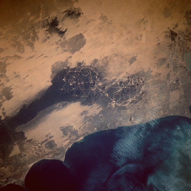
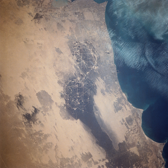
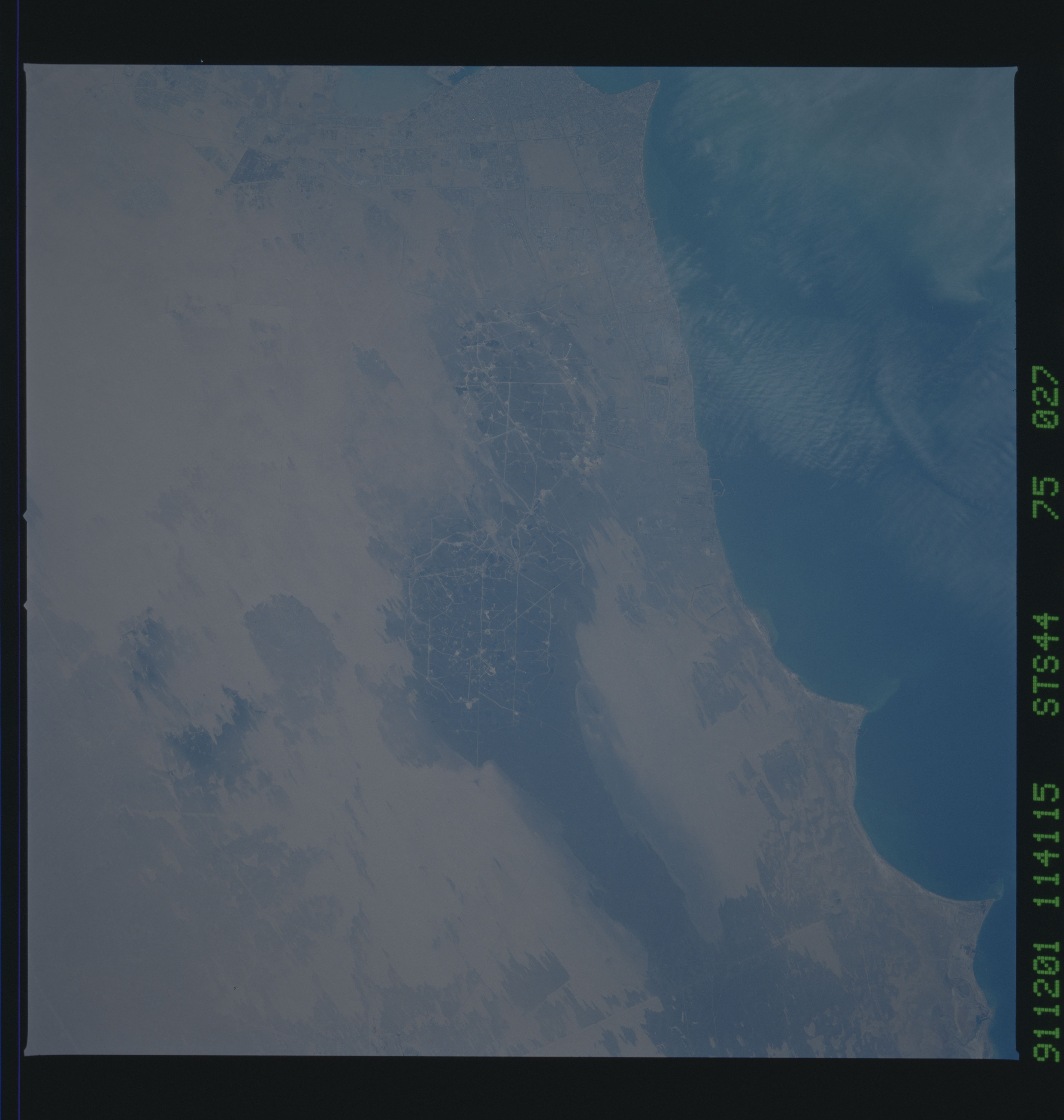
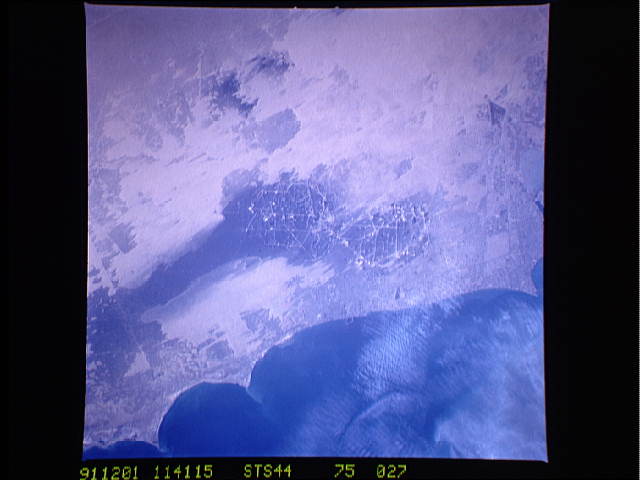
Image Caption: STS044-75-27 Oil Well Fire Residue, Kuwait November 1991
This near-vertical photograph of southern Kuwait, taken nine months after the oil well fires of Desert Storm were ignited, shows the environmental devastation in the area immediately south of Kuwait City. The black and dark gray areas of the Alburoan Oil Field (large oil field in the center of the photograph) and the smaller Umm Gudair Oil Field to the west show the extent and pattern of environmental degradation caused by the smoke residue from the oil well fires. The interconnected roads and tiny, highly reflective, circular well heads within the Alburoan Field are easily discernible. The prevailing northwest wind direction is easily determined by the orientation of the oil residue stain on the desert and the alignment of the dual airport runways of Kuwait International Airport north of Alburoan and south of Kuwait City. Ground transportation features, such as roads, highways, and grid street patterns, are visible in Kuwait City along the northern edge of the photograph.
This near-vertical photograph of southern Kuwait, taken nine months after the oil well fires of Desert Storm were ignited, shows the environmental devastation in the area immediately south of Kuwait City. The black and dark gray areas of the Alburoan Oil Field (large oil field in the center of the photograph) and the smaller Umm Gudair Oil Field to the west show the extent and pattern of environmental degradation caused by the smoke residue from the oil well fires. The interconnected roads and tiny, highly reflective, circular well heads within the Alburoan Field are easily discernible. The prevailing northwest wind direction is easily determined by the orientation of the oil residue stain on the desert and the alignment of the dual airport runways of Kuwait International Airport north of Alburoan and south of Kuwait City. Ground transportation features, such as roads, highways, and grid street patterns, are visible in Kuwait City along the northern edge of the photograph.
