< STS046-78-26 >
| NASA Photo ID | STS046-78-26 |
| Focal Length | 250mm |
| Date taken | 1992.08.02 |
| Time taken | 19:10:34 GMT |
Resolutions offered for this image:
5275 x 5222 pixels 639 x 633 pixels 5700 x 6000 pixels 500 x 526 pixels 640 x 480 pixels
5275 x 5222 pixels 639 x 633 pixels 5700 x 6000 pixels 500 x 526 pixels 640 x 480 pixels

Cloud masks available for this image:
Spacecraft nadir point: 11.7° S, 61.8° W
Photo center point:
Photo center point by machine learning:
Photo center point:
Photo center point by machine learning:
Nadir to Photo Center:
Spacecraft Altitude: 232 nautical miles (430km)
Camera: | Hasselblad |
Focal Length: | 250mm |
Camera Tilt: | Low Oblique |
Format: | 5017: Kodak, natural color positive, Ektachrome, X Professional, ASA 64, standard base |
Film Exposure: | Normal |
| Additional Information | |
| Width | Height | Annotated | Cropped | Purpose | Links |
|---|---|---|---|---|---|
| 5275 pixels | 5222 pixels | No | No | Earth From Space collection | Download Image |
| 639 pixels | 633 pixels | No | No | Earth From Space collection | Download Image |
| 5700 pixels | 6000 pixels | No | No | Download Image Download Color Calibration Image for this Image |
|
| 500 pixels | 526 pixels | No | No | Download Image Download Color Calibration Image for this Image |
|
| 640 pixels | 480 pixels | No | No | Download Image |
Download Packaged File
Download a Google Earth KML for this Image
View photo footprint information
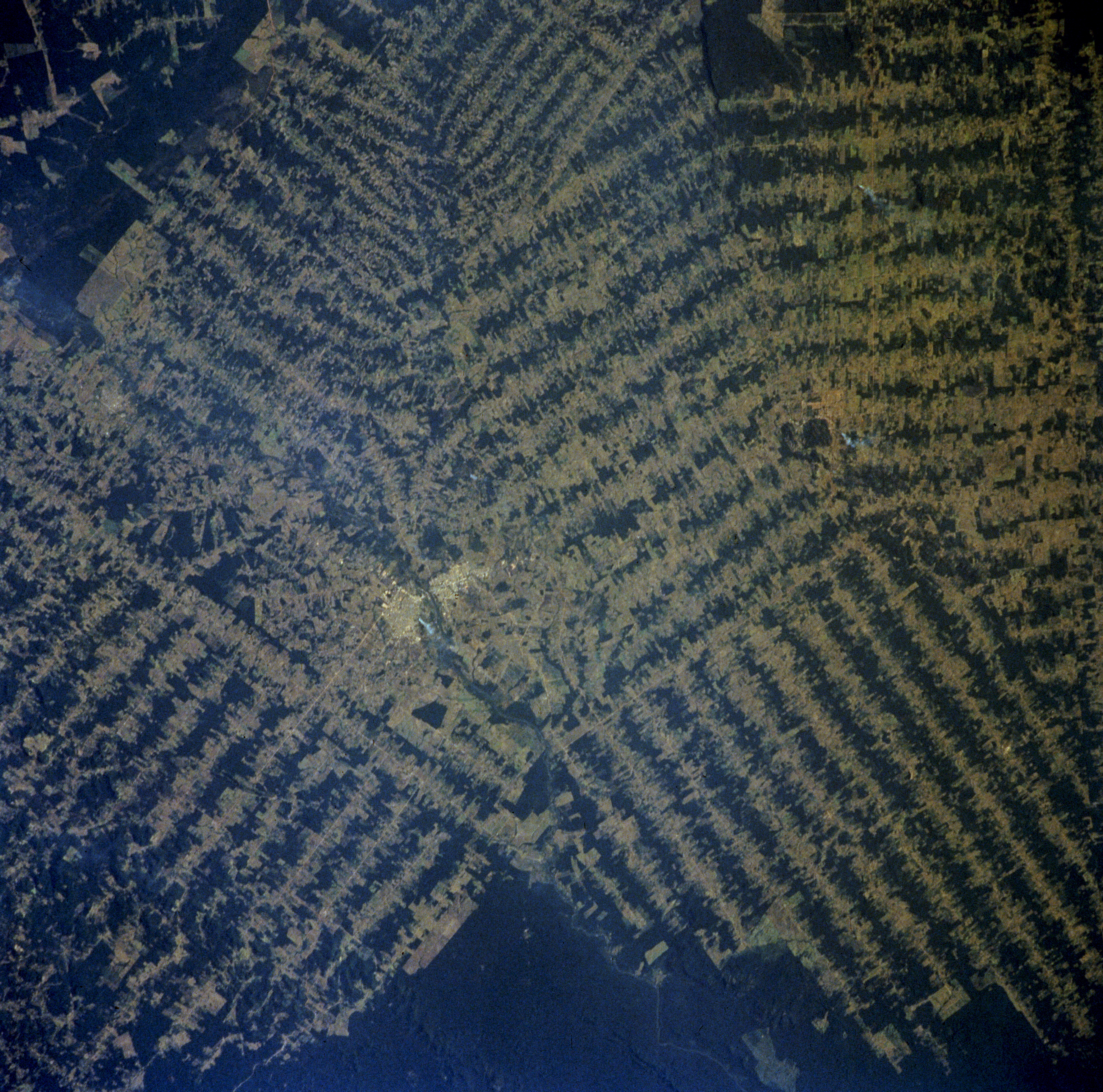
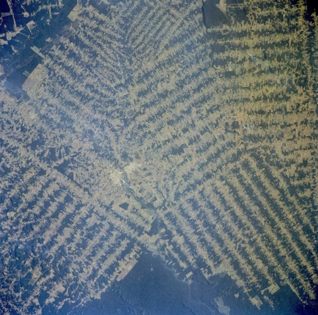
No GeoTIFF is available for this photo.Image Caption: STS046-078-026 Rondônia, Brazil August 1992
This photograph, showing the destruction of tropical rain forests, provides a visual indication of the rate of deforestation that is taking place in the state of Rondônia, which has been especially hard hit by deforestation. The amount of clear-cut area now exceeds the area of remaining rain forest timber stands. The solid dark green areas show the remaining tropical rain forest canopy. Two urban areas separated by a small river can be seen near the center of the photograph. This photograph and photograph STS-51G-034-0060, taken 7 years earlier, are representative of much larger areas where tropical rain forests are being decimated to permit farming and grazing in Brazil, Central America, Africa, Asia, and Australia.
This photograph, showing the destruction of tropical rain forests, provides a visual indication of the rate of deforestation that is taking place in the state of Rondônia, which has been especially hard hit by deforestation. The amount of clear-cut area now exceeds the area of remaining rain forest timber stands. The solid dark green areas show the remaining tropical rain forest canopy. Two urban areas separated by a small river can be seen near the center of the photograph. This photograph and photograph STS-51G-034-0060, taken 7 years earlier, are representative of much larger areas where tropical rain forests are being decimated to permit farming and grazing in Brazil, Central America, Africa, Asia, and Australia.
