< STS102-716-25 >

| NASA Photo ID | STS102-716-25 |
| Focal Length | 250mm |
| Date taken | 2001.03.15 |
| Time taken | 10:29:55 GMT |
Resolutions offered for this image:
1000 x 950 pixels 540 x 513 pixels 540 x 441 pixels 540 x 418 pixels 1031 x 1024 pixels 2063 x 2048 pixels 4127 x 4096 pixels 5700 x 5900 pixels 515 x 512 pixels 483 x 500 pixels 539 x 440 pixels
1000 x 950 pixels 540 x 513 pixels 540 x 441 pixels 540 x 418 pixels 1031 x 1024 pixels 2063 x 2048 pixels 4127 x 4096 pixels 5700 x 5900 pixels 515 x 512 pixels 483 x 500 pixels 539 x 440 pixels


Cloud masks available for this image:
Spacecraft nadir point: 24.0° N, 30.2° E
Photo center point: 22.5° N, 31.0° E
Photo center point by machine learning:
Photo center point: 22.5° N, 31.0° E
Photo center point by machine learning:
Nadir to Photo Center: Southeast
Spacecraft Altitude: 200 nautical miles (370km)
Country or Geographic Name: | EGYPT |
Features: | TOSHKA LAKES |
| Features Found Using Machine Learning: | |
Cloud Cover Percentage: | 10 (1-10)% |
Sun Elevation Angle: | 64° |
Sun Azimuth: | 192° |
Camera: | Hasselblad |
Focal Length: | 250mm |
Camera Tilt: | 27 degrees |
Format: | 5069: Kodak Elite 100S, E6 Reversal, Replaces Lumiere, Warmer in tone vs. Lumiere |
Film Exposure: | |
| Additional Information | |
| Width | Height | Annotated | Cropped | Purpose | Links |
|---|---|---|---|---|---|
| 1000 pixels | 950 pixels | No | Yes | Earth From Space collection | Download Image |
| 540 pixels | 513 pixels | Yes | Yes | Earth From Space collection | Download Image |
| 540 pixels | 441 pixels | Yes | Yes | NASA's Earth Observatory web site | Download Image |
| 540 pixels | 418 pixels | Yes | Yes | NASA's Earth Observatory web site | Download Image |
| 1031 pixels | 1024 pixels | No | No | Download Image | |
| 2063 pixels | 2048 pixels | No | No | Download Image | |
| 4127 pixels | 4096 pixels | No | No | Download Image | |
| 5700 pixels | 5900 pixels | No | No | Download Image Download Color Calibration Image for this Image |
|
| 515 pixels | 512 pixels | No | No | Download Image | |
| 483 pixels | 500 pixels | No | No | Download Image Download Color Calibration Image for this Image |
|
| 539 pixels | 440 pixels | Yes | Photographic Highlights | Download Image |
Download Packaged File
Download a Google Earth KML for this Image
View photo footprint information
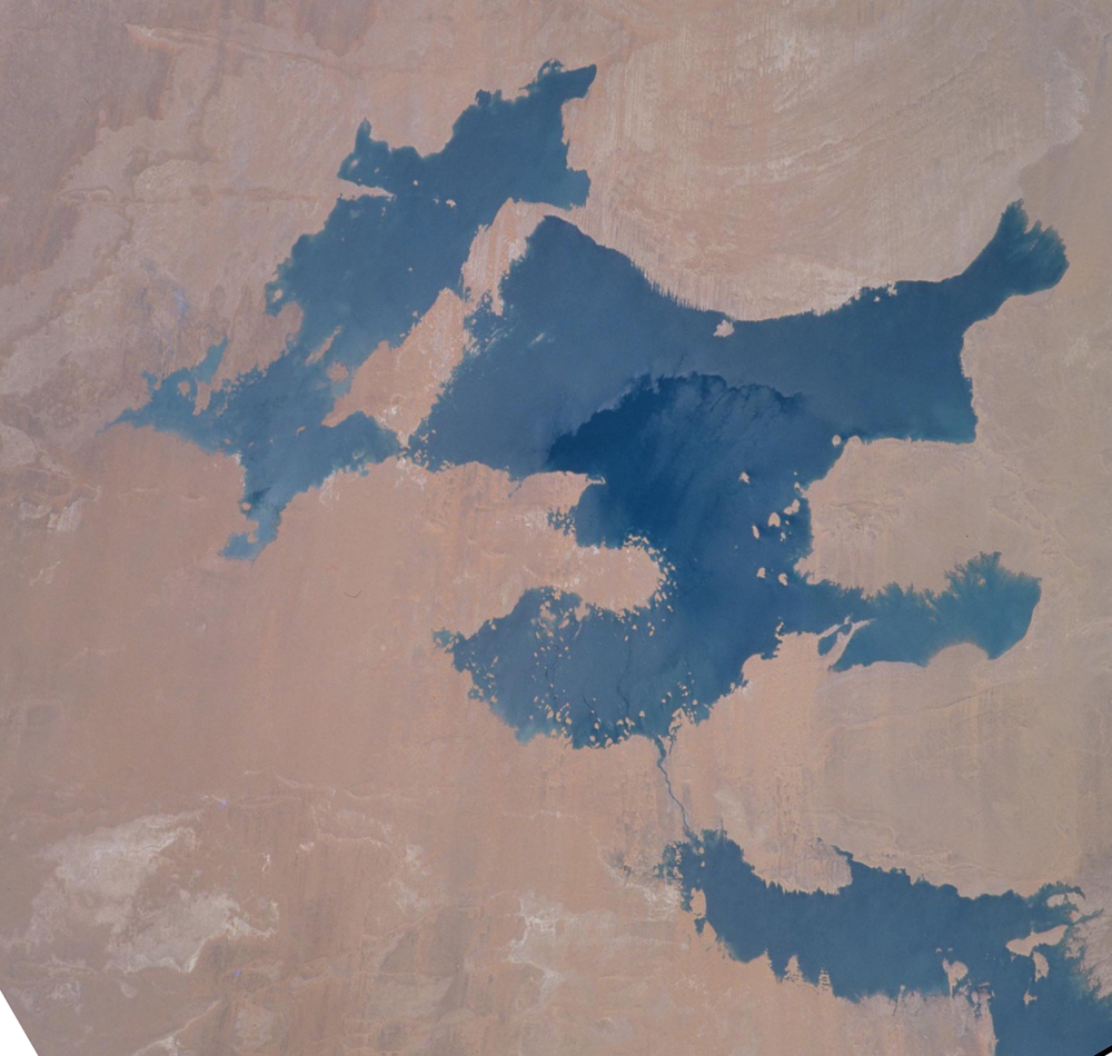
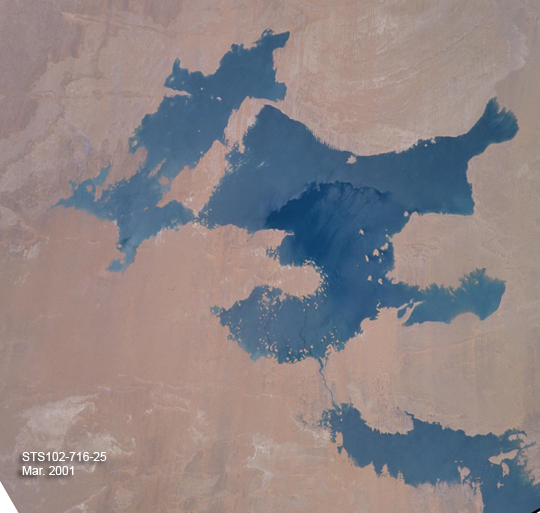
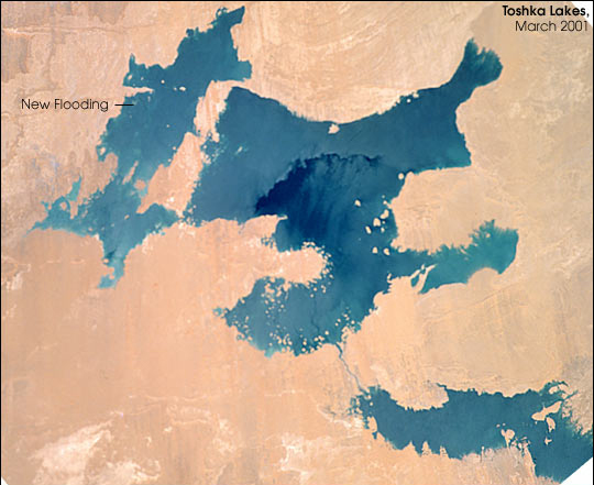
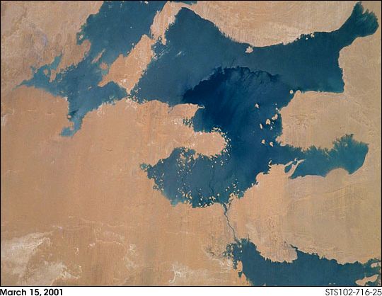
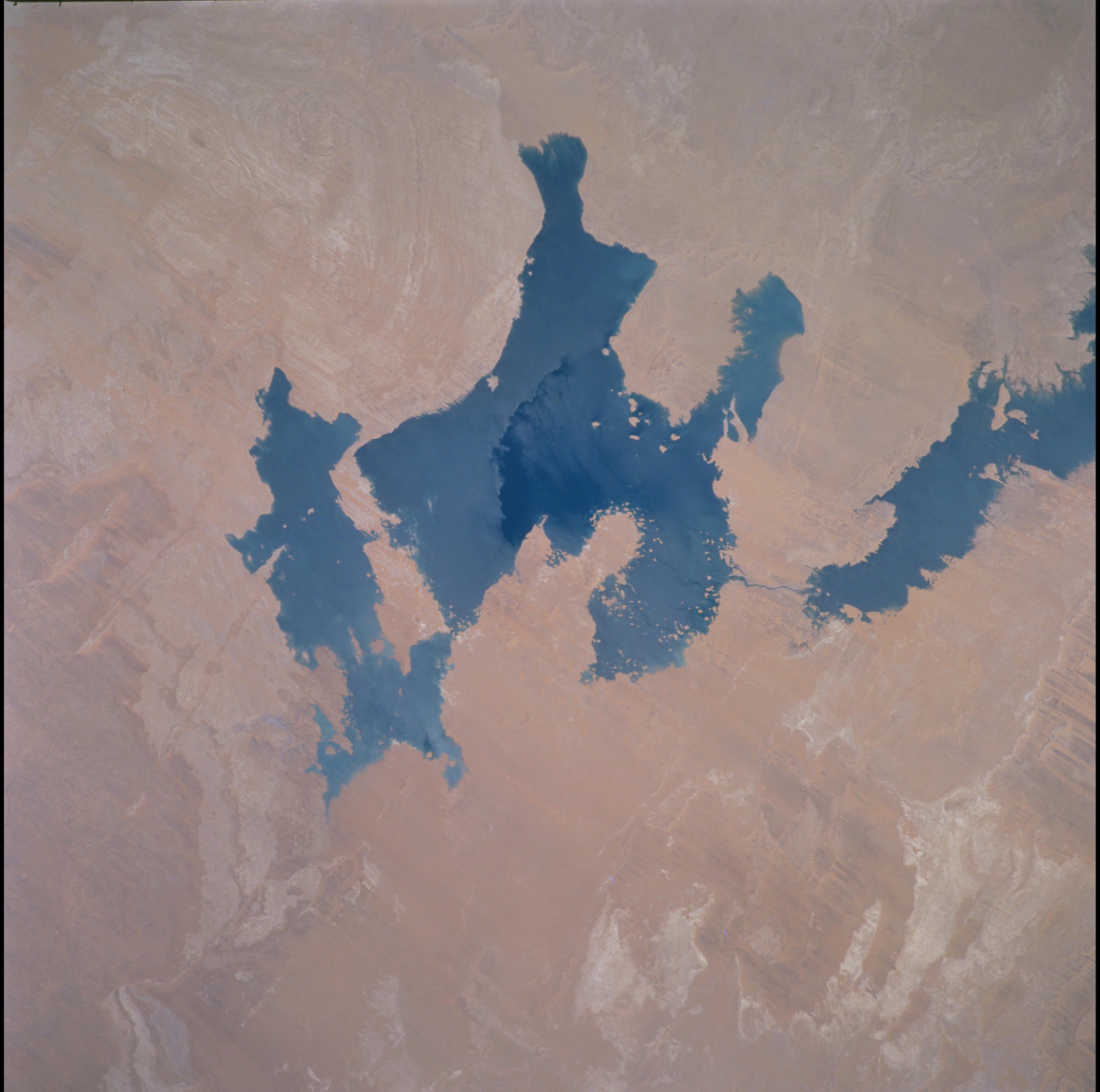
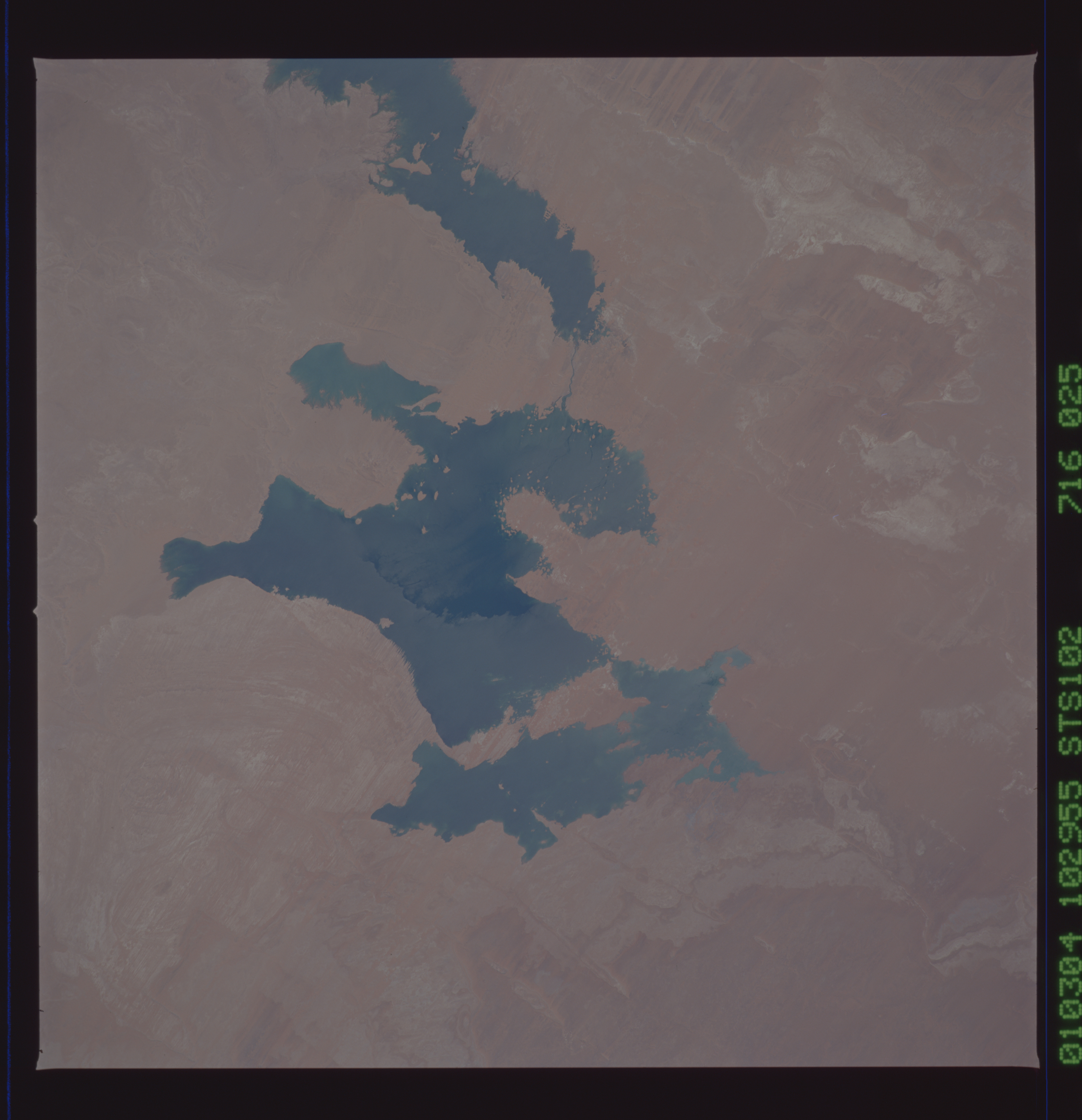
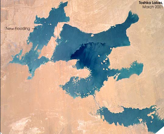
No GeoTIFF is available for this photo.Image Caption: As the Space Shuttle Atlantis passed over southern Egypt in mid-March 2001, the STS-102 astronauts were able to document new flooding in the Toshka region west of Lake Nasser. The formation of the Toshka Lakes in southern Egypt is part of Egypt's New Valley Project. The flooding of the region has been monitored by astronauts since 1998, and continues to show rapid changes.
An animation in a previous posting on the Earth Observatory links together several photographs of the region taken by astronauts to show the sequence of flooding in the Toshka depression. The last image of that sequence was acquired in September, 2000 (Image number STS106-716-96), and is included here for reference. Since September, flooding has occurred over a large area at the western end of the Toshka lakes. The region will be the location of large Egyptian agricultural developments that will support millions of people.
An animation in a previous posting on the Earth Observatory links together several photographs of the region taken by astronauts to show the sequence of flooding in the Toshka depression. The last image of that sequence was acquired in September, 2000 (Image number STS106-716-96), and is included here for reference. Since September, flooding has occurred over a large area at the western end of the Toshka lakes. The region will be the location of large Egyptian agricultural developments that will support millions of people.
