< STS091-707-24 >
| NASA Photo ID | STS091-707-24 |
| Focal Length | 250mm |
| Date taken | 1998.06.07 |
| Time taken | 21:27:52 GMT |
Resolutions offered for this image:
4049 x 4049 pixels 640 x 640 pixels 5700 x 5900 pixels 483 x 500 pixels 512 x 500 pixels 479 x 479 pixels
4049 x 4049 pixels 640 x 640 pixels 5700 x 5900 pixels 483 x 500 pixels 512 x 500 pixels 479 x 479 pixels


Cloud masks available for this image:
Spacecraft nadir point: 34.0° N, 92.3° W
Photo center point: 34.0° N, 91.0° W
Photo center point by machine learning:
Photo center point: 34.0° N, 91.0° W
Photo center point by machine learning:
Nadir to Photo Center: East
Spacecraft Altitude: 197 nautical miles (365km)
Country or Geographic Name: | USA-MISSISSIPPI |
Features: | MISSISSIPPI R., AR. RIVER |
| Features Found Using Machine Learning: | |
Cloud Cover Percentage: | 0 (no clouds present) |
Sun Elevation Angle: | 45° |
Sun Azimuth: | 269° |
Camera: | Hasselblad |
Focal Length: | 250mm |
Camera Tilt: | 22 degrees |
Format: | 5069: Kodak Elite 100S, E6 Reversal, Replaces Lumiere, Warmer in tone vs. Lumiere |
Film Exposure: | Normal |
| Additional Information | |
| Width | Height | Annotated | Cropped | Purpose | Links |
|---|---|---|---|---|---|
| 4049 pixels | 4049 pixels | No | No | Earth From Space collection | Download Image |
| 640 pixels | 640 pixels | No | No | Earth From Space collection | Download Image |
| 5700 pixels | 5900 pixels | No | No | Download Image Download Color Calibration Image for this Image |
|
| 483 pixels | 500 pixels | No | No | Download Image Download Color Calibration Image for this Image |
|
| 512 pixels | 500 pixels | No | No | Download Image | |
| 479 pixels | 479 pixels | Download Image |
Download Packaged File
Download a Google Earth KML for this Image
View photo footprint information
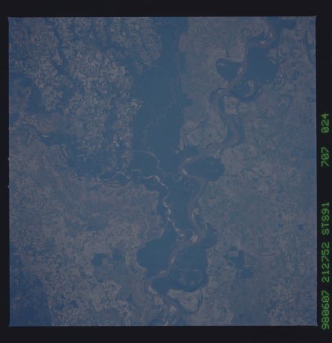
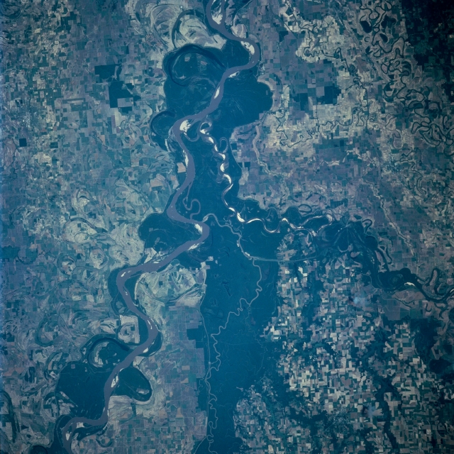
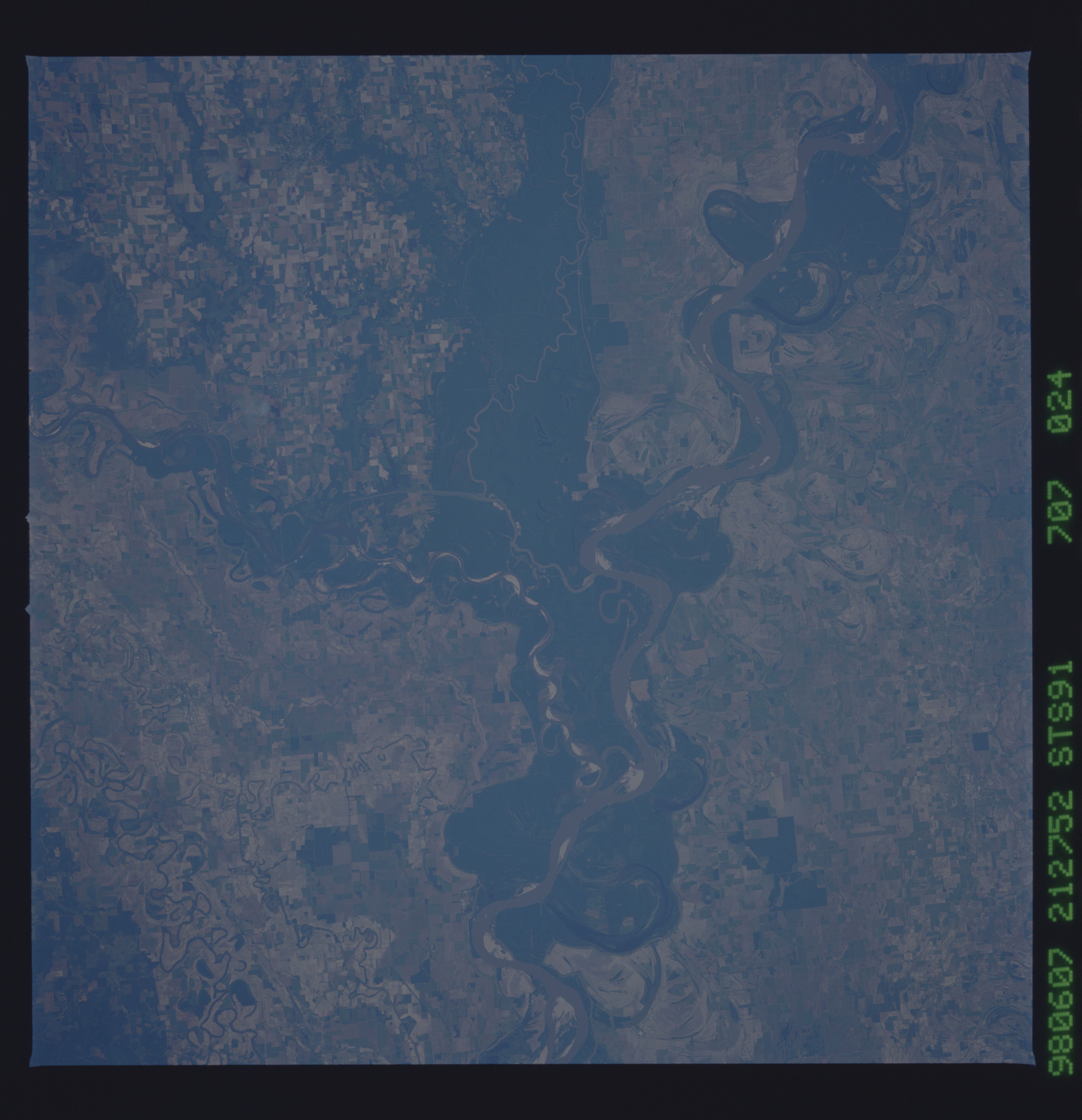
No GeoTIFF is available for this photo.Image Caption: STS091-707-024 White, Arkansas, and Mississippi Rivers, Mississippi June 1998
Near the center of the image is the confluence of the White, Arkansas, and Mississippi Rivers. The sediment-laden Mississippi River traverses the scene from the upper left (north) to the right center (south) of the image. The Arkansas River, 1450 miles (2335 km) long, enters the scene just to the left of the center bottom (west) of the image. The Arkansas River navigation system begins here making the river navigable northwestward 500 miles (805 km) upstream past Little Rock, Arkansas to Tulsa, Oklahoma. The 690 mile (1110 km) long White River enters the scene at the left center of the image. Forest cover (darker areas) abounds on either side of the river. Along the Mississippi River numerous oxbow patterns are visible. These patterns represent the changes in the course the river has taken over thousands of years.
Near the center of the image is the confluence of the White, Arkansas, and Mississippi Rivers. The sediment-laden Mississippi River traverses the scene from the upper left (north) to the right center (south) of the image. The Arkansas River, 1450 miles (2335 km) long, enters the scene just to the left of the center bottom (west) of the image. The Arkansas River navigation system begins here making the river navigable northwestward 500 miles (805 km) upstream past Little Rock, Arkansas to Tulsa, Oklahoma. The 690 mile (1110 km) long White River enters the scene at the left center of the image. Forest cover (darker areas) abounds on either side of the river. Along the Mississippi River numerous oxbow patterns are visible. These patterns represent the changes in the course the river has taken over thousands of years.
