< STS054-80-24 >
| NASA Photo ID | STS054-80-24 |
| Focal Length | 100mm |
| Date taken | 1993.01.18 |
| Time taken | 04:20:36 GMT |
Cloud masks available for this image:
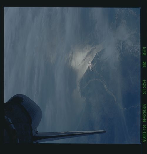
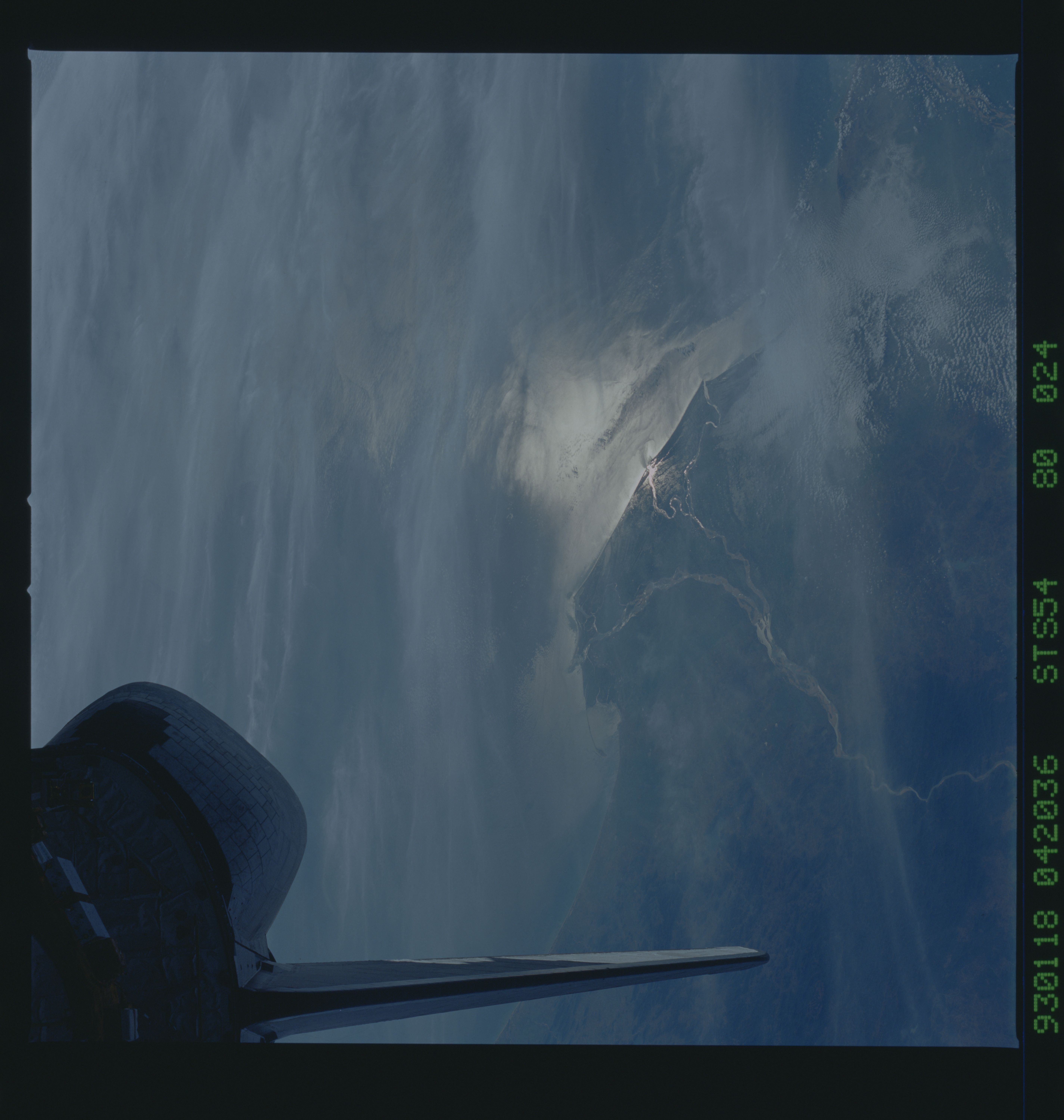
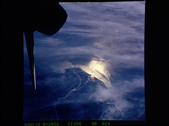
Spacecraft nadir point: 18.6° N, 79.5° E
Photo center point: 16.0° N, 82.0° E
Photo center point by machine learning:
Photo center point: 16.0° N, 82.0° E
Photo center point by machine learning:
Nadir to Photo Center: Southeast
Spacecraft Altitude: 167 nautical miles (309km)
Country or Geographic Name: | INDIA |
Features: | PAN-GODAVARI RIVER DELTA |
| Features Found Using Machine Learning: | |
Cloud Cover Percentage: | 50 (26-50)% |
Sun Elevation Angle: | 36° |
Sun Azimuth: | 135° |
Camera: | Hasselblad |
Focal Length: | 100mm |
Camera Tilt: | High Oblique |
Format: | 5017: Kodak, natural color positive, Ektachrome, X Professional, ASA 64, standard base |
Film Exposure: | Normal |
| Additional Information | |
| Width | Height | Annotated | Cropped | Purpose | Links |
|---|---|---|---|---|---|
| 5700 pixels | 6000 pixels | No | No | Download Image Download Color Calibration Image for this Image |
|
| 500 pixels | 526 pixels | No | No | Download Image Download Color Calibration Image for this Image |
|
| 640 pixels | 480 pixels | No | No | Download Image |
Download Packaged File
Download a Google Earth KML for this Image
View photo footprint information
No GeoTIFF is available for this photo.Image Caption: Sunglint over the Godavari River Delta (16.0N, 82.0E) on the Bay of Bengal, highlights the intricate drainage pattern of the river basin. Offshore, the current boundries and river plumes are readily visible. The line of clouds along the coast south of the delta indicate surface winds blowing onshore from the Bay. As the air passes over the warmer coastal land and water, it begins to rise and form clouds as it reaches the cooler upper atmosphere.
