< STS078-730-23 >
| NASA Photo ID | STS078-730-23 |
| Focal Length | 50mm |
| Date taken | 1996.06.22 |
| Time taken | 22:42:39 GMT |
Cloud masks available for this image:
Spacecraft nadir point: 18.7° N, 102.2° W
Photo center point:
Photo center point by machine learning:
Photo center point:
Photo center point by machine learning:
Nadir to Photo Center:
Spacecraft Altitude: 147 nautical miles (272km)
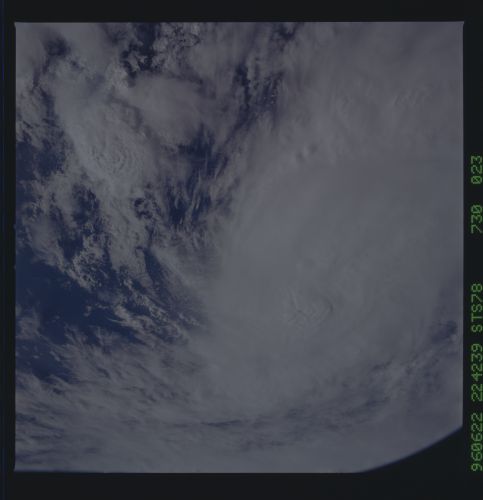
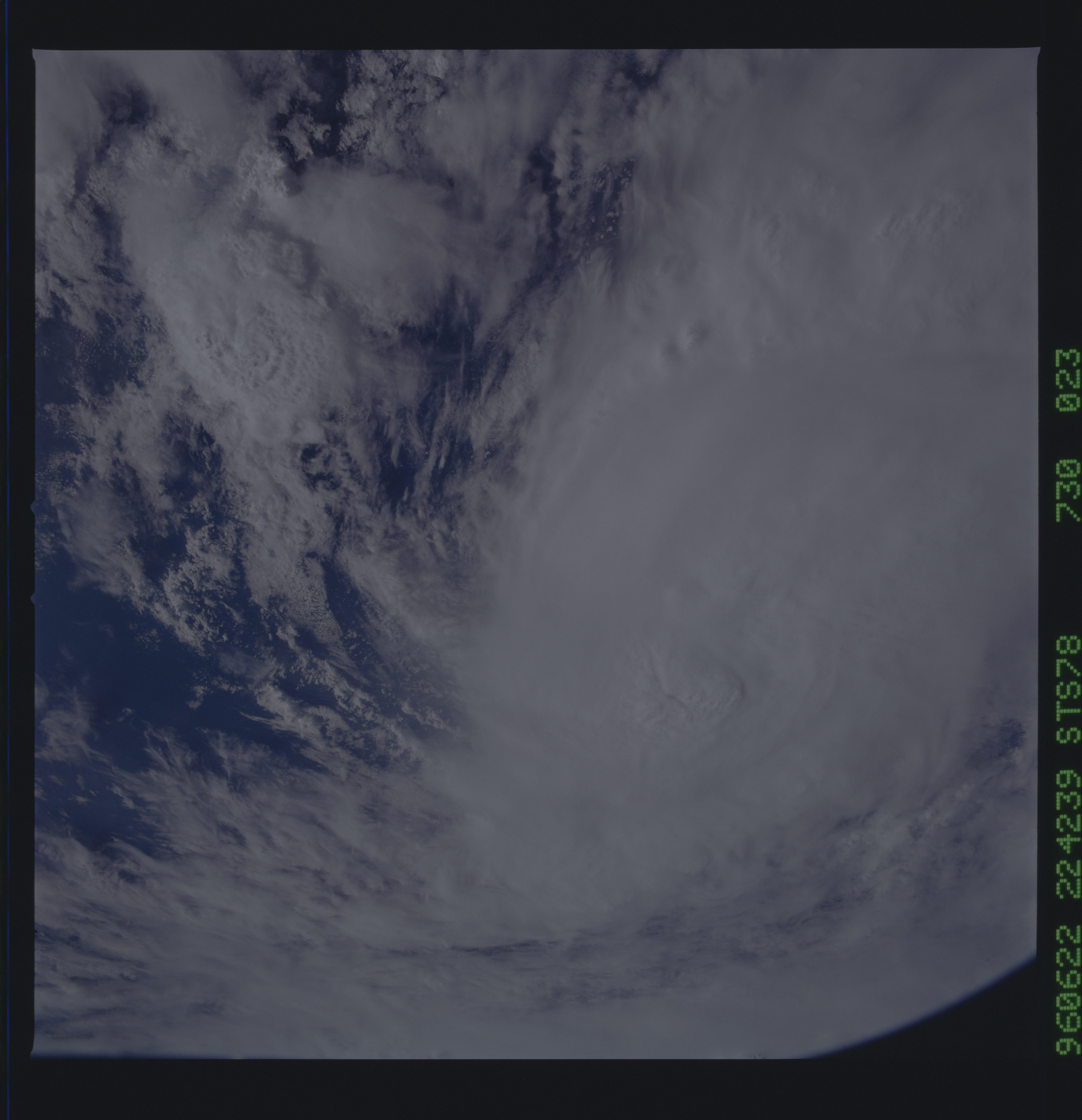
Country or Geographic Name: | PACIFIC OCEAN |
Features: | SPIRAL CLOUD FORMATION |
| Features Found Using Machine Learning: | |
Cloud Cover Percentage: | 85 (76-100)% |
Sun Elevation Angle: | 36° |
Sun Azimuth: | 286° |
Camera: | Hasselblad |
Focal Length: | 50mm |
Camera Tilt: | Low Oblique |
Format: | 5046: Kodak, natural color positive, Lumiere 100/5046, ASA 100, standard base |
Film Exposure: | Normal |
| Additional Information | |
| Width | Height | Annotated | Cropped | Purpose | Links |
|---|---|---|---|---|---|
| 5700 pixels | 5900 pixels | No | No | Download Image Download Color Calibration Image for this Image |
|
| 483 pixels | 500 pixels | No | No | Download Image Download Color Calibration Image for this Image |
Download Packaged File
Download a Google Earth KML for this Image
View photo footprint information
No GeoTIFF is available for this photo.Image Caption: Hurricanes
in the Pacific Ocean: Two different hurricanes occurred off the West
coast of Mexico in the Pacific Ocean during the duration of the STS-78
mission. The first three photos document the size and intensity of
Hurricane Alma which made landfall early in the day on June 24th. The
last photo shows Hurricane Boris, a second hurricane which made
landfall just days after Alma in the same region. The two storms
reached category 2 strength with winds on 100 mph, but reports showed
only minor damage.
