STS066-118-23
| NASA Photo ID | STS066-118-23 |
| Focal Length | 100mm |
| Date taken | 1994.11.08 |
| Time taken | 04:13:36 GMT |
Resolutions offered for this image:
5294 x 5294 pixels 640 x 640 pixels 5700 x 5900 pixels 500 x 518 pixels 640 x 480 pixels
5294 x 5294 pixels 640 x 640 pixels 5700 x 5900 pixels 500 x 518 pixels 640 x 480 pixels


Cloud masks available for this image:
Spacecraft nadir point: 38.0° N, 96.9° E
Photo center point: 37.0° N, 100.0° E
Photo center point by machine learning:
Photo center point: 37.0° N, 100.0° E
Photo center point by machine learning:
Nadir to Photo Center: East
Spacecraft Altitude: 161 nautical miles (298km)
Country or Geographic Name: | CHINA |
Features: | CH'ING-HAI L., MOUNTAINS |
| Features Found Using Machine Learning: | |
Cloud Cover Percentage: | 0 (no clouds present) |
Sun Elevation Angle: | 34° |
Sun Azimuth: | 162° |
Camera: | Hasselblad |
Focal Length: | 100mm |
Camera Tilt: | 51 degrees |
Format: | 5046: Kodak, natural color positive, Lumiere 100/5046, ASA 100, standard base |
Film Exposure: | Normal |
| Additional Information | |
| Width | Height | Annotated | Cropped | Purpose | Links |
|---|---|---|---|---|---|
| 5294 pixels | 5294 pixels | No | No | Earth From Space collection | Download Image |
| 640 pixels | 640 pixels | No | No | Earth From Space collection | Download Image |
| 5700 pixels | 5900 pixels | No | No | Download Image | |
| 500 pixels | 518 pixels | No | No | Download Image | |
| 640 pixels | 480 pixels | No | No | Download Image |
Download Packaged File
Download a Google Earth KML for this Image
View photo footprint information
Download a GeoTIFF for this photo
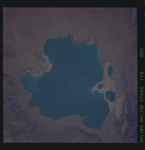
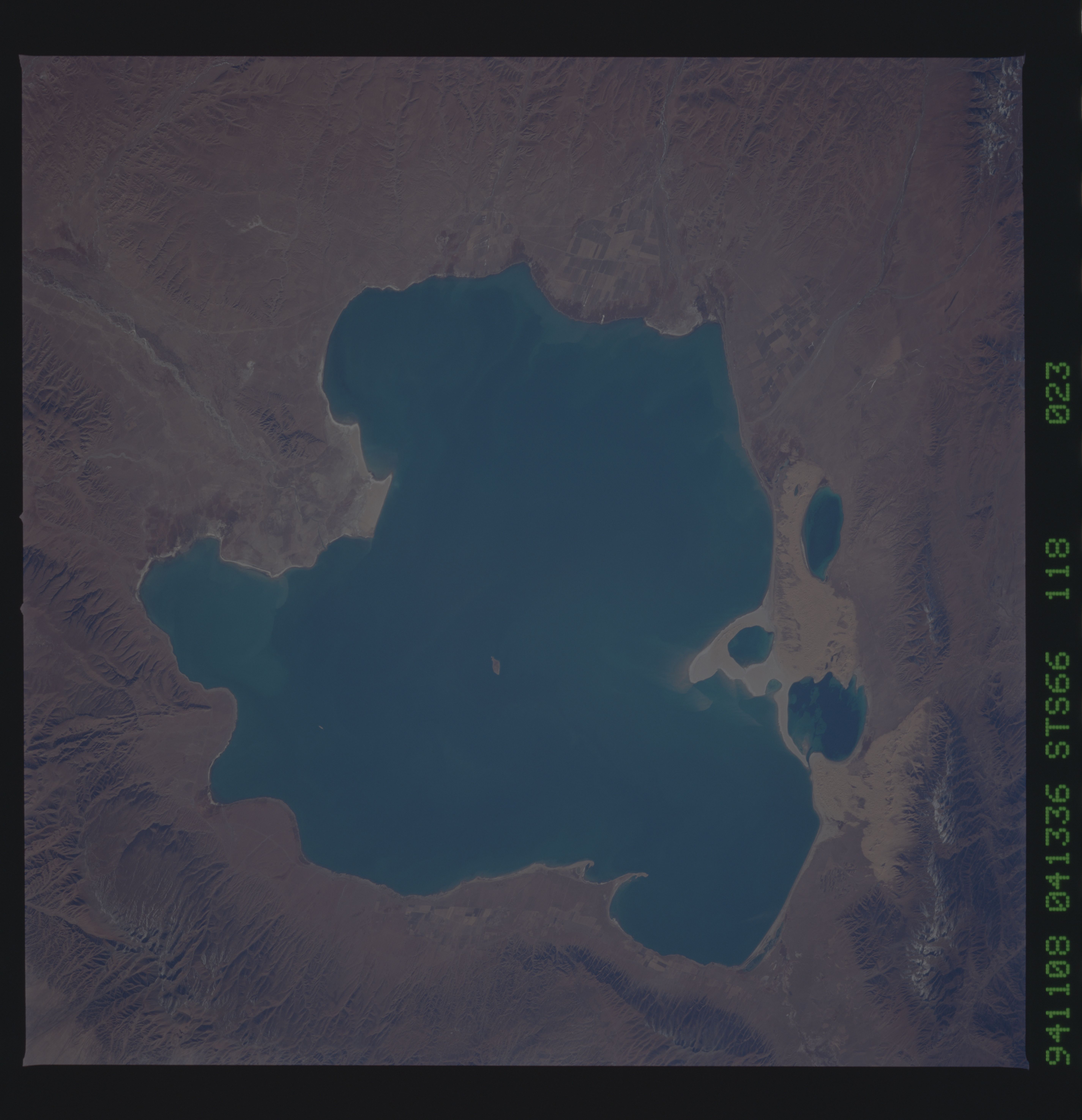
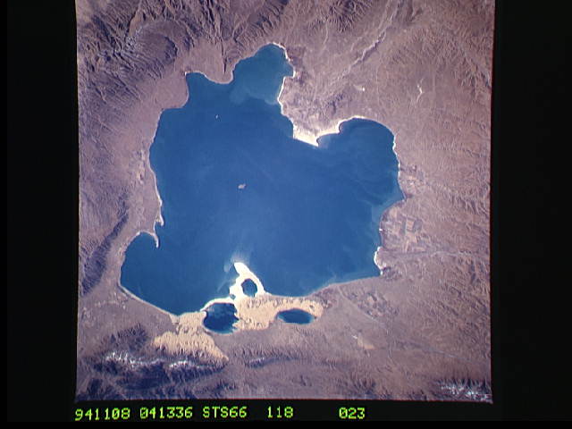
Image Caption: STS066-118-023 Qinghai Lake, Qinghai Province, China November 1994
Qinghai Lake, with an area of 1770 square miles (4580 square kilometers) and a maximum depth of 108 feet (33 meters), is the largest natural lake in China. Situated in the eastern end of the desert environment of the Qaidam Basin in Qinghai Province, the lake's main source of recharge water is snowmelt from the encircling mountain ranges that rise in excess of 14 000 feet (4265 meters). Several small deltas with cultivated field patterns surround the lake. Qinghai Lake, one of many inland saline lakes in west-central and northwest China, exhibits sand deposits on its western shoreline as well as its eastern shoreline where the deposits extend into the lake.
Qinghai Lake, with an area of 1770 square miles (4580 square kilometers) and a maximum depth of 108 feet (33 meters), is the largest natural lake in China. Situated in the eastern end of the desert environment of the Qaidam Basin in Qinghai Province, the lake's main source of recharge water is snowmelt from the encircling mountain ranges that rise in excess of 14 000 feet (4265 meters). Several small deltas with cultivated field patterns surround the lake. Qinghai Lake, one of many inland saline lakes in west-central and northwest China, exhibits sand deposits on its western shoreline as well as its eastern shoreline where the deposits extend into the lake.
