STS41D-40-22

| NASA Photo ID | STS41D-40-22 |
| Focal Length | 50mm |
| Date taken | 1984.08.31 |
| Time taken | 17:52:04 GMT |
Resolutions offered for this image:
5266 x 5266 pixels 1000 x 1000 pixels 639 x 639 pixels 540 x 540 pixels 4000 x 4000 pixels 4440 x 4600 pixels 483 x 500 pixels 640 x 480 pixels 691 x 700 pixels
5266 x 5266 pixels 1000 x 1000 pixels 639 x 639 pixels 540 x 540 pixels 4000 x 4000 pixels 4440 x 4600 pixels 483 x 500 pixels 640 x 480 pixels 691 x 700 pixels


Cloud masks available for this image:
Spacecraft nadir point: 8.3° S, 60.3° W
Photo center point:
Photo center point by machine learning:
Photo center point:
Photo center point by machine learning:
Nadir to Photo Center:
Spacecraft Altitude: 163 nautical miles (302km)
Country or Geographic Name: | BRAZIL |
Features: | CLOUDS |
| Features Found Using Machine Learning: | |
Cloud Cover Percentage: | 100 (76-100)% |
Sun Elevation Angle: | 57° |
Sun Azimuth: | 117° |
Camera: | Hasselblad |
Focal Length: | 50mm |
Camera Tilt: | High Oblique |
Format: | 6017: Kodak Ektachrome 64, 220 Roll Format |
Film Exposure: | Normal |
| Additional Information | |
| Width | Height | Annotated | Cropped | Purpose | Links |
|---|---|---|---|---|---|
| 5266 pixels | 5266 pixels | No | No | Earth From Space collection | Download Image |
| 1000 pixels | 1000 pixels | No | Yes | Earth From Space collection | Download Image |
| 639 pixels | 639 pixels | No | No | Earth From Space collection | Download Image |
| 540 pixels | 540 pixels | No | Yes | Earth From Space collection | Download Image |
| 4000 pixels | 4000 pixels | No | No | NASA's Earth Observatory web site | Download Image |
| 4440 pixels | 4600 pixels | No | No | Download Image | |
| 483 pixels | 500 pixels | No | No | Download Image | |
| 640 pixels | 480 pixels | No | No | Download Image | |
| 691 pixels | 700 pixels | Yes | No | Download Image |
Download Packaged File
Download a Google Earth KML for this Image
View photo footprint information
Download a GeoTIFF for this photo
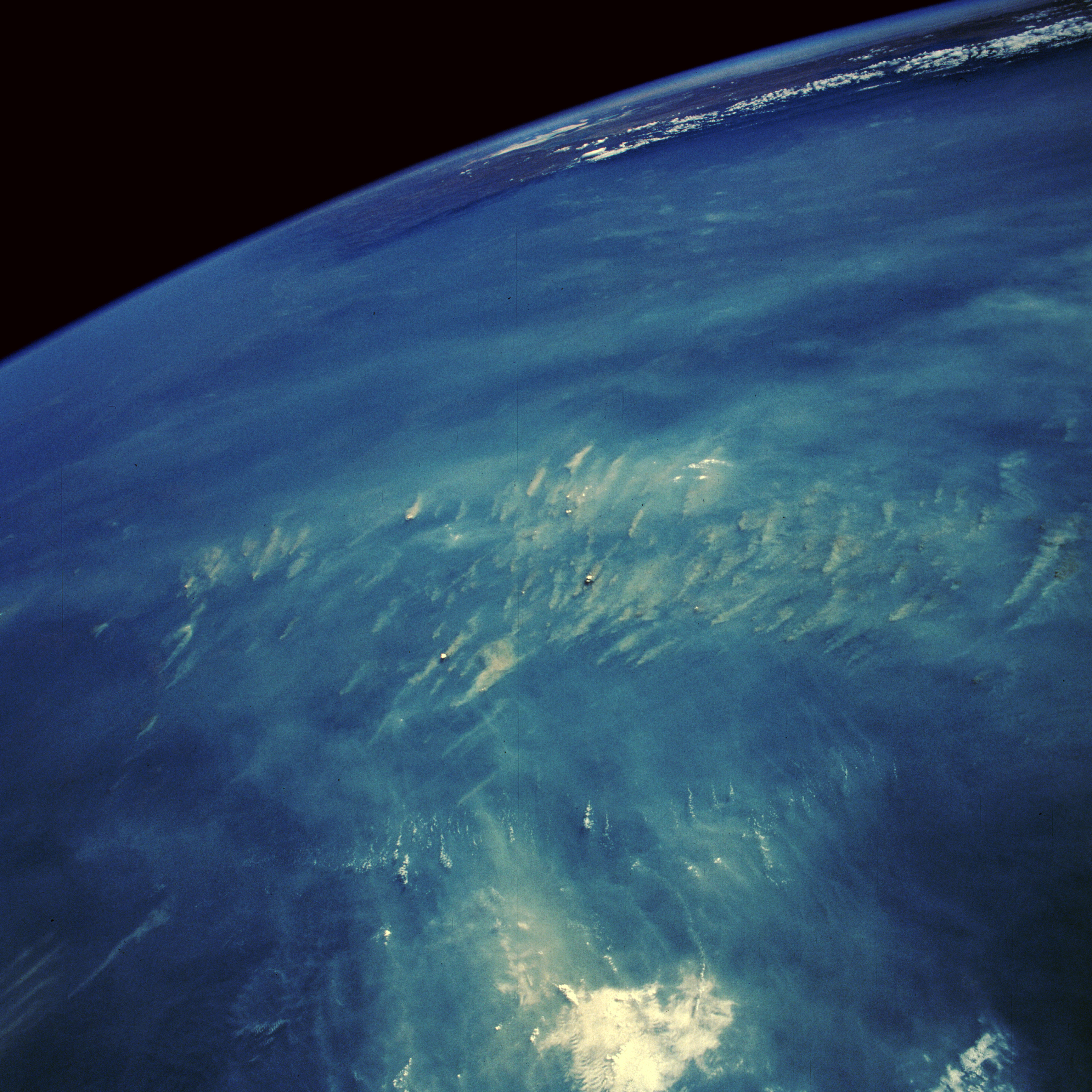
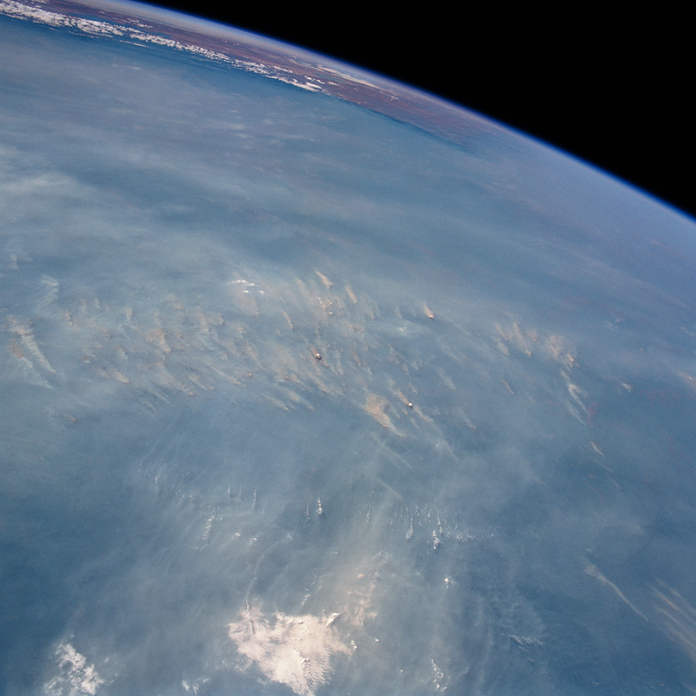
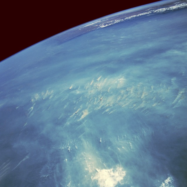
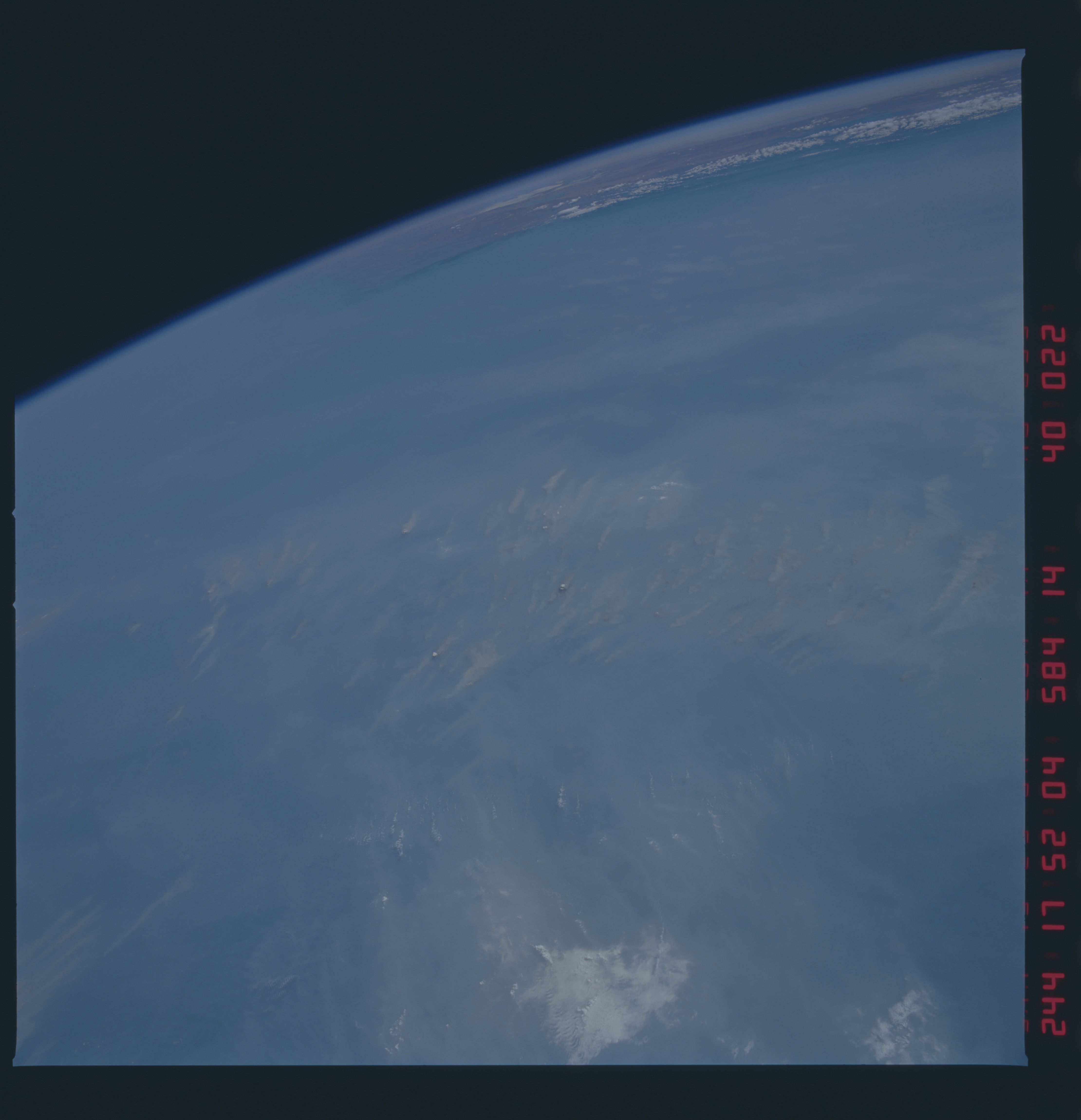
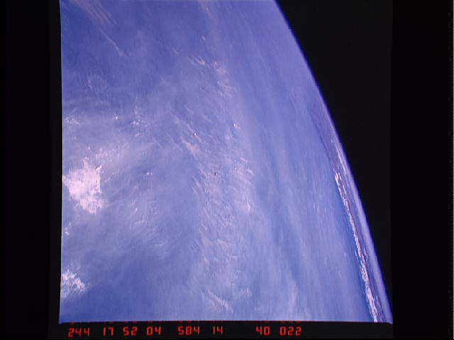
Image Caption: STS41D-40-22 Fires and Smoke, Rondonia, Brazil September 1984
Space Shuttle astronauts sometimes photograph major smoke palls (primarily in the equatorial belt) where "slash-and-burn" techniques are used to clear land for agricultural purposes--for raising crops or for developing pastureland for cattle. This photograph documents numerous smoke plumes, which represent destruction of part of the Amazon rain forest in the State of Rondonia in western Brazil. During the last several decades, worldwide slash-and-burn practices have been exacerbated by population pressures to expand into virgin tropical woodland. Peak burning periods occur during the dry season, which for this Southern Hemisphere region is June through September. Visible near the horizon are the Andes Mountains of Bolivia, which provide a natural barrier so that little dense smoke reaches the altiplano of southern Peru and Bolivia; only valleys and canyons along the eastern slopes of the Andes are impacted by this periodic, widespread burning.
Space Shuttle astronauts sometimes photograph major smoke palls (primarily in the equatorial belt) where "slash-and-burn" techniques are used to clear land for agricultural purposes--for raising crops or for developing pastureland for cattle. This photograph documents numerous smoke plumes, which represent destruction of part of the Amazon rain forest in the State of Rondonia in western Brazil. During the last several decades, worldwide slash-and-burn practices have been exacerbated by population pressures to expand into virgin tropical woodland. Peak burning periods occur during the dry season, which for this Southern Hemisphere region is June through September. Visible near the horizon are the Andes Mountains of Bolivia, which provide a natural barrier so that little dense smoke reaches the altiplano of southern Peru and Bolivia; only valleys and canyons along the eastern slopes of the Andes are impacted by this periodic, widespread burning.
