< STS080-732-22 >
| NASA Photo ID | STS080-732-22 |
| Focal Length | 100mm |
| Date taken | 1996.11.28 |
| Time taken | 09:44:56 GMT |
Cloud masks available for this image:
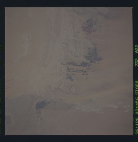
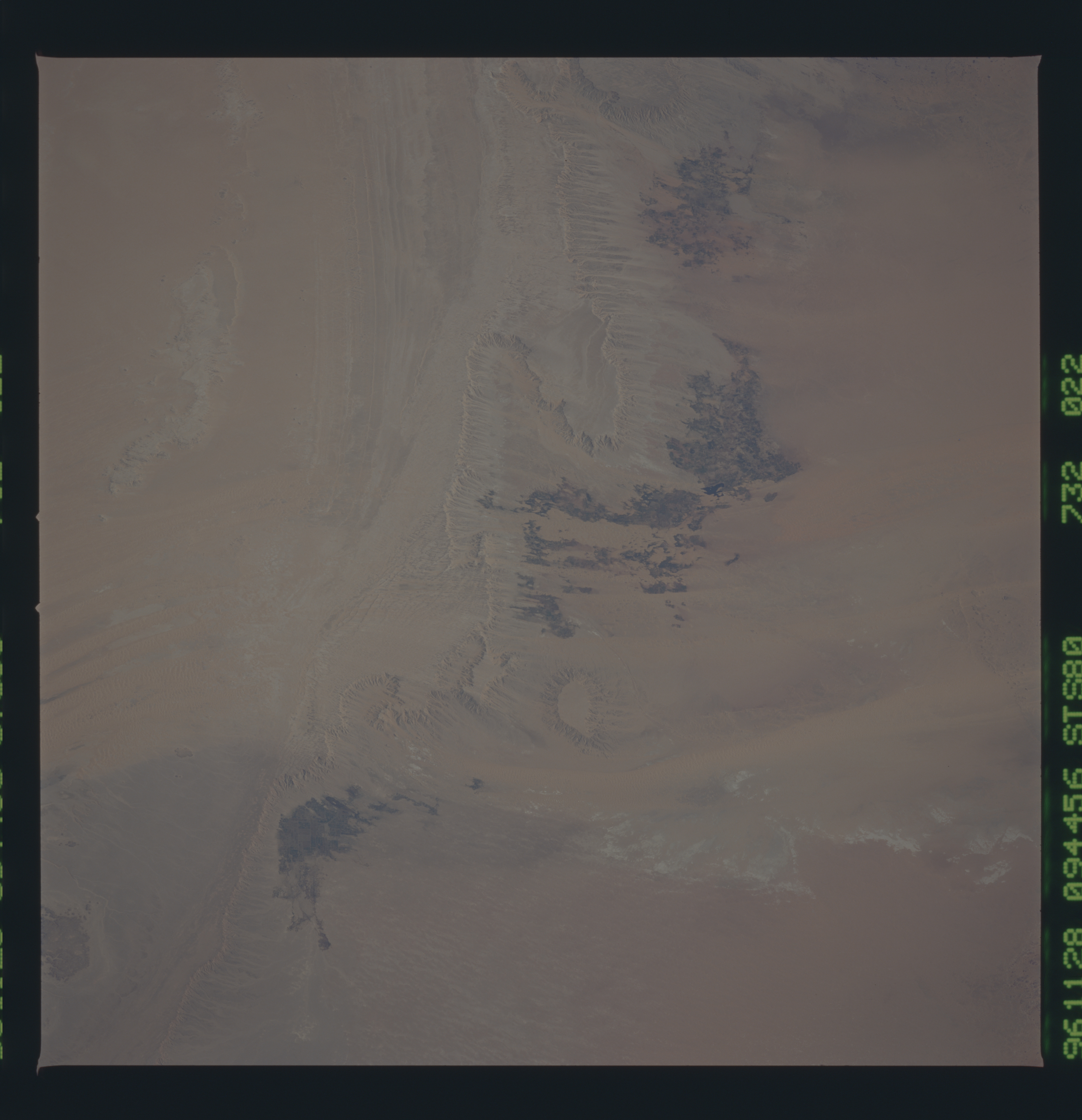
Spacecraft nadir point: 26.4° N, 26.7° E
Photo center point: 26.0° N, 29.0° E
Photo center point by machine learning:
Photo center point: 26.0° N, 29.0° E
Photo center point by machine learning:
Nadir to Photo Center: East
Spacecraft Altitude: 188 nautical miles (348km)
Country or Geographic Name: | EGYPT |
Features: | EDMONSTONE MOUNTAIN |
| Features Found Using Machine Learning: | |
Cloud Cover Percentage: | 0 (no clouds present) |
Sun Elevation Angle: | 42° |
Sun Azimuth: | 175° |
Camera: | Hasselblad |
Focal Length: | 100mm |
Camera Tilt: | 37 degrees |
Format: | 5046: Kodak, natural color positive, Lumiere 100/5046, ASA 100, standard base |
Film Exposure: | Normal |
| Additional Information | |
| Width | Height | Annotated | Cropped | Purpose | Links |
|---|---|---|---|---|---|
| 5700 pixels | 5900 pixels | No | No | Download Image Download Color Calibration Image for this Image |
|
| 483 pixels | 500 pixels | No | No | Download Image Download Color Calibration Image for this Image |
Download Packaged File
Download a Google Earth KML for this Image
View photo footprint information
No GeoTIFF is available for this photo.Image Caption: Erta Ale volcano and vents, Ethiopia. The vents of Erta Ale are aligned along the axial fault system of the Danakil segment of the Red Sea rift, which is extending at a rate of 20 mm per year. This excellent photo permits discrimination of separate vents and flows along the fissure. Vast volcanic rift plateaus, such as the Ethiopian plateau, are constructed of flows from such fissures, as well as from lavas issuing from major volcanoes like Kilamanjaro and Ngorongoro. The pile of lava flows in this area is from 1500 to 3000 meters thick.
