ISS008-E-19646

| NASA Photo ID | ISS008-E-19646 |
| Focal Length | 50mm |
| Date taken | 2004.03.27 |
| Time taken | 13:58:41 GMT |
Resolutions offered for this image:
540 x 334 pixels 1000 x 662 pixels 3032 x 2064 pixels 639 x 435 pixels
540 x 334 pixels 1000 x 662 pixels 3032 x 2064 pixels 639 x 435 pixels
Spacecraft nadir point: 35.1° S, 47.1° W
Photo center point:
Photo center point by machine learning:
Photo center point:
Photo center point by machine learning:
Nadir to Photo Center:
Spacecraft Altitude: 196 nautical miles (363km)
Country or Geographic Name: | ATLANTIC OCEAN |
Features: | HURRICANE CATARINA, EYE, BANDING |
| Features Found Using Machine Learning: | |
Cloud Cover Percentage: | 75 (51-75)% |
Sun Elevation Angle: | 48° |
Sun Azimuth: | 29° |
Camera: | Kodak DCS760c Electronic Still Camera |
Focal Length: | 50mm |
Camera Tilt: | High Oblique |
Format: | 3060E: 3060 x 2036 pixel CCD, RGBG array |
Film Exposure: | |
| Additional Information | |
| Width | Height | Annotated | Cropped | Purpose | Links |
|---|---|---|---|---|---|
| 540 pixels | 334 pixels | No | No | Earth From Space collection | Download Image |
| 1000 pixels | 662 pixels | No | No | NASA's Earth Observatory web site | Download Image |
| 3032 pixels | 2064 pixels | No | No | Download Image | |
| 639 pixels | 435 pixels | No | No | Download Image |
Download Packaged File
Download a Google Earth KML for this Image
View photo footprint information
Download a GeoTIFF for this photo
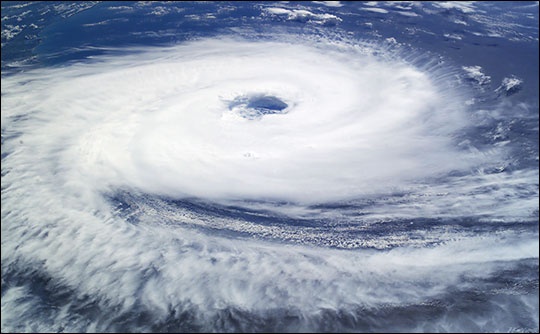
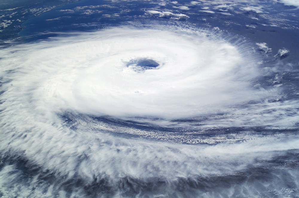
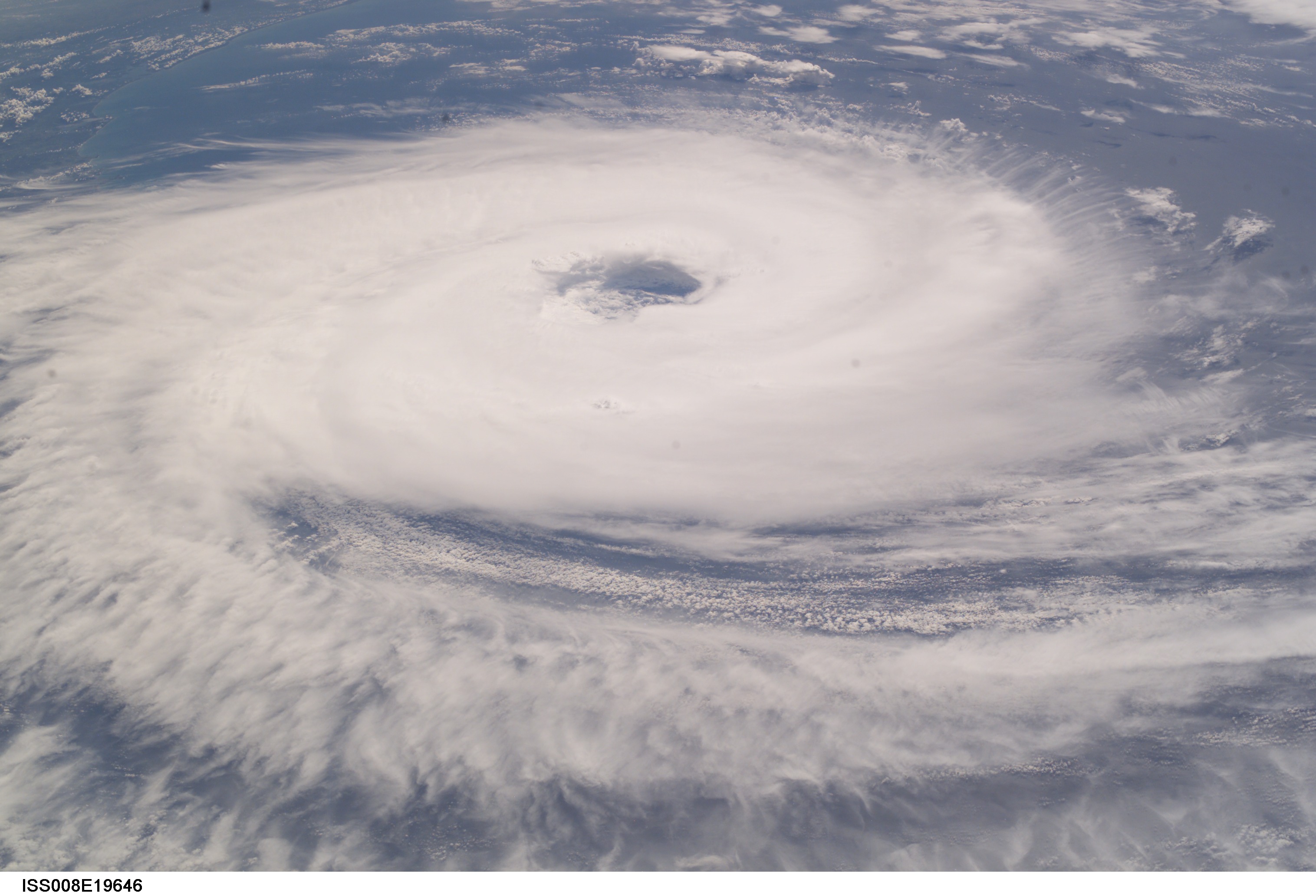
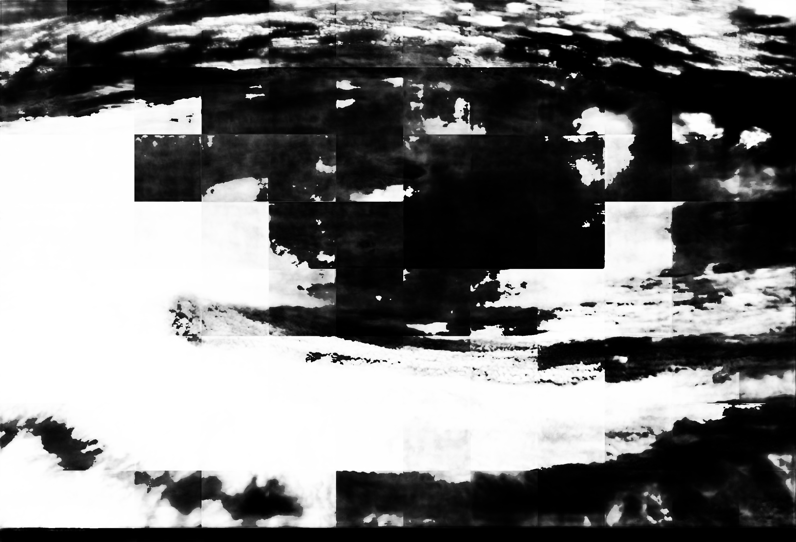
Image Caption: "Hurricane" Catarina hits Brazil:
Until this past week only two tropical cyclones had ever been noted in the South Atlantic Basin, and no hurricanes. However, late last week, a circulation center well off the coast of southern Brazil developed tropical cyclone characteristics and continued to intensify as it moved westward. The system developed an eye and apparently reached hurricane strength on Friday, March 28, before eventually making landfall late on Saturday, March 27, 2004.
The crew of the International Space Station was notified of the cyclone and acquired excellent photographs of the storm just as it made landfall on the southern Brazilian state of Catarina (the storm has been unofficially dubbed "Hurricane Catarina"). Note the clockwise circulation of Southern Hemisphere cyclones, the well-defined banding features, and the eyewall of at least a Category 1 system. The coastline is visible under the clouds in the upper left corner of the image.
Additional images of this rare South Atlantic tropical cyclone are in the Earth Observatory Natural Hazards section.
