< ISS030-E-19056 >

| NASA Photo ID | ISS030-E-19056 |
| Focal Length | 28mm |
| Date taken | 2011.12.29 |
| Time taken | 21:51:45 GMT |
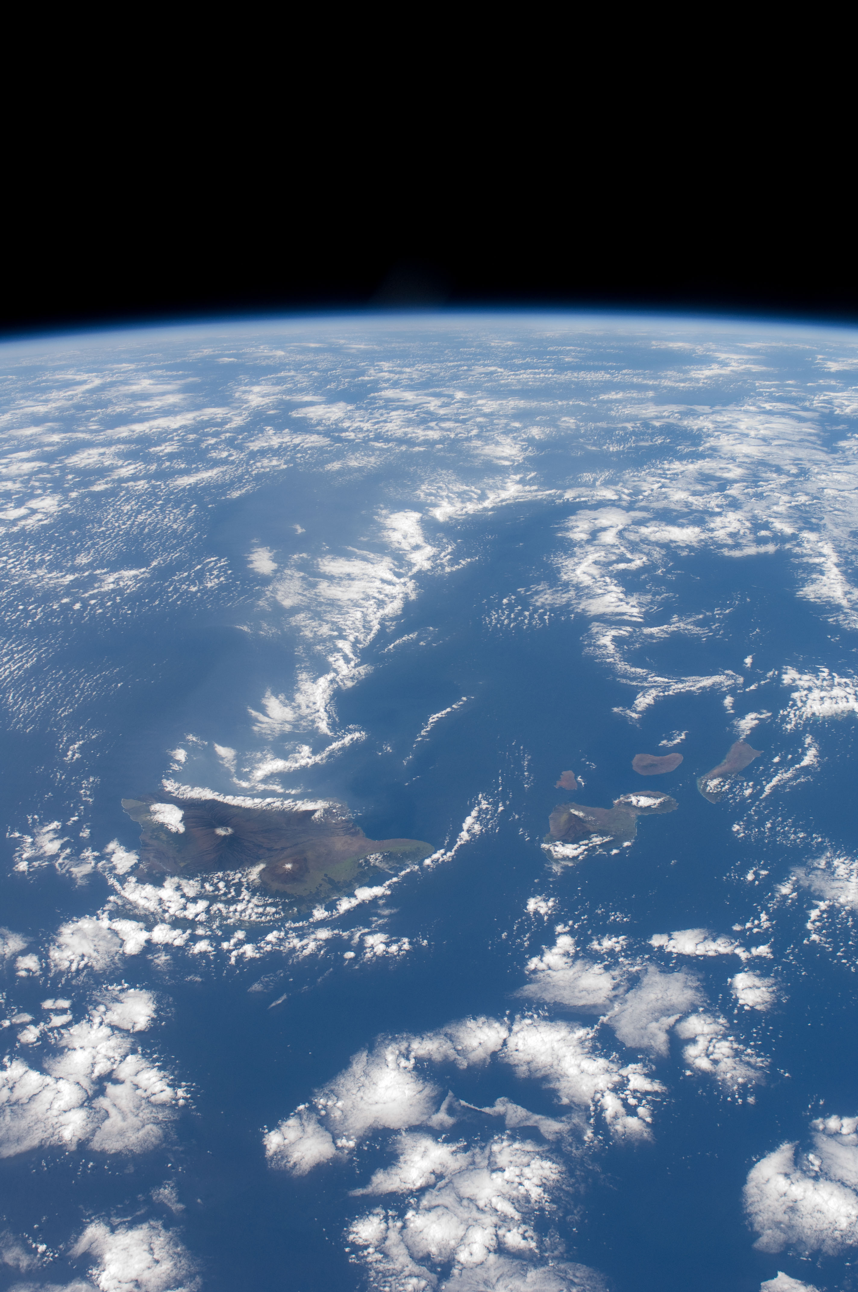

Spacecraft nadir point: 17.2° N, 155.5° W
Photo center point: 20.0° N, 157.5° W
Photo center point by machine learning:
Photo center point: 20.0° N, 157.5° W
Photo center point by machine learning:
Nadir to Photo Center: Northwest
Spacecraft Altitude: 219 nautical miles (406km)
Country or Geographic Name: | USA-HAWAII |
Features: | |
| Features Found Using Machine Learning: | PAN- |
Cloud Cover Percentage: | 25 (11-25)% |
Sun Elevation Angle: | 49° |
Sun Azimuth: | 169° |
Camera: | Nikon D2Xs Electronic Still Camera |
Focal Length: | 28mm |
Camera Tilt: | 43 degrees |
Format: | 4288E: 4288 x 2848 pixel CMOS sensor, RGBG imager color filter |
Film Exposure: | |
| Additional Information | |
| Width | Height | Annotated | Cropped | Purpose | Links |
|---|---|---|---|---|---|
| 2848 pixels | 4288 pixels | No | No | Download Image | |
| 425 pixels | 640 pixels | No | No | Download Image |
Download Packaged File
Download a Google Earth KML for this Image
View photo footprint information
No GeoTIFF is available for this photo.Image Caption: none
