< ISS008-E-18935 >
| NASA Photo ID | ISS008-E-18935 |
| Focal Length | 28mm |
| Date taken | 2004.03.24 |
| Time taken | 12:53:__ GMT |
Resolutions offered for this image:
2000 x 1305 pixels 1024 x 768 pixels 2000 x 1368 pixels 639 x 437 pixels
2000 x 1305 pixels 1024 x 768 pixels 2000 x 1368 pixels 639 x 437 pixels


Spacecraft nadir point:
Photo center point: 31.0° N, 47.5° E
Photo center point by machine learning:
Photo center point: 31.0° N, 47.5° E
Photo center point by machine learning:
Nadir to Photo Center:
Spacecraft Altitude: 196 nautical miles (363km)
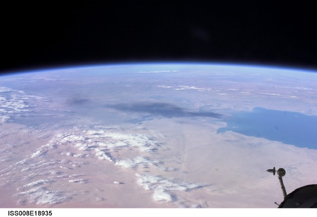
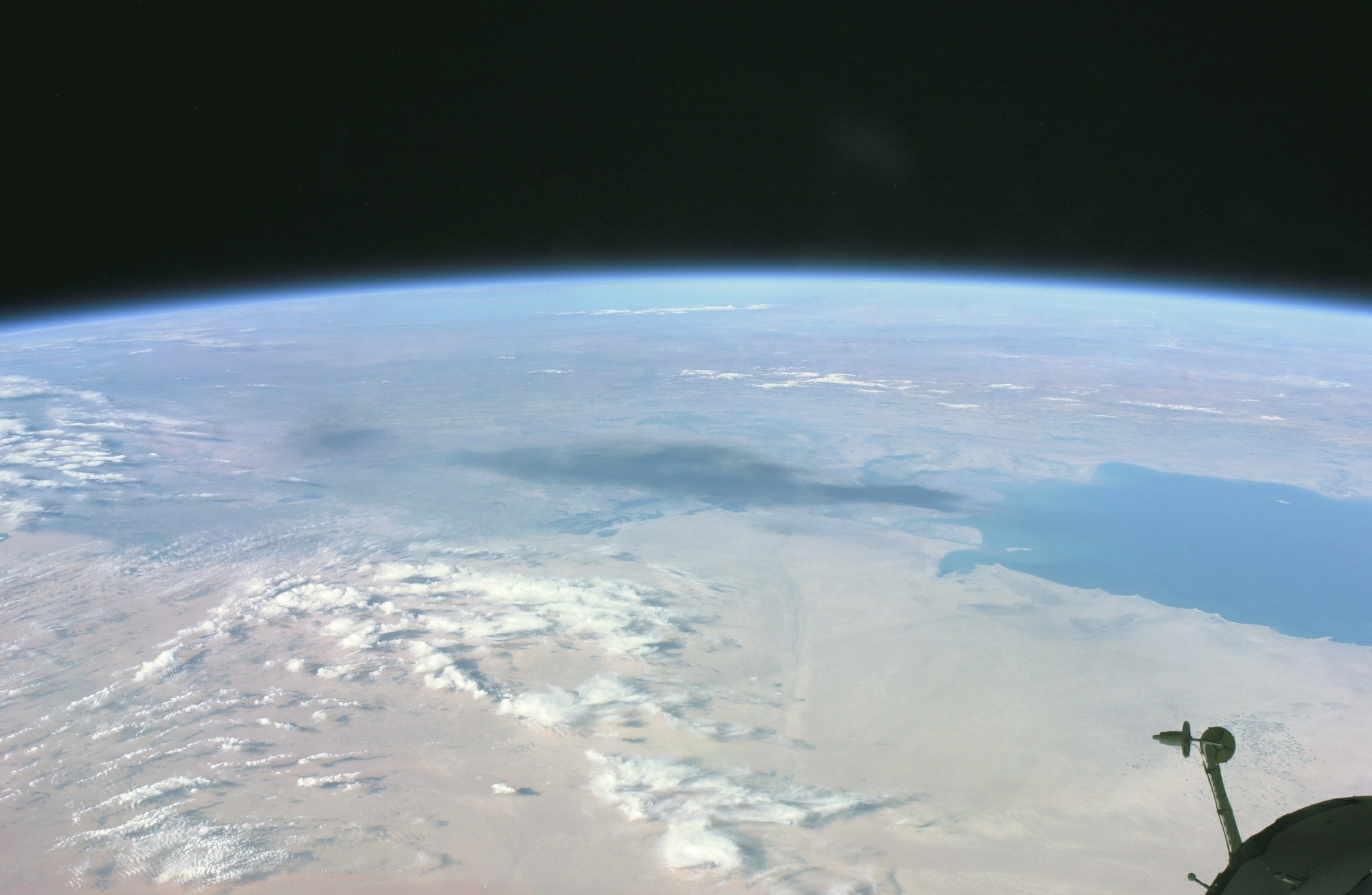
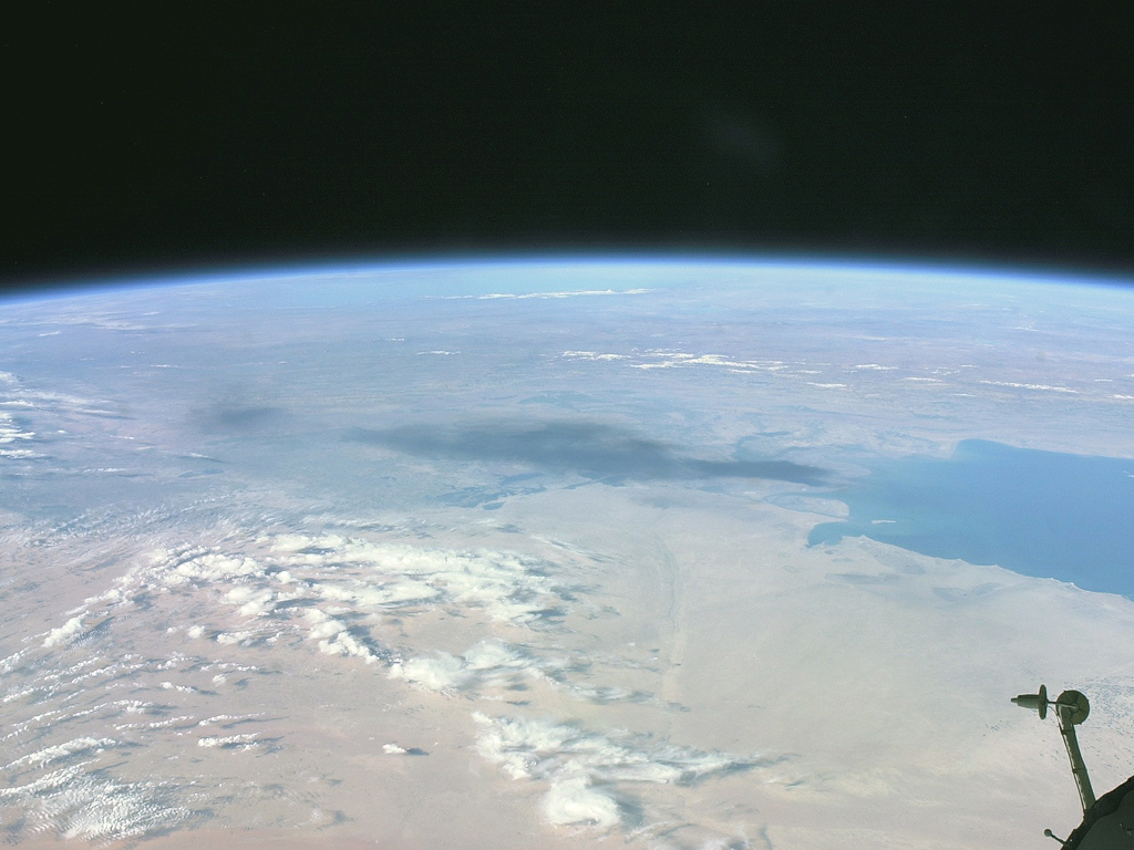
Country or Geographic Name: | IRAQ |
Features: | PAN-SMOKE PLUME, PERSIAN GULF |
| Features Found Using Machine Learning: | PAN- |
Cloud Cover Percentage: | 25 (11-25)% |
Sun Elevation Angle: | 21° |
Sun Azimuth: | 257° |
Camera: | Nikon D1 Electronic Still Camera |
Focal Length: | 28mm |
Camera Tilt: | High Oblique |
Format: | 2000E: 2000 x 1312 pixel CCD, RGBG imager color filter |
Film Exposure: | |
| Additional Information | |
| Width | Height | Annotated | Cropped | Purpose | Links |
|---|---|---|---|---|---|
| 2000 pixels | 1305 pixels | No | No | Earth From Space collection | Download Image |
| 1024 pixels | 768 pixels | No | Yes | NASA's Earth Observatory web site | Download Image |
| 2000 pixels | 1368 pixels | No | No | Download Image | |
| 639 pixels | 437 pixels | No | No | Download Image |
Download Packaged File
Download a Google Earth KML for this Image
View photo footprint information
No GeoTIFF is available for this photo.Image Caption: ISS008-E-18935 (24 March 2004) --- This photo of a large black smoke plume from an oil fire was taken by an Expedition 8 crewmember on the International Space Station as the Station orbited northeastward across Saudi Arabia. According to a front-page story in the New York Times, an oil pipeline near the channel of Shatt al Arab in southeastern Iraq on the Persian Gulf ruptured the day before. The resulting oil spill ignited and its smoke can here be seen to extend over 100 miles northwestward into southern Iraq.
