< ISS040-E-18752 >
| NASA Photo ID | ISS040-E-18752 |
| Focal Length | 80mm |
| Date taken | 2014.06.24 |
| Time taken | 16:43:24 GMT |

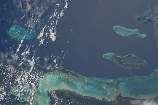
Spacecraft nadir point: 16.7° N, 87.6° W
Photo center point:
Photo center point by machine learning:
Photo center point:
Photo center point by machine learning:
Nadir to Photo Center:
Spacecraft Altitude: 223 nautical miles (413km)
Country or Geographic Name: | |
Features: | |
| Features Found Using Machine Learning: | |
Cloud Cover Percentage: | 10 (1-10)% |
Sun Elevation Angle: | 72° |
Sun Azimuth: | 65° |
Camera: | NIKON D3S S/N: 2007945 |
Focal Length: | 80mm |
Camera Tilt: | |
Format: | |
Film Exposure: | |
| Additional Information | |
| Width | Height | Annotated | Cropped | Purpose | Links |
|---|---|---|---|---|---|
| 4256 pixels | 2832 pixels | No | No | Download Image | |
| 640 pixels | 426 pixels | No | No | Download Image |
Download Packaged File
Download a Google Earth KML for this Image
View photo footprint information
No GeoTIFF is available for this photo.Image Caption: ISS040-E-018752 (24 June 2014) --- One of the Expedition 40 crew members aboard the International Space Station, flying at an altitude of 223 nautical miles, photographed this image of the Caribbean Coast of Belize near the point where it borders Mexico's Yucatan Peninsula. Belize has more than 200 islands or "cayes."
