< ISS026-E-18177 >
| NASA Photo ID | ISS026-E-18177 |
| Focal Length | 80mm |
| Date taken | 2011.01.16 |
| Time taken | 17:19:12 GMT |
Cloud masks available for this image:
Spacecraft nadir point: 51.8° N, 67.8° W
Photo center point:
Photo center point by machine learning:
Photo center point:
Photo center point by machine learning:
Nadir to Photo Center:
Spacecraft Altitude: 187 nautical miles (346km)Body: Earth
Country or Geographic Name: | |
Features: | |
| Features Found Using Machine Learning: | |
Cloud Cover Percentage: | 8 (1-10)% |
Sun Elevation Angle: | 17° |
Sun Azimuth: | 189° |
Camera: | NIKON D3S S/N: 2007934 |
Focal Length: | 80mm |
Camera Tilt: | |
Format: | |
Film Exposure: | |
| Additional Information | |
| Width | Height | Annotated | Cropped | Purpose | Links |
|---|---|---|---|---|---|
| 4256 pixels | 2913 pixels | No | No | Download Image | |
| 640 pixels | 438 pixels | No | No | Download Image |
Download Packaged File
Download a Google Earth KML for this Image
View photo footprint information
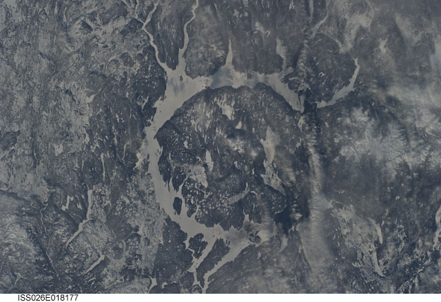
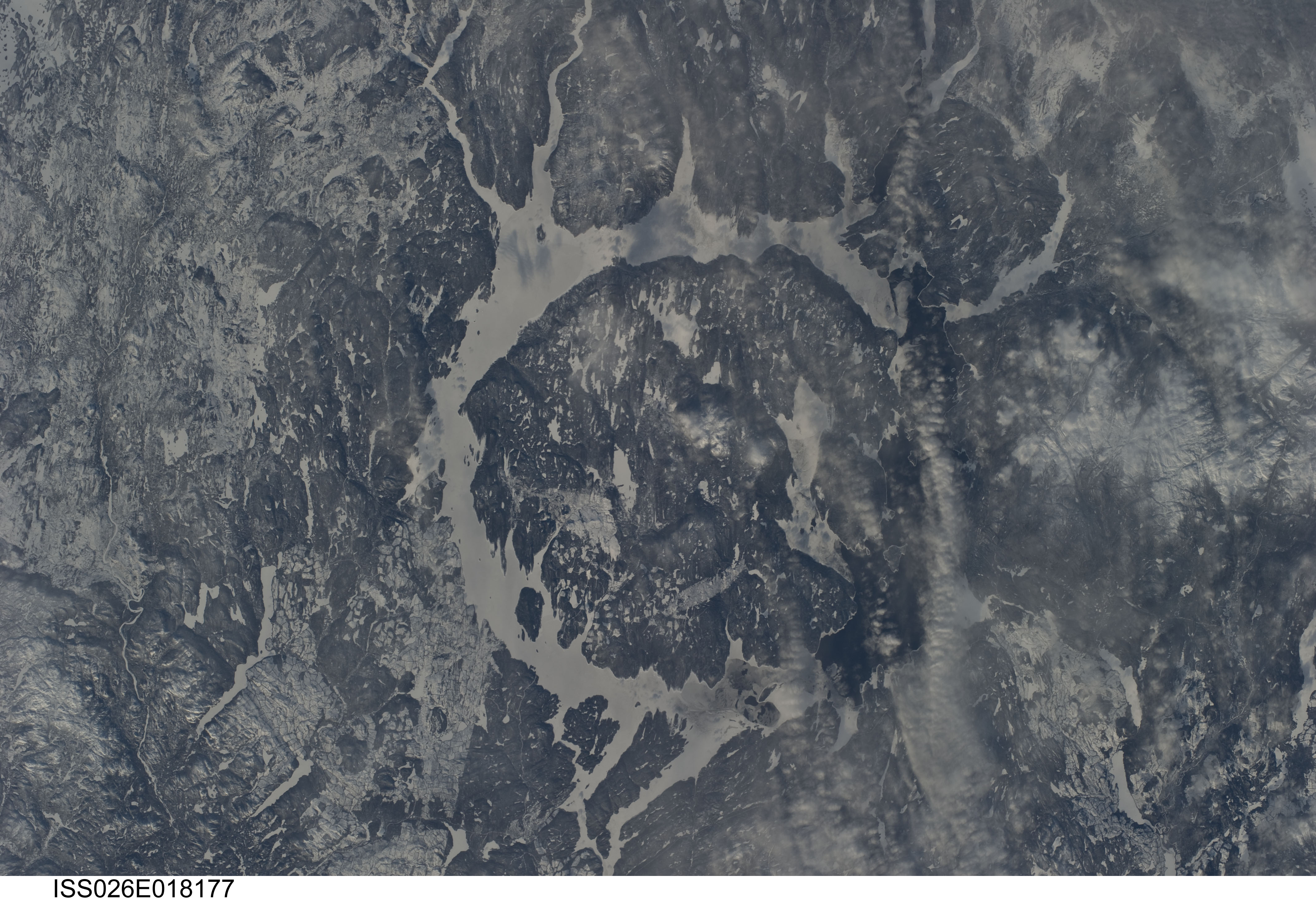
No GeoTIFF is available for this photo.Image Caption: ISS026-E-018177 (16 Jan. 2011) --- From approximately 220 miles above Earth, one of the Expedition 26 crew members aboard the International Space Station took this photo of the Manicouagan Crater in northern Canada (Quebec), one of the oldest impact craters known. According to scientists, the feature was formed about 200 million years ago. The present day terrain supports a hydroelectric reservoir in the telltale form of an annular lake. The crater itself, say scientists, has been worn away by the passing of glaciers and other erosional processes. Still, the hard rock at the impact site has preserved much of the complex impact structure and so allows scientists a leading case to help understand large impact features on Earth and other solar system bodies.
