ISS007-E-18088

| NASA Photo ID | ISS007-E-18088 |
| Focal Length | 800mm |
| Date taken | 2003.10.26 |
| Time taken | 19:54:26 GMT |
Resolutions offered for this image:
540 x 354 pixels 997 x 653 pixels 3032 x 2064 pixels 1000 x 681 pixels 540 x 334 pixels 3032 x 2064 pixels 6144 x 4068 pixels 639 x 435 pixels
540 x 354 pixels 997 x 653 pixels 3032 x 2064 pixels 1000 x 681 pixels 540 x 334 pixels 3032 x 2064 pixels 6144 x 4068 pixels 639 x 435 pixels

Spacecraft nadir point: 41.1° N, 120.0° W
Photo center point: 34.0° N, 117.5° W
Photo center point by machine learning:
Photo center point: 34.0° N, 117.5° W
Photo center point by machine learning:
Nadir to Photo Center: South
Spacecraft Altitude: 200 nautical miles (370km)
Country or Geographic Name: | USA-CALIFORNIA |
Features: | FIRE SMOKE, SAN BERNARDINO MTS. |
| Features Found Using Machine Learning: | |
Cloud Cover Percentage: | 10 (1-10)% |
Sun Elevation Angle: | 37° |
Sun Azimuth: | 183° |
Camera: | Kodak DCS760c Electronic Still Camera |
Focal Length: | 800mm |
Camera Tilt: | High Oblique |
Format: | 3060E: 3060 x 2036 pixel CCD, RGBG array |
Film Exposure: | |
| Additional Information | |
| Width | Height | Annotated | Cropped | Purpose | Links |
|---|---|---|---|---|---|
| 540 pixels | 354 pixels | Photographic Highlights | Download Image | ||
| 997 pixels | 653 pixels | Photographic Highlights | Download Image | ||
| 3032 pixels | 2064 pixels | No | No | Earth From Space collection | Download Image |
| 1000 pixels | 681 pixels | No | Yes | Earth From Space collection | Download Image |
| 540 pixels | 334 pixels | No | Yes | Earth From Space collection | Download Image |
| 3032 pixels | 2064 pixels | No | No | Download Image | |
| 6144 pixels | 4068 pixels | No | No | Presentation | Download Image |
| 639 pixels | 435 pixels | No | No | Download Image |
Download Packaged File
Download a Google Earth KML for this Image
View photo footprint information
Download a GeoTIFF for this photo
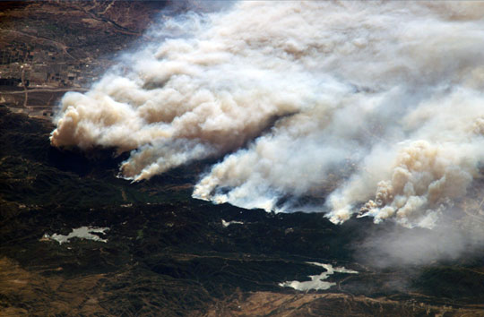
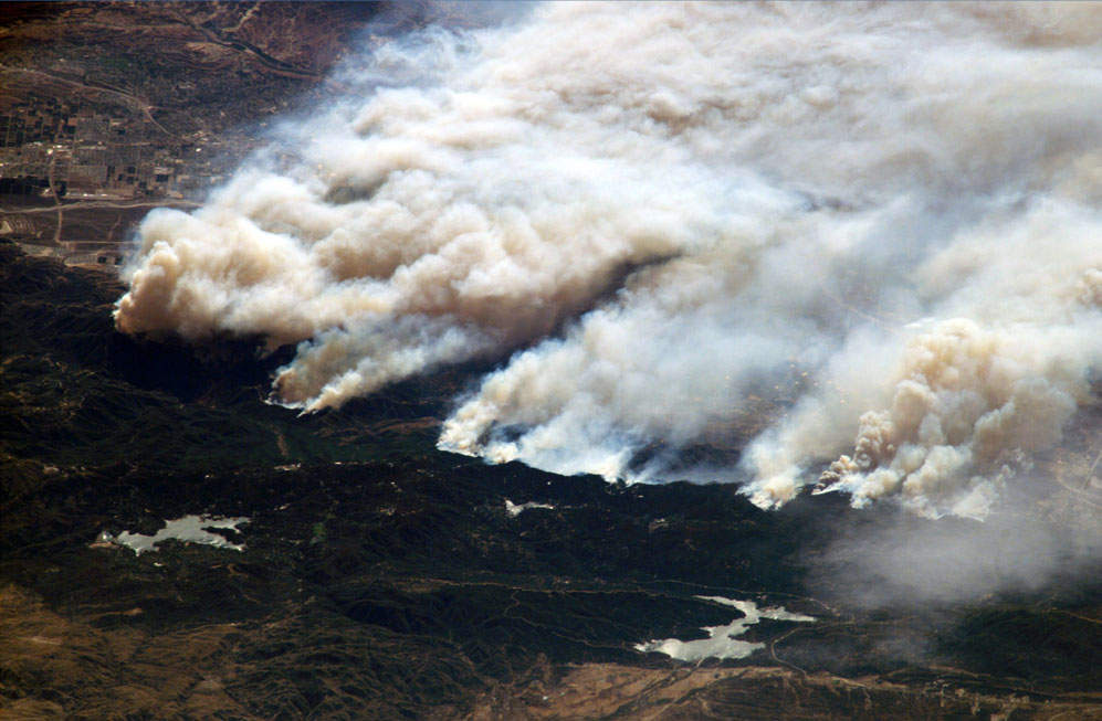
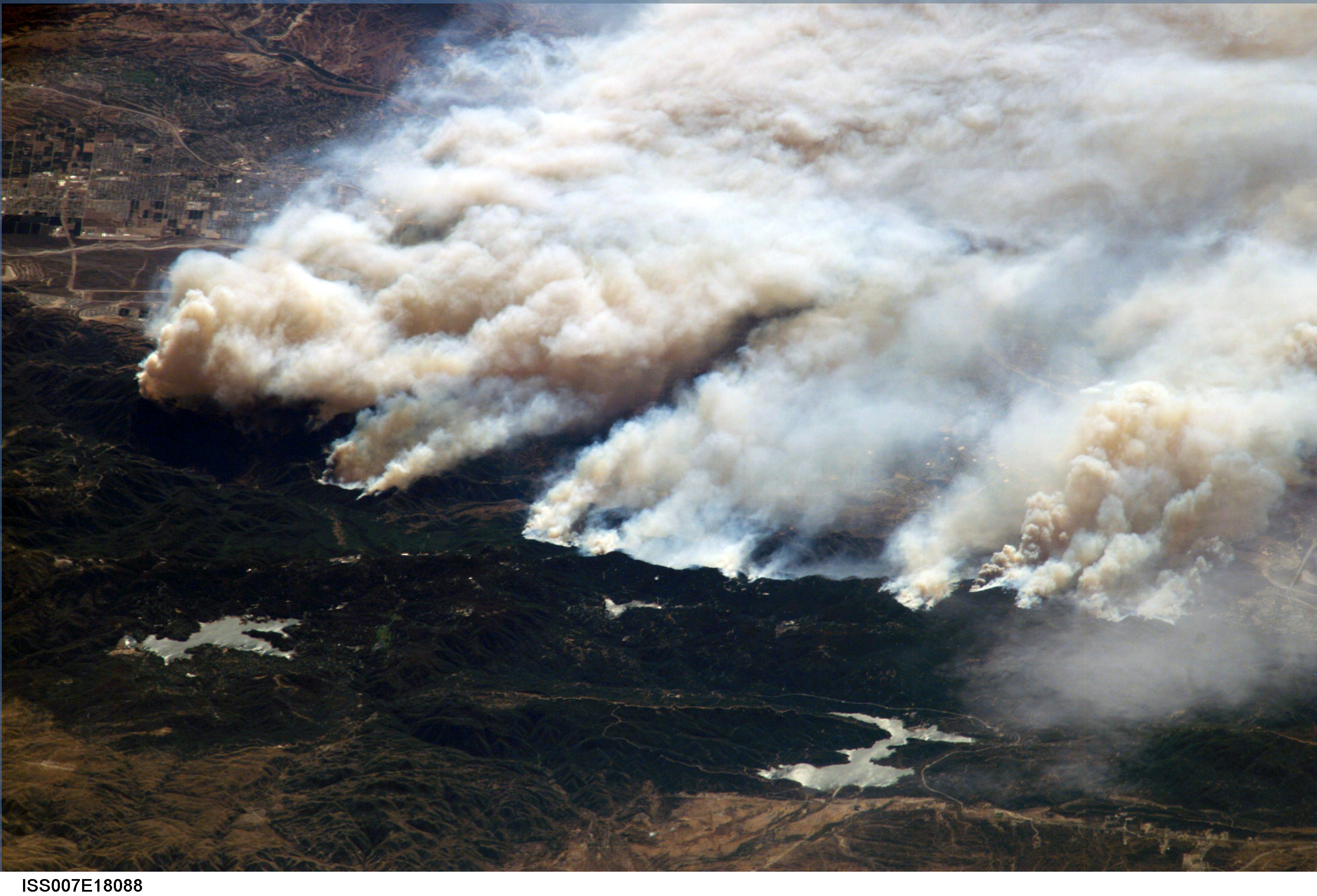
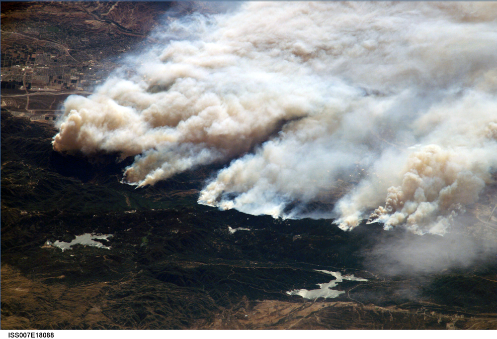
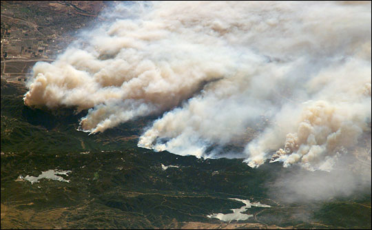
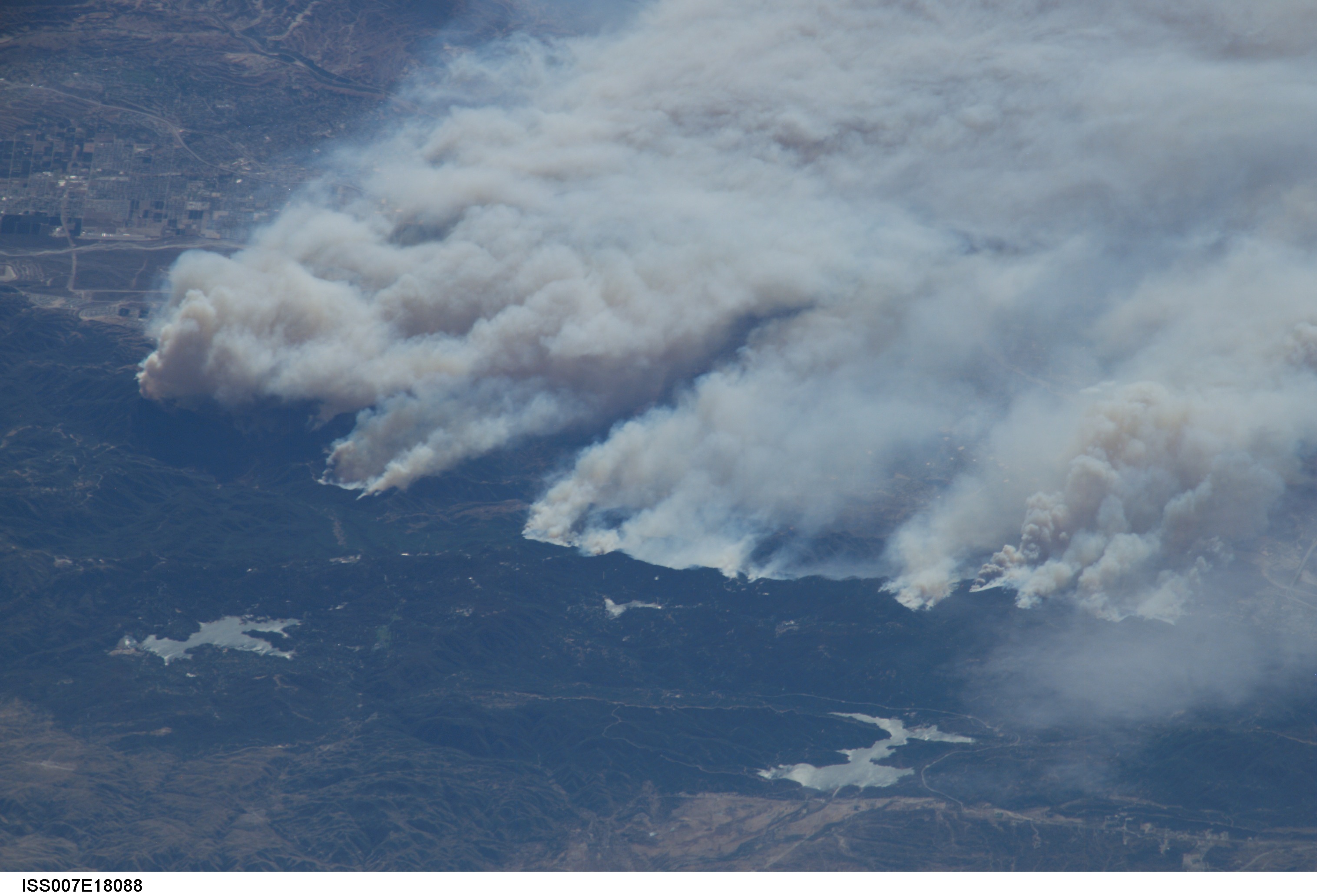
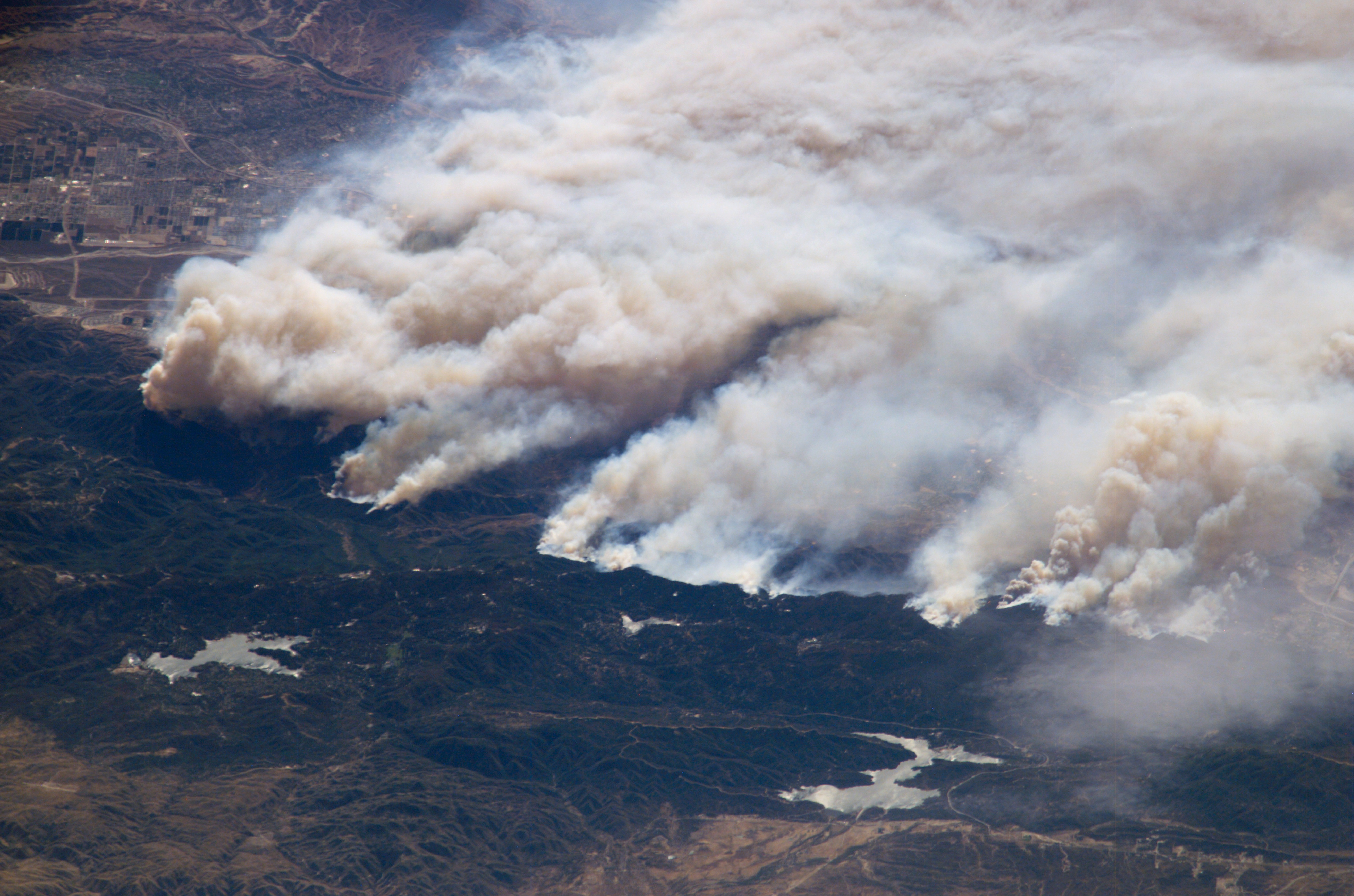
Image Caption: Fires in Southern California
Fires in the San Bernadino Mountains, driven by Santa Ana winds, burned out of control Sunday morning when these images were taken from the International Space Station (ISS) at roughly 11 a.m. PST. Thick yellow smoke blows south, blanketing the valley below. This photograph, looking southeast, captures the smoke pall as the ISS approached and passed over the region. Lake Arrowhead is the reservoir near the left edge of the photograph.
Fires in the San Bernadino Mountains, driven by Santa Ana winds, burned out of control Sunday morning when these images were taken from the International Space Station (ISS) at roughly 11 a.m. PST. Thick yellow smoke blows south, blanketing the valley below. This photograph, looking southeast, captures the smoke pall as the ISS approached and passed over the region. Lake Arrowhead is the reservoir near the left edge of the photograph.
