< ISS036-E-17952 >
| NASA Photo ID | ISS036-E-17952 |
| Focal Length | 50mm |
| Date taken | 2013.07.11 |
| Time taken | 18:35:33 GMT |
Cloud masks available for this image:
Spacecraft nadir point: 46.0° S, 12.2° E
Photo center point:
Photo center point by machine learning:
Photo center point:
Photo center point by machine learning:
Nadir to Photo Center:
Spacecraft Altitude: 227 nautical miles (420km)
Country or Geographic Name: | |
Features: | |
| Features Found Using Machine Learning: | PAN- |
Cloud Cover Percentage: | 50 (26-50)% |
Sun Elevation Angle: | -29° |
Sun Azimuth: | 272° |
Camera: | NIKON D3S S/N: 2007945 |
Focal Length: | 50mm |
Camera Tilt: | |
Format: | |
Film Exposure: | |
| Additional Information | |
| Width | Height | Annotated | Cropped | Purpose | Links |
|---|---|---|---|---|---|
| 4256 pixels | 2832 pixels | No | No | Download Image | |
| 640 pixels | 426 pixels | No | No | Download Image |
Download Packaged File
Download a Google Earth KML for this Image
View photo footprint information
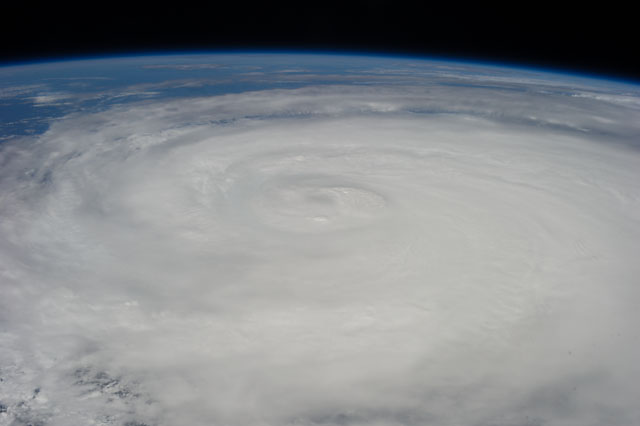
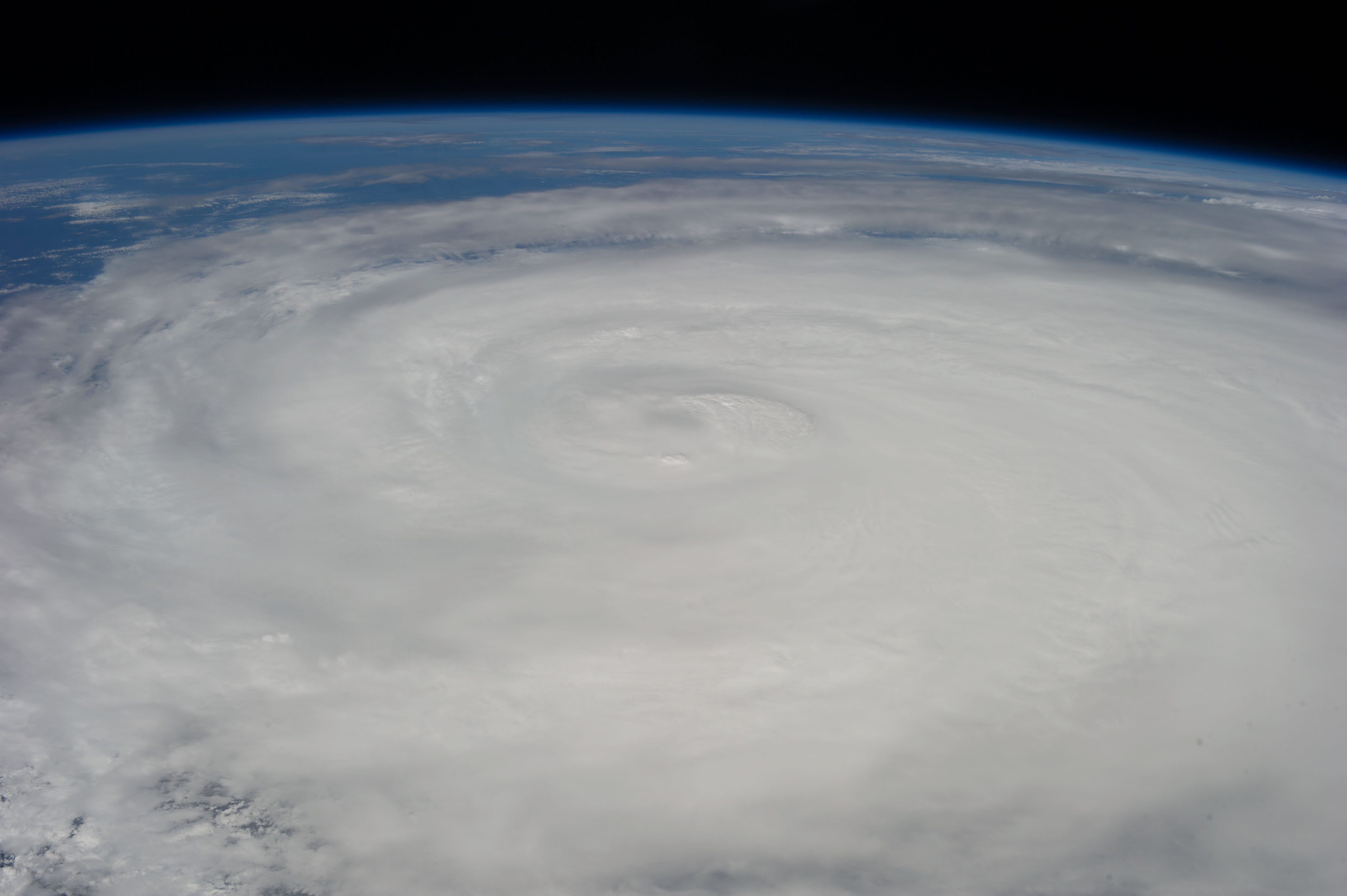
No GeoTIFF is available for this photo.Image Caption: ISS036-E-017952 (11 July 2013) --- One of the Expedition 36 crew members aboard the International Space Station photographed this image of Typhoon Soulik just east of northern Taiwan in the Pacific Ocean. [Editor's update: Thousands of people were evacuated in Taiwan; and the entire island was declared an "alert zone," as Typhoon Soulik made landfall early on July 13 (local time), pounding the country with powerful winds and heavy rain].
