< ISS033-E-17269 >

| NASA Photo ID | ISS033-E-17269 |
| Focal Length | 800mm |
| Date taken | 2012.10.28 |
| Time taken | 21:10:07 GMT |
Cloud masks available for this image:
Spacecraft nadir point: 35.1° N, 31.5° W
Photo center point:
Photo center point by machine learning:
Photo center point:
Photo center point by machine learning:
Nadir to Photo Center:
Spacecraft Altitude: 220 nautical miles (407km)Body: Earth
Country or Geographic Name: | |
Features: | |
| Features Found Using Machine Learning: | PAN- |
Cloud Cover Percentage: | |
Sun Elevation Angle: | -24° |
Sun Azimuth: | 270° |
Camera: | NIKON D3S S/N: 2053892 |
Focal Length: | 800mm |
Camera Tilt: | |
Format: | |
Film Exposure: | |
| Additional Information | |
| Width | Height | Annotated | Cropped | Purpose | Links |
|---|---|---|---|---|---|
| 4256 pixels | 2832 pixels | No | No | Download Image | |
| 640 pixels | 426 pixels | No | No | Download Image |
Download Packaged File
Download a Google Earth KML for this Image
View photo footprint information
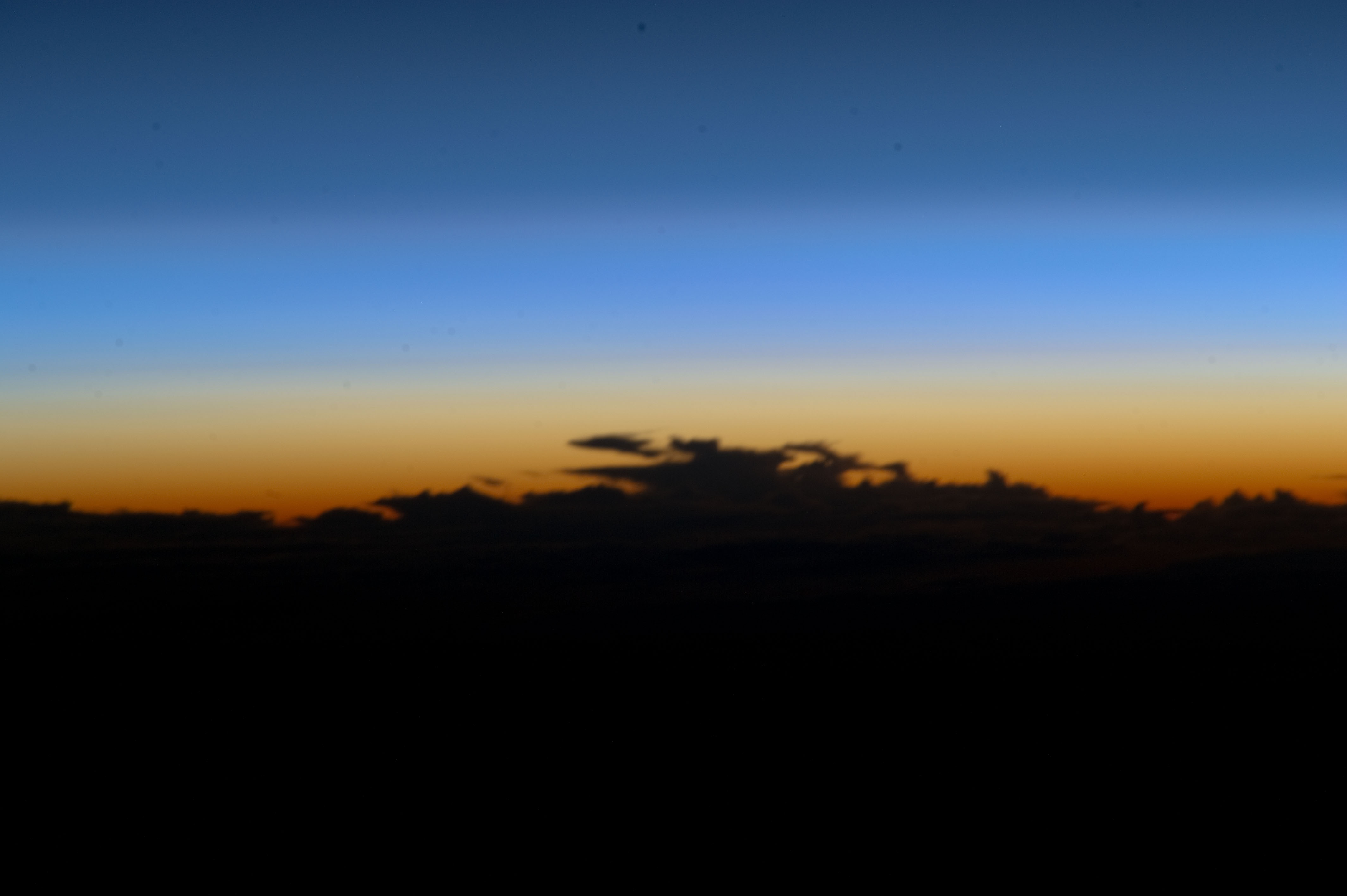
No GeoTIFF is available for this photo.Image Caption: ISS033-E-017269 (28 Oct. 2012) --- This picture, taken by one of the Expedition 33 crew members on the International Space Station, features a silhouette of clouds on Earth's horizon over the East Central Atlantic Ocean, about 4.2 degrees southwest of the Azores. Nadir location is over a point on Earth at 35.1 degrees north latitude and 31.5 degrees west longitude.
