< STS091-719-17 >
| NASA Photo ID | STS091-719-17 |
| Focal Length | 250mm |
| Date taken | 1998.06.12 |
| Time taken | 08:57:07 GMT |
Cloud masks available for this image:
Spacecraft nadir point: 48.5° N, 153.6° E
Photo center point: 49.5° N, 154.5° E
Photo center point by machine learning:
Photo center point: 49.5° N, 154.5° E
Photo center point by machine learning:
Nadir to Photo Center: Northeast
Spacecraft Altitude: 189 nautical miles (350km)
Country or Geographic Name: | RUSSIAN FEDERATION |
Features: | ONEKOTAN I, KHARIMKOTAN I |
| Features Found Using Machine Learning: | |
Cloud Cover Percentage: | 0 (no clouds present) |
Sun Elevation Angle: | 6° |
Sun Azimuth: | 298° |
Camera: | Hasselblad |
Focal Length: | 250mm |
Camera Tilt: | 23 degrees |
Format: | 5069: Kodak Elite 100S, E6 Reversal, Replaces Lumiere, Warmer in tone vs. Lumiere |
Film Exposure: | Normal |
| Additional Information | |
| Width | Height | Annotated | Cropped | Purpose | Links |
|---|---|---|---|---|---|
| 5700 pixels | 5900 pixels | No | No | Download Image Download Color Calibration Image for this Image |
|
| 483 pixels | 500 pixels | No | No | Download Image Download Color Calibration Image for this Image |
|
| 640 pixels | 597 pixels | Download Image |
Download Packaged File
Download a Google Earth KML for this Image
View photo footprint information
No GeoTIFF is available for this photo.Image Caption:
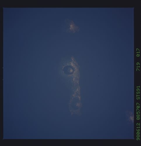
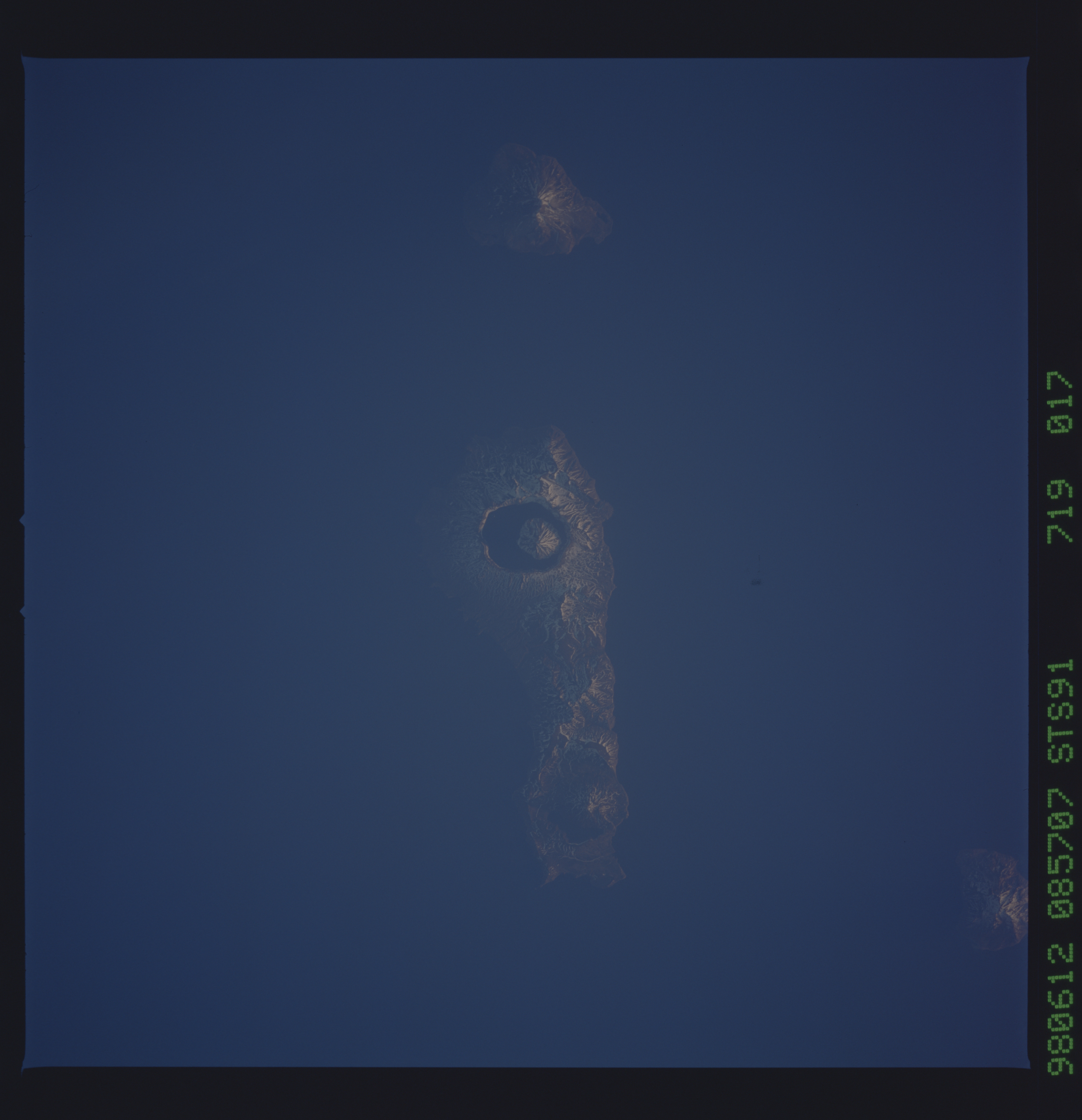
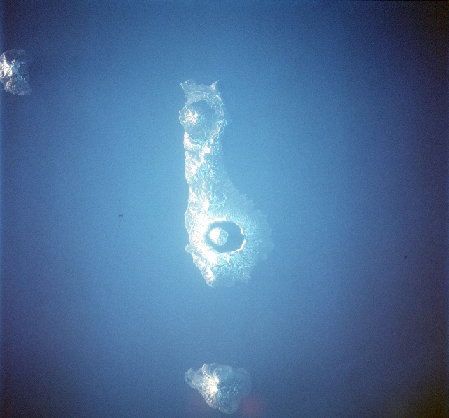
STS091-719-17 Onekotan and Kharimkotan, Kuril Islands.Onekotan , the island with two volcanoes on either end, and Kharimkotan, the single volcano are located in the northern part of the Kuril Islands.The Kuril Island archipelago extends for 750 miles (1,200 km) from the southern tip of the Kamchatka Peninsula (Russia) to the northeastern corner of Hokkaido island (Japan) and separates the Sea of Okhotsk from the Pacific Ocean. The 56 islands cover 6,000 square miles (15,600 square km). The chain is part of the belt of geologic instability circling the Pacific and contains at least 100 volcanoes, of which 35 are still active, and many hot springs. Earthquakes and tidal waves are common; the tidal wave of 1737 attained a height of 210 feet (64 m), one of the highest on record. Parallel to the chain, in the Pacific floor, is the Kuril Trench, which reaches a depth of more than 6.5 miles (10.5 km). The climate in the islands is severe, with long, cold, snowy winters and cool, wet, foggy summers. The average annual precipitation is 30-40 inches (760-1,000 mm), most of which falls as snow, which may occur in any month from the end of September to the beginning of June.
STS091-719-17 Onekotan and Kharimkotan, Kuril Islands.Onekotan , the island with two volcanoes on either end, and Kharimkotan, the single volcano are located in the northern part of the Kuril Islands.The Kuril Island archipelago extends for 750 miles (1,200 km) from the southern tip of the Kamchatka Peninsula (Russia) to the northeastern corner of Hokkaido island (Japan) and separates the Sea of Okhotsk from the Pacific Ocean. The 56 islands cover 6,000 square miles (15,600 square km). The chain is part of the belt of geologic instability circling the Pacific and contains at least 100 volcanoes, of which 35 are still active, and many hot springs. Earthquakes and tidal waves are common; the tidal wave of 1737 attained a height of 210 feet (64 m), one of the highest on record. Parallel to the chain, in the Pacific floor, is the Kuril Trench, which reaches a depth of more than 6.5 miles (10.5 km). The climate in the islands is severe, with long, cold, snowy winters and cool, wet, foggy summers. The average annual precipitation is 30-40 inches (760-1,000 mm), most of which falls as snow, which may occur in any month from the end of September to the beginning of June.
