< SL4-52-17 >
| NASA Photo ID | SL4-52-17 |
| Focal Length | 152mm |
| Date taken | 1973.11.29 |
| Time taken | 18:57:45 GMT |
Cloud masks available for this image:
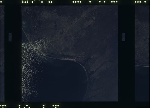
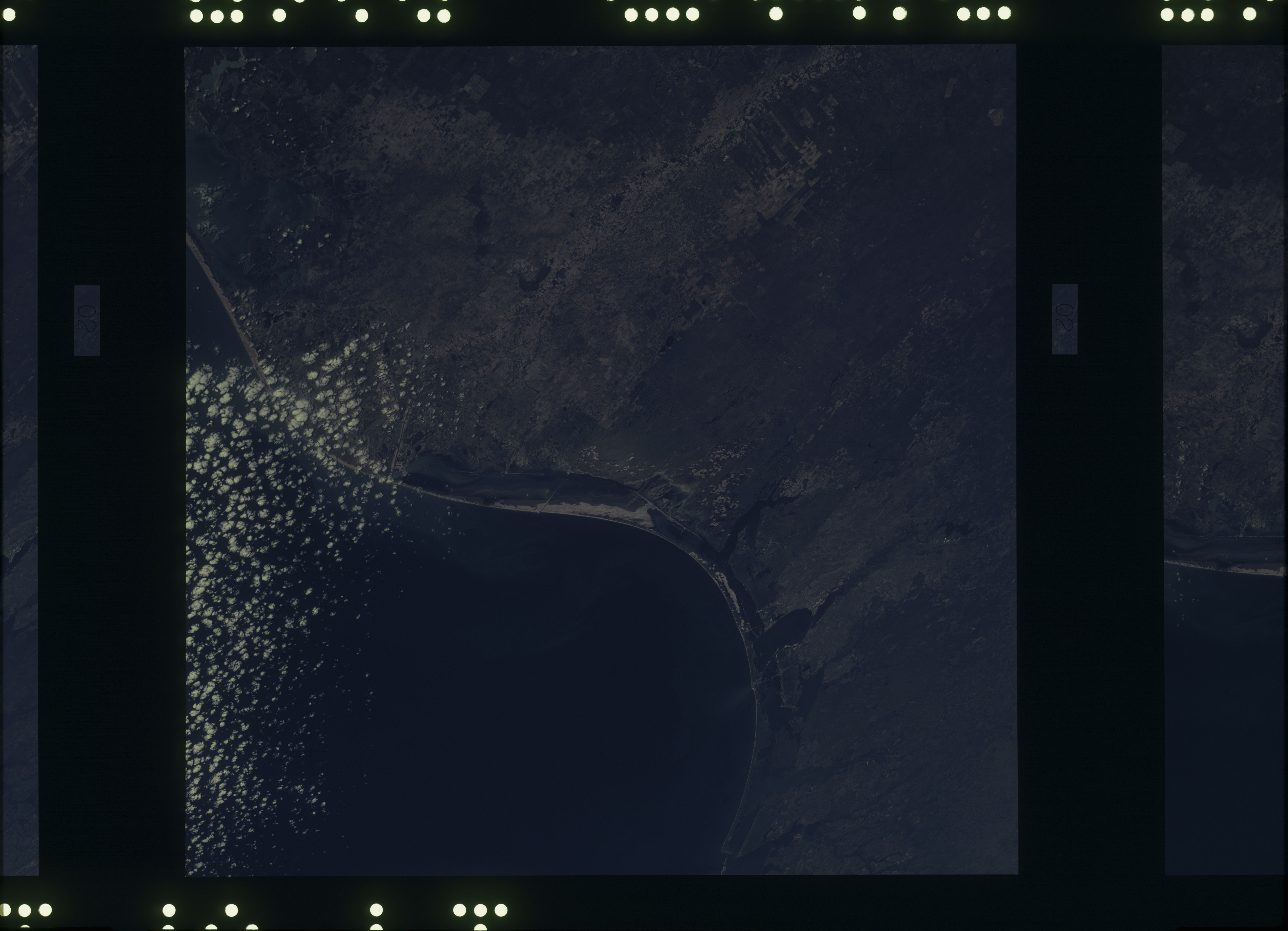
Spacecraft nadir point: 26.7° N, 97.5° W
Photo center point: 26.7° N, 97.5° W
Photo center point by machine learning:
Photo center point: 26.7° N, 97.5° W
Photo center point by machine learning:
Nadir to Photo Center:
Spacecraft Altitude: 239 nautical miles (443km)
Country or Geographic Name: | |
Features: | TEX., MEXICO (TAMAULIPAS-RIO GRANDE), BROWNSVILLE, MATAMOROS |
| Features Found Using Machine Learning: | |
Cloud Cover Percentage: | 10 (1-10)% |
Sun Elevation Angle: | ° |
Sun Azimuth: | ° |
Camera: | Skylab Multispectral (S190A) |
Focal Length: | 152mm |
Camera Tilt: | 0 degrees |
Format: | SO356: Unknown SkyLab |
Film Exposure: | |
| Additional Information | |
| Width | Height | Annotated | Cropped | Purpose | Links |
|---|---|---|---|---|---|
| 6830 pixels | 4937 pixels | No | No | Download Image | |
| 500 pixels | 361 pixels | No | No | Download Image |
Download Packaged File
Download a Google Earth KML for this Image
View photo footprint information
No GeoTIFF is available for this photo.Image Caption: Excellent oblique view of the entire cultivated portion of the Rio Grande delta, land-use patterns in the South Texas Plain, and the Laguna Madre.
