< ISS040-E-16569 >
| NASA Photo ID | ISS040-E-16569 |
| Focal Length | 70mm |
| Date taken | 2014.06.21 |
| Time taken | 20:44:34 GMT |

Spacecraft nadir point: 28.1° N, 119.9° W
Photo center point:
Photo center point by machine learning:
Photo center point:
Photo center point by machine learning:
Nadir to Photo Center:
Spacecraft Altitude: 222 nautical miles (411km)
Country or Geographic Name: | |
Features: | |
| Features Found Using Machine Learning: | |
Cloud Cover Percentage: | 90 (76-100)% |
Sun Elevation Angle: | 79° |
Sun Azimuth: | 248° |
Camera: | NIKON D3S S/N: 2007931 |
Focal Length: | 70mm |
Camera Tilt: | |
Format: | |
Film Exposure: | |
| Additional Information | |
| Width | Height | Annotated | Cropped | Purpose | Links |
|---|---|---|---|---|---|
| 4256 pixels | 2832 pixels | No | No | Download Image | |
| 640 pixels | 426 pixels | No | No | Download Image |
Download Packaged File
Download a Google Earth KML for this Image
View photo footprint information
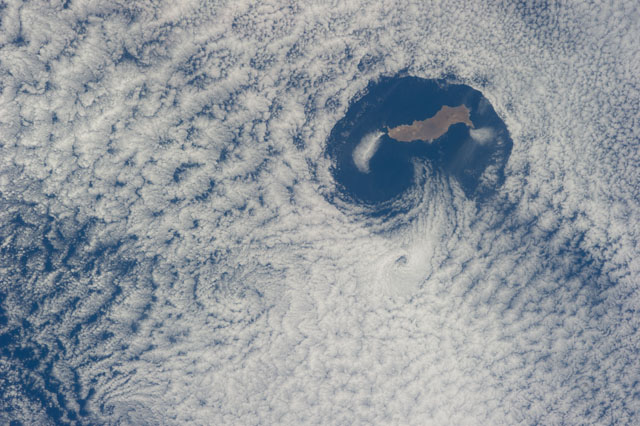
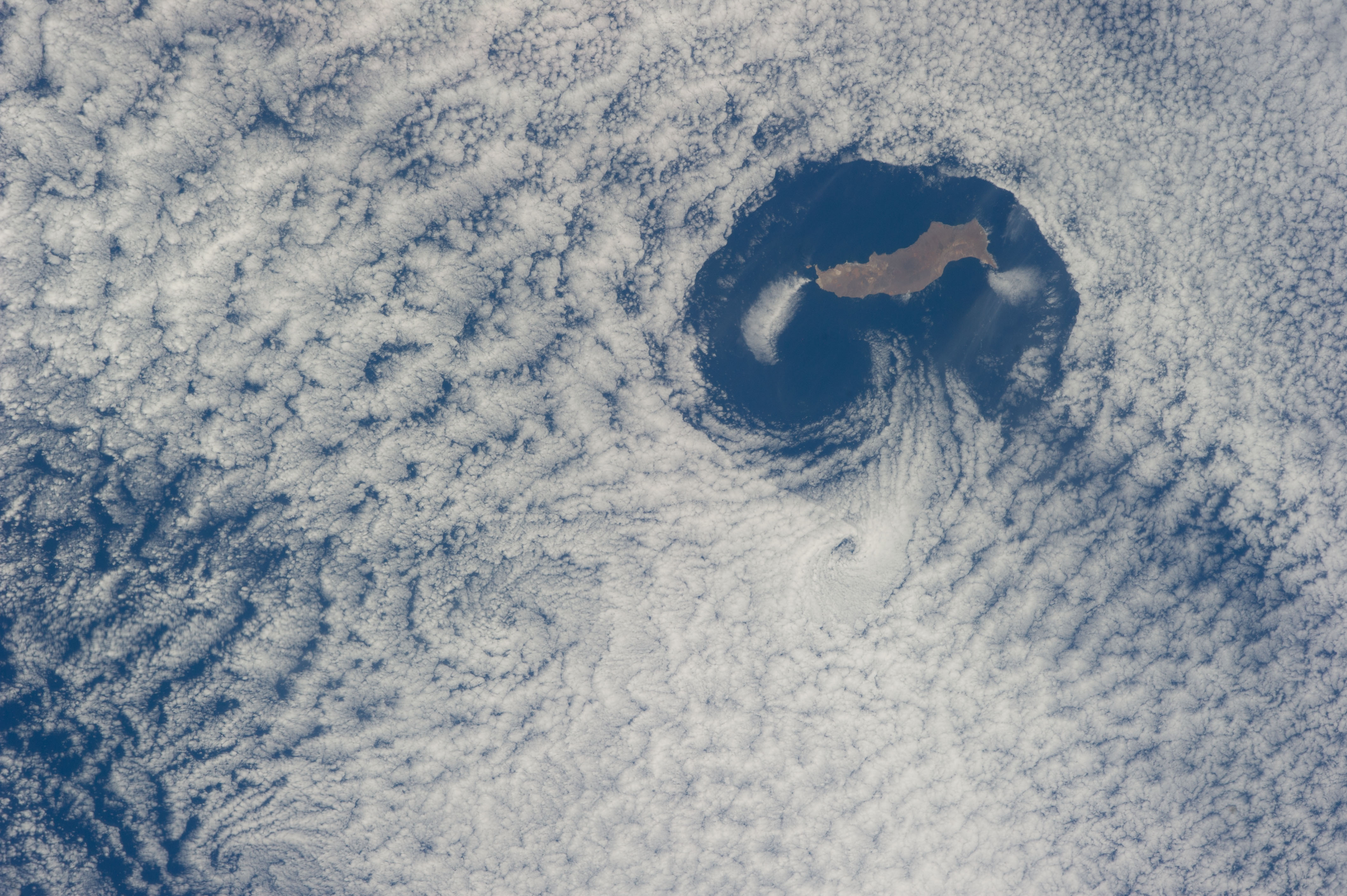
No GeoTIFF is available for this photo.Image Caption: ISS040-E-016569 (21 June 2014) --- From an altitude of 223 nautical miles, one of the Expedition 40 crew members on the International Space Station photographed this nearly vertical image of Guadalupe Island and the Von Karman cloud vortices that are its storied neighbors just off southern California's Pacific Coast.
