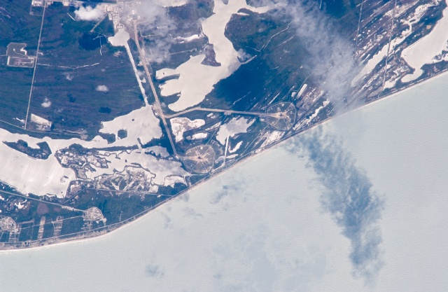
< ISS011-E-15330 >
| NASA Photo ID | ISS011-E-15330 |
| Focal Length | 800mm |
| Date taken | 2005.05.17 |
| Time taken | 19:01:30 GMT |
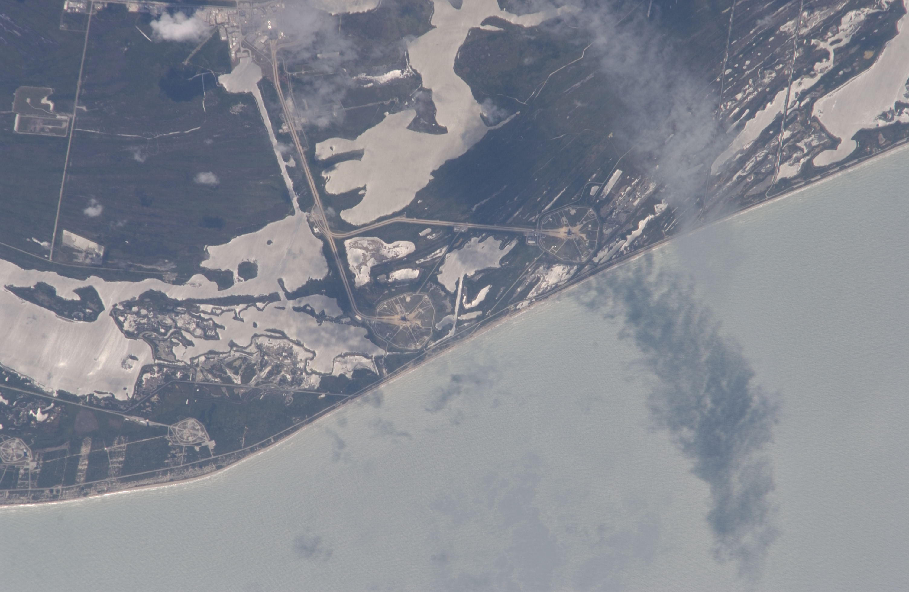

Spacecraft nadir point: 29.1° N, 78.4° W
Photo center point: 28.6° N, 80.6° W
Photo center point by machine learning: 28.61° N, 80.61° W
Photo center point: 28.6° N, 80.6° W
Photo center point by machine learning: 28.61° N, 80.61° W
Nadir to Photo Center: West
Spacecraft Altitude: 189 nautical miles (350km)

Country or Geographic Name: | USA-FLORIDA |
Features: | KENNEDY SPACE CENTER, LAUNCH COMPLEX |
| Features Found Using Machine Learning: | |
Cloud Cover Percentage: | 10 (1-10)% |
Sun Elevation Angle: | 63° |
Sun Azimuth: | 256° |
Camera: | Nikon D1 Electronic Still Camera |
Focal Length: | 800mm |
Camera Tilt: | 36 degrees |
Format: | 2000E: 2000 x 1312 pixel CCD, RGBG imager color filter |
Film Exposure: | |
| Additional Information | |
| Width | Height | Annotated | Cropped | Purpose | Links |
|---|---|---|---|---|---|
| 3008 pixels | 1960 pixels | No | No | Not enhanced | Download Image |
| 640 pixels | 417 pixels | No | No | Download Image |
Download Packaged File
Download a Google Earth KML for this Image
View photo footprint information
No GeoTIFF is available for this photo.Image Caption: none
