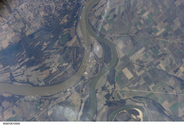
ISS012-E-15035
| NASA Photo ID | ISS012-E-15035 |
| Focal Length | 400mm |
| Date taken | 2006.01.12 |
| Time taken | 18:38:03 GMT |
1000 x 694 pixels 540 x 375 pixels 540 x 405 pixels 1520 x 1008 pixels 639 x 435 pixels

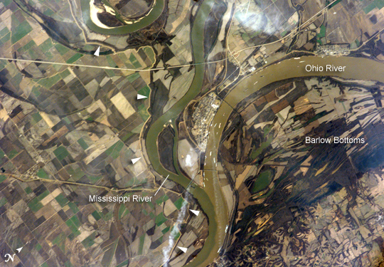
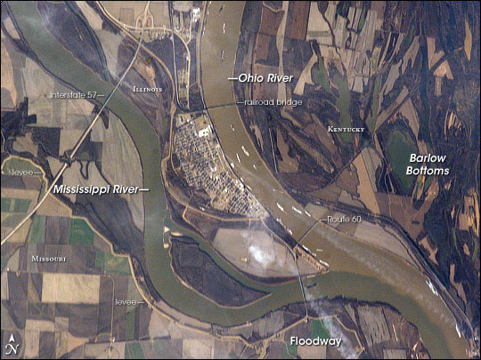
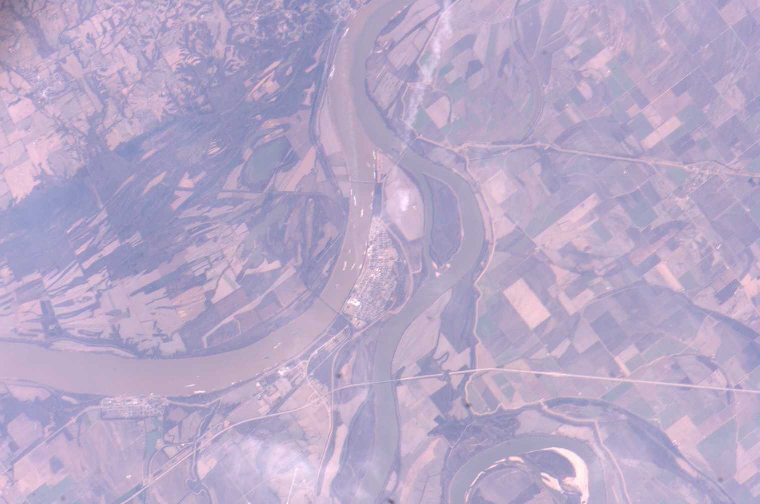


Photo center point: 37.0° N, 89.2° W
Photo center point by machine learning:
Country or Geographic Name: | USA-ILLINOIS |
Features: | CAIRO, MISSISSIPPI R., OHIO R. |
| Features Found Using Machine Learning: | |
Cloud Cover Percentage: | 10 (1-10)% |
Sun Elevation Angle: | 31° |
Sun Azimuth: | 190° |
Camera: | Kodak DCS760c Electronic Still Camera |
Focal Length: | 400mm |
Camera Tilt: | 17 degrees |
Format: | 3060E: 3060 x 2036 pixel CCD, RGBG array |
Film Exposure: | |
| Additional Information | |
| Width | Height | Annotated | Cropped | Purpose | Links |
|---|---|---|---|---|---|
| 1000 pixels | 694 pixels | No | Yes | Earth From Space collection | Download Image |
| 540 pixels | 375 pixels | Yes | Yes | Earth From Space collection | Download Image |
| 540 pixels | 405 pixels | Yes | Yes | NASA's Earth Observatory web site | Download Image |
| 1520 pixels | 1008 pixels | No | No | Not enhanced | Download Image |
| 639 pixels | 435 pixels | No | No | Download Image |
The Ohio River becomes a tributary of the Mississippi River directly south of Cairo, Illinois, a small city on the spit of land where the rivers converge (at center of this astronaut photograph). Brown, sediment-laden water flowing generally northeast to south from the Ohio River is distinct from the green and relatively sediment-poor water of the Mississippi River (flowing northwest to south). The color of the rivers in this image is reversed from the usual condition of a green Ohio and a brown Mississippi. This suggests that the very high rainfall in December 2005 over the Appalachians and the northeastern United States has led to greater-than-normal amounts of sediment in the rivers and streams of the Ohio River watershed. The distinct boundary between the two river's waters indicates that little to no mixing occurs even 5-6 kilometers (3-4 miles) downstream.
Cairo became a prosperous port following the Civil War due to increased riverboat and railroad commerce. Small features visible in the image on the Ohio are river barges, which indicate the continued importance of Cairo as a transport hub. Flooding of the Ohio and Mississippi Rivers presents a continual danger to the city; this danger is lessened by the Birds Point-New Madrid Floodway that begins directly to the south of the river confluence. During major flood events, the floodway lessens flood stages upstream (such as at Cairo) and adjacent to the floodway. Part of the extensive levee system associated with flood control of the Mississippi River is visible in the image. Barlow Bottoms (image right), located in adjacent Kentucky, is a wetland bird-watching location that is replenished by periodic floods and releases of Ohio River water.
