< STS091-707-15 >
| NASA Photo ID | STS091-707-15 |
| Focal Length | 250mm |
| Date taken | 1998.06.07 |
| Time taken | 21:26:32 GMT |
Resolutions offered for this image:
5700 x 5900 pixels 483 x 500 pixels 2140 x 2020 pixels 505 x 518 pixels 639 x 604 pixels
5700 x 5900 pixels 483 x 500 pixels 2140 x 2020 pixels 505 x 518 pixels 639 x 604 pixels
Cloud masks available for this image:
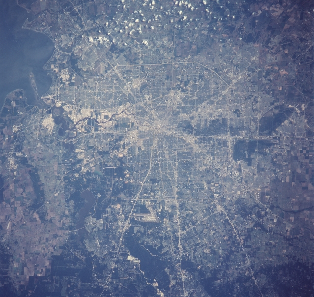
Spacecraft nadir point: 30.5° N, 96.5° W
Photo center point: 29.5° N, 95.5° W
Photo center point by machine learning:
Photo center point: 29.5° N, 95.5° W
Photo center point by machine learning:
Nadir to Photo Center: Southeast
Spacecraft Altitude: 198 nautical miles (367km)
Country or Geographic Name: | USA-TEXAS |
Features: | HOUSTON |
| Features Found Using Machine Learning: | |
Cloud Cover Percentage: | 10 (1-10)% |
Sun Elevation Angle: | 49° |
Sun Azimuth: | 271° |
Camera: | Hasselblad |
Focal Length: | 250mm |
Camera Tilt: | 23 degrees |
Format: | 5069: Kodak Elite 100S, E6 Reversal, Replaces Lumiere, Warmer in tone vs. Lumiere |
Film Exposure: | Normal |
| Additional Information | |
| Width | Height | Annotated | Cropped | Purpose | Links |
|---|---|---|---|---|---|
| 5700 pixels | 5900 pixels | No | No | Download Image Download Color Calibration Image for this Image |
|
| 483 pixels | 500 pixels | No | No | Download Image Download Color Calibration Image for this Image |
|
| 2140 pixels | 2020 pixels | Download Image | |||
| 505 pixels | 518 pixels | No | No | Download Image | |
| 639 pixels | 604 pixels | Download Image |
Download Packaged File
Download a Google Earth KML for this Image
View photo footprint information
No GeoTIFF is available for this photo.Image Caption:
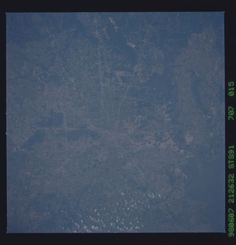
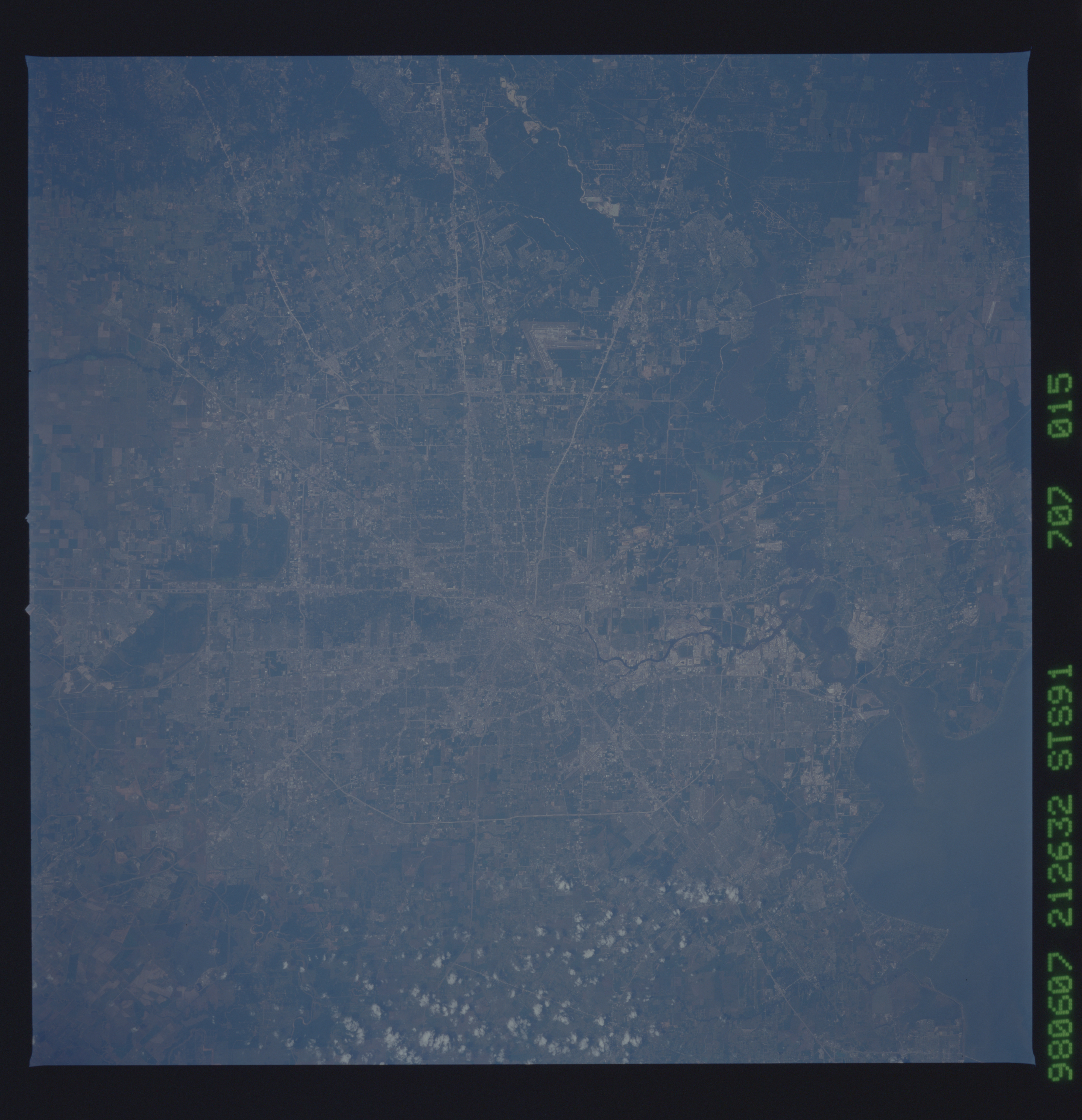
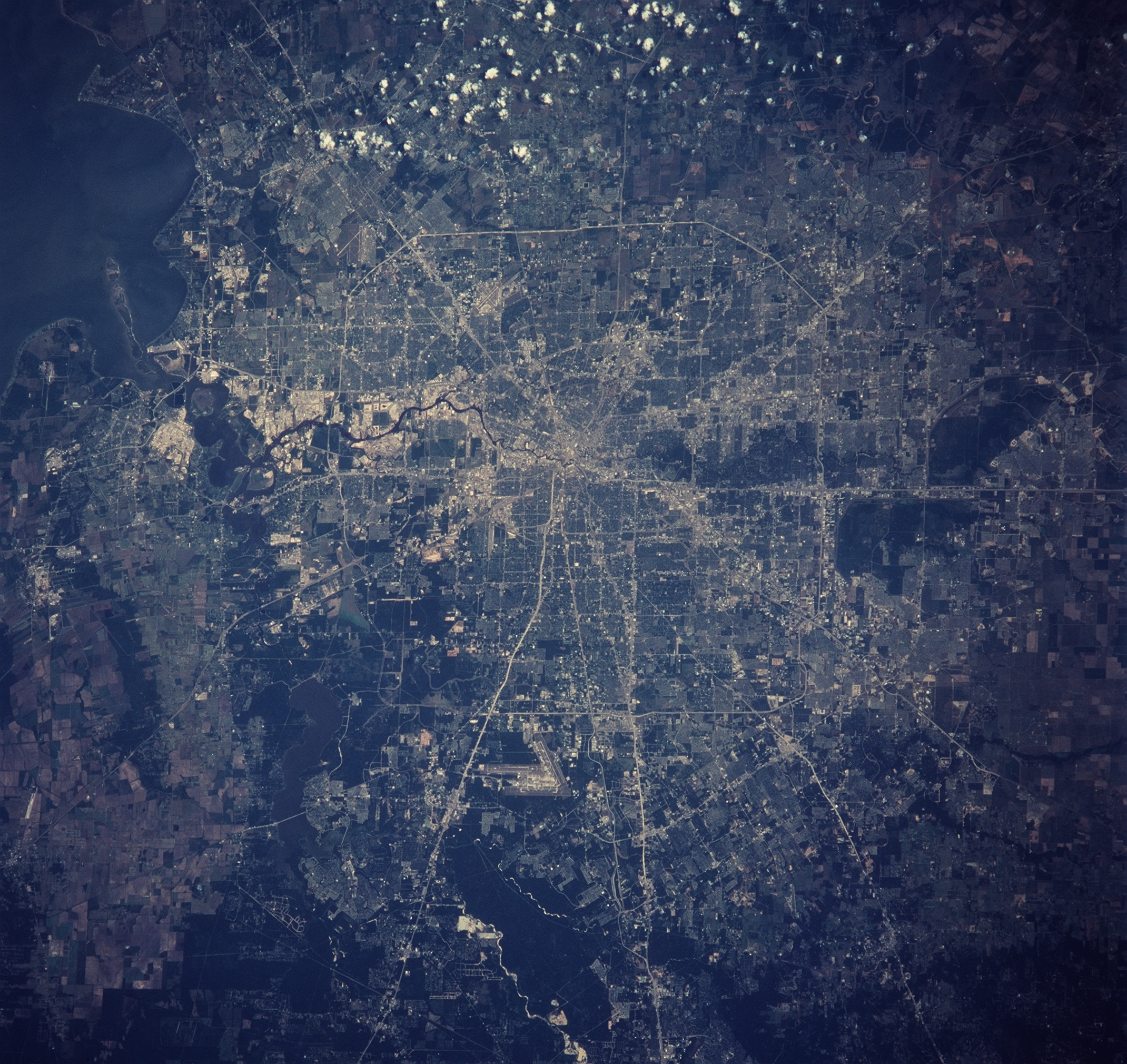
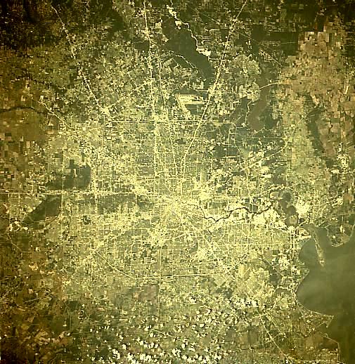
STS091-707-15 Houston, TexasHouston, Texas, the state's largest city, is an inland port city, linked by the Houston Ship Channel to the Gulf of Mexico and the Intracoastal Waterway at Galveston, 51 miles (82 km) southeast. Built on a flat Gulf Coastal Plain, the city is named for Sam Houston the first president elect of the Republic of Texas. The city developed as a rail center, with 12 railways by 1891; and, after the Galveston hurricane and flood in 1900, it emerged as the state's leading port. Oil, discovered in the area in 1901, brought considerable industrial development, triggering the city's expansion and prosperity. Houston is now a leading oil and petrochemical center, the focal point for networks of natural gas pipelines, and an aerospace research and development center. Immense resources of oil, natural gas, sulfur, lime, salt, and water have created one of the world's greatest concentrations of industries along the ship channel. Southeast near Clear Lake, 22 miles from the city's downtown area, is the NASA Lyndon B. Johnson Space Center (1961), which is the command post for the flights by U.S. astronauts. The area around Houston is also important for rice, cotton, and cattle
STS091-707-15 Houston, TexasHouston, Texas, the state's largest city, is an inland port city, linked by the Houston Ship Channel to the Gulf of Mexico and the Intracoastal Waterway at Galveston, 51 miles (82 km) southeast. Built on a flat Gulf Coastal Plain, the city is named for Sam Houston the first president elect of the Republic of Texas. The city developed as a rail center, with 12 railways by 1891; and, after the Galveston hurricane and flood in 1900, it emerged as the state's leading port. Oil, discovered in the area in 1901, brought considerable industrial development, triggering the city's expansion and prosperity. Houston is now a leading oil and petrochemical center, the focal point for networks of natural gas pipelines, and an aerospace research and development center. Immense resources of oil, natural gas, sulfur, lime, salt, and water have created one of the world's greatest concentrations of industries along the ship channel. Southeast near Clear Lake, 22 miles from the city's downtown area, is the NASA Lyndon B. Johnson Space Center (1961), which is the command post for the flights by U.S. astronauts. The area around Houston is also important for rice, cotton, and cattle
