ISS064-E-14839
| NASA Photo ID | ISS064-E-14839 |
| Focal Length | 400mm |
| Date taken | 2020.12.19 |
| Time taken | 13:50:17 GMT |
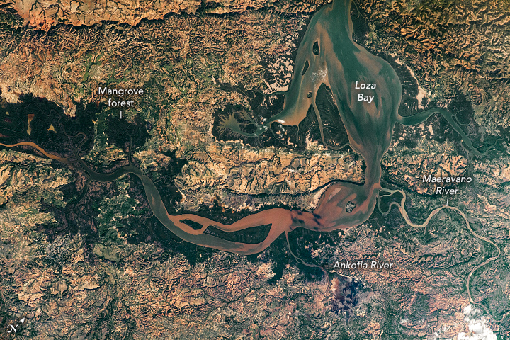
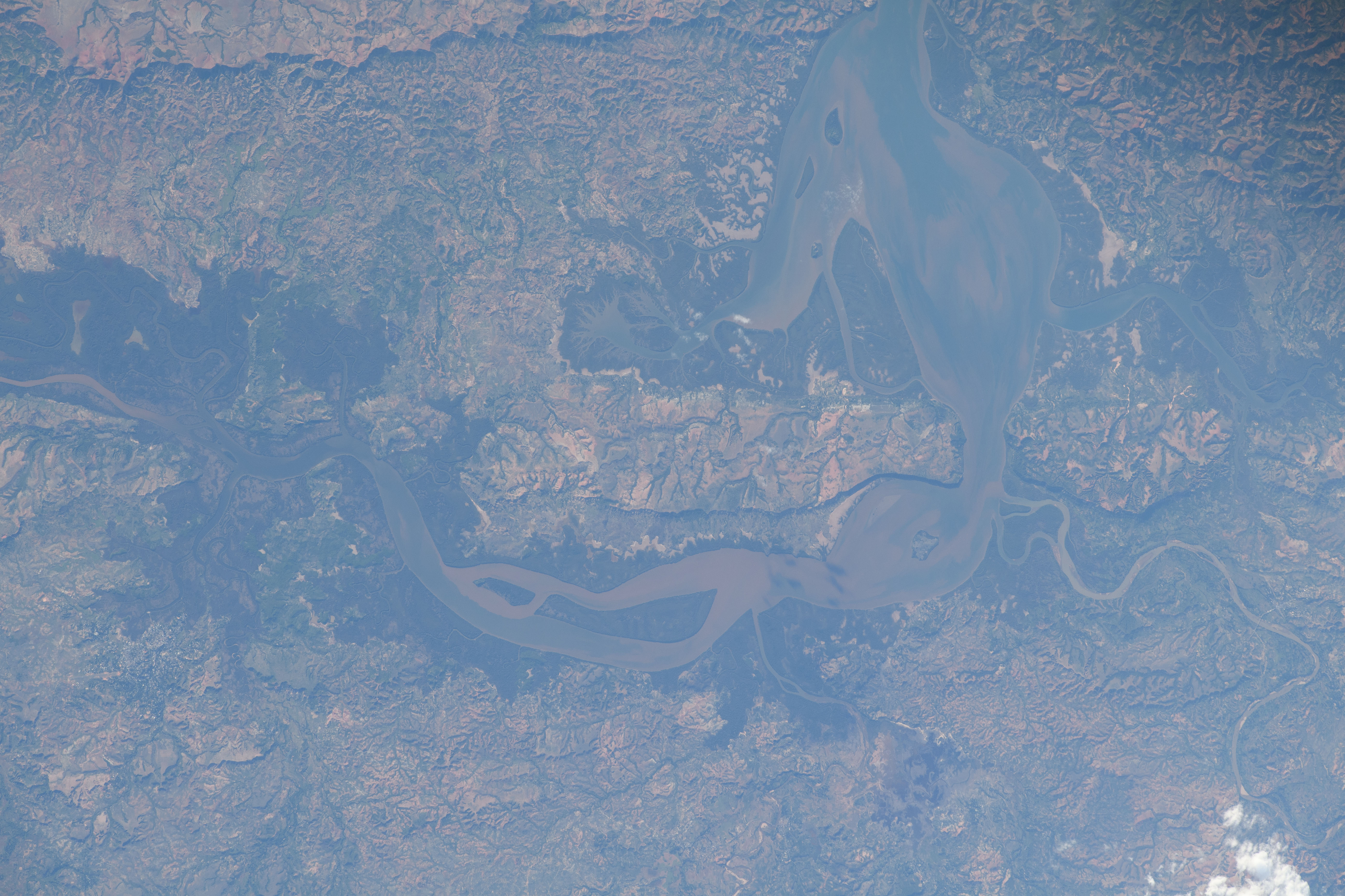


Photo center point: 14.7° S, 48.0° E
Photo center point by machine learning: 14.71° S, 47.95° E

Country or Geographic Name: | MADAGASCAR |
Features: | ANKOFIA RIVER, MAEVARANO RIVER, ESTUARY, MAEVERANO RIVER DELTA |
| Features Found Using Machine Learning: | |
Cloud Cover Percentage: | 10 (1-10)% |
Sun Elevation Angle: | 18° |
Sun Azimuth: | 250° |
Camera: | Nikon D5 Electronic Still Camera |
Focal Length: | 400mm |
Camera Tilt: | 24 degrees |
Format: | 5568E: 5568 x 3712 pixel CMOS sensor, 35.9 x 23.9 mm, total pixels: 21.33 million, Nikon FX format |
Film Exposure: | |
| Additional Information | |
| Width | Height | Annotated | Cropped | Purpose | Links |
|---|---|---|---|---|---|
| 720 pixels | 480 pixels | Yes | No | Download Image | |
| 5568 pixels | 3712 pixels | No | No | Download Image | |
| 640 pixels | 427 pixels | No | No | Download Image |
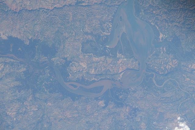
This photograph, taken by an astronaut from the International Space Station (ISS), captures the estuarine ecosystem of the Loza Bay wetlands (//datazone.birdlife.org/site/factsheet/loza-bay-wetlands-iba-madagascar) in northwest Madagascar. Estuaries are coastal habitats where fresh water from rivers - in this case, the Ankofia and Maevarano - mixes with salt water from the ocean in partially enclosed basins.
Rivers carry oxidized sediment loads down from Madagascar's high central plateau toward the Mozambique Channel (not pictured). This reddish-brown sediment-laden freshwater mixes with the clearer, blue saltwater that sloshes in and out of the estuary from the sea with the movement of the tides.
Mangrove forests are common around Madagascar's major estuaries as the brackish waters create the environmental conditions in which the trees thrive. Mangrove forests play a vital role in sustaining coastal communities - not only as resources for agriculture and aquaculture, but as sources for fuelwood, charcoal production, and timber. However, the unsustainable harvesting of these mangroves and other local vegetation and wildlife threatens the biodiversity of coastal Madagascar.
Further Reading: NASA Earth Observatory (2018, November 4) A Close-Up View of the Betsiboka.
