< STS037-151-145 >
| NASA Photo ID | STS037-151-145 |
| Focal Length | 250mm |
| Date taken | 1991.04.06 |
| Time taken | 06:19:04 GMT |

Cloud masks available for this image:
Spacecraft nadir point: 9.7° N, 107.0° E
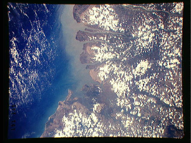
Photo center point: 10.0° N, 106.5° E
Photo center point by machine learning:
Photo center point: 10.0° N, 106.5° E
Photo center point by machine learning:
Nadir to Photo Center: Northwest
Spacecraft Altitude: 244 nautical miles (452km)
Country or Geographic Name: | VIETNAM |
Features: | MOUTHS OF THE MEKONG |
| Features Found Using Machine Learning: | |
Cloud Cover Percentage: | 45 (26-50)% |
Sun Elevation Angle: | 69° |
Sun Azimuth: | 262° |
Camera: | Linhof |
Focal Length: | 250mm |
Camera Tilt: | 8 degrees |
Format: | QX868: Kodak, natural color positive, Ektachrome QX868(5017 emulsion), ASA 64, thin base |
Film Exposure: | Normal |
| Additional Information | |
| Width | Height | Annotated | Cropped | Purpose | Links |
|---|---|---|---|---|---|
| 640 pixels | 480 pixels | No | No | ISD 1 | Download Image |
| 8094 pixels | 8880 pixels | Download Image |
Download Packaged File
Download a Google Earth KML for this Image
View photo footprint information
No GeoTIFF is available for this photo.Image Caption: none
