< ISS010-E-13680 >
| NASA Photo ID | ISS010-E-13680 |
| Focal Length | 800mm |
| Date taken | 2005.01.17 |
| Time taken | 20:59:37 GMT |
Cloud masks available for this image:
Spacecraft nadir point: 32.4° N, 92.9° W
Photo center point:
Photo center point by machine learning: 29.51° N, 95.18° W
Photo center point:
Photo center point by machine learning: 29.51° N, 95.18° W
Nadir to Photo Center:
Spacecraft Altitude: 189 nautical miles (350km)Body: Earth
Country or Geographic Name: | |
Features: | |
| Features Found Using Machine Learning: | |
Cloud Cover Percentage: | 1 (1-10)% |
Sun Elevation Angle: | 25° |
Sun Azimuth: | 221° |
Camera: | K760C-01498 |
Focal Length: | 800mm |
Camera Tilt: | |
Format: | |
Film Exposure: | |
| Additional Information | |
| Width | Height | Annotated | Cropped | Purpose | Links |
|---|---|---|---|---|---|
| 3032 pixels | 2064 pixels | No | No | Download Image | |
| 639 pixels | 435 pixels | No | No | Download Image |
Download Packaged File
Download a Google Earth KML for this Image
View photo footprint information
Download a GeoTIFF for this photo
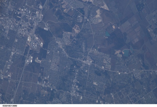
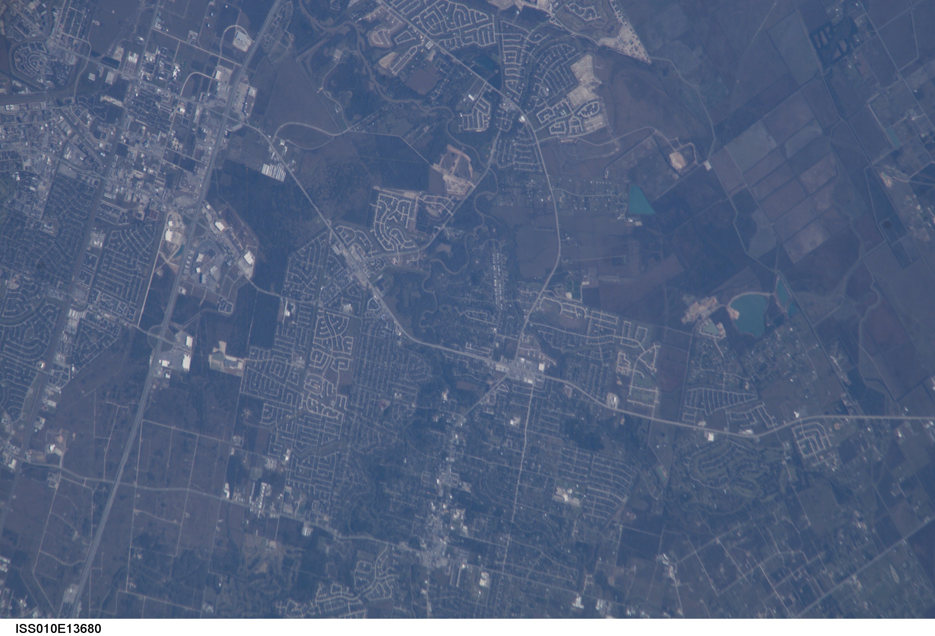
Image Caption: ISS010-E-13680 (17 January 2005) --- The border of Galveston and Brazoria Counties in Texas is visible in this electronic still camera's image, as photographed by the Expedition 10 crew onboard the International Space Station. Polly Ranch, near Friendswood, is visible west of Interstate Highway 45 (right side). FM528 goes horizontally through the middle, and FM518 runs vertically through frame center, with the two roads intersecting near Friendswood.

