< STS068-163-136 >
| NASA Photo ID | STS068-163-136 |
| Focal Length | 250mm |
| Date taken | 1994.10.07 |
| Time taken | 06:32:41 GMT |

Cloud masks available for this image:
Spacecraft nadir point: 40.2° N, 78.4° E
Photo center point: 39.0° N, 76.0° E
Photo center point by machine learning:
Photo center point: 39.0° N, 76.0° E
Photo center point by machine learning:
Nadir to Photo Center: Southwest
Spacecraft Altitude: 115 nautical miles (213km)
Country or Geographic Name: | CHINA |
Features: | TAKLA MAKAN DES, DRAIN. |
| Features Found Using Machine Learning: | |
Cloud Cover Percentage: | 5 (1-10)% |
Sun Elevation Angle: | 45° |
Sun Azimuth: | 179° |
Camera: | Linhof |
Focal Length: | 250mm |
Camera Tilt: | 55 degrees |
Format: | 5046: Kodak, natural color positive, Lumiere 100/5046, ASA 100, standard base |
Film Exposure: | Normal |
| Additional Information | |
| Width | Height | Annotated | Cropped | Purpose | Links |
|---|---|---|---|---|---|
| 5651 pixels | 4521 pixels | No | No | Earth From Space collection | Download Image |
| 640 pixels | 512 pixels | No | No | Earth From Space collection | Download Image |
| 640 pixels | 480 pixels | No | No | ISD 1 | Download Image |
Download Packaged File
Download a Google Earth KML for this Image
View photo footprint information
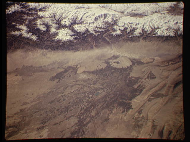
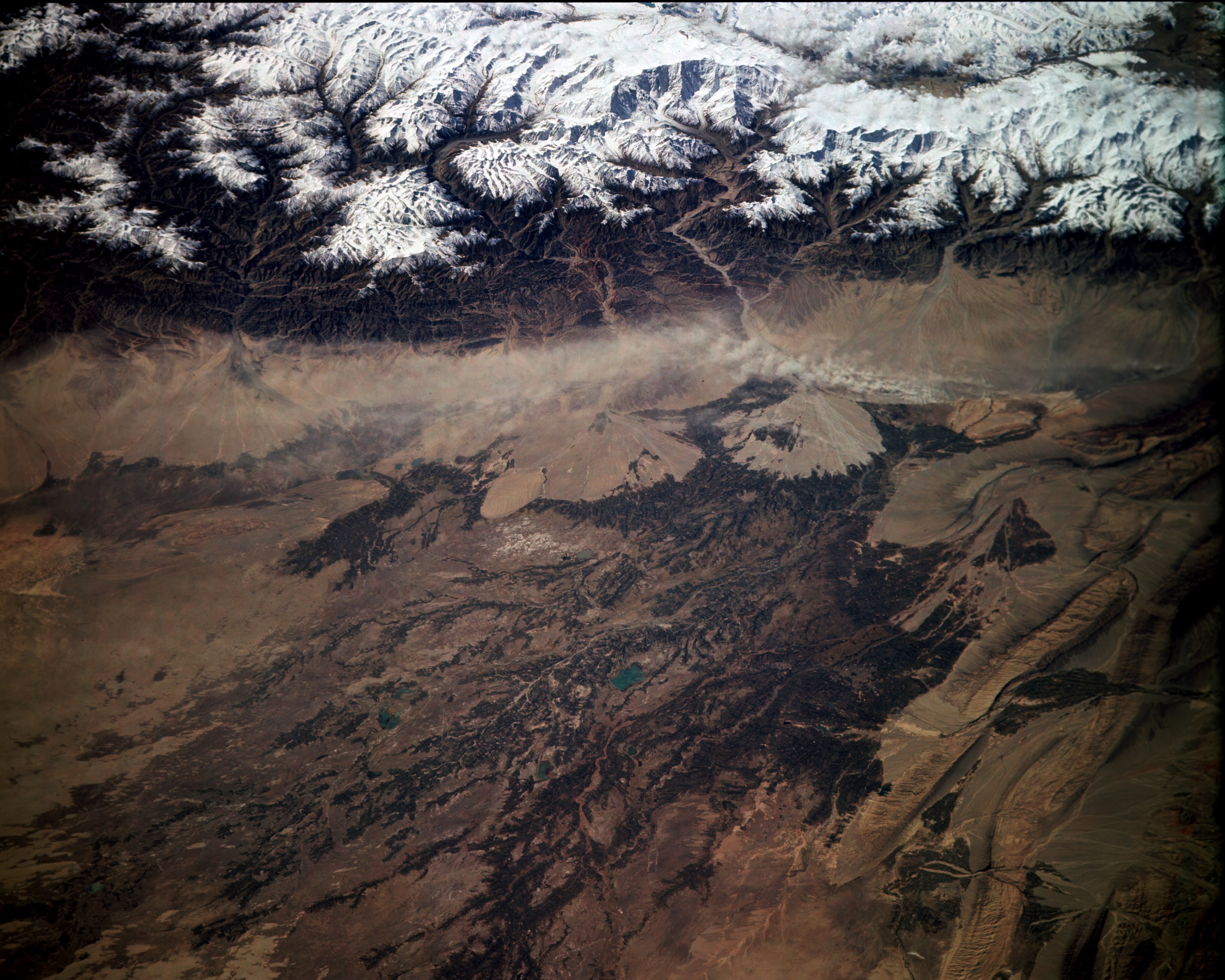
No GeoTIFF is available for this photo.Image Caption: STS068-163-136 Western Xinjiang Province, China October 1994
The snowcapped northwest Kunlun Mountains and Tien Mountains almost pinch together at the western end of the arid Tarim Basin in extreme western China as pictured in this low-oblique, southwest-looking photograph. The large alluvial fans along the northeast slopes of these mountains are the result of years of material deposition from glacial scouring and snowmelt. Many individual glaciers and glacial features are visible in this photograph. Because of the extensive browns and tans within the arid western Tarim Basin, surface water is assumed to be available for irrigation farming. No perennial rivers flow through this desert; only intermittent streams and rivers that originate in the surrounding mountains flow into the basin. Proof that the tributaries diminish and the water quality deteriorates as these streams flow from their source is provided as the browns become lighter with increased distance from water sources. Although not discernible at this scale, the city of Kashi is slightly west of center within the cultivated brown field patterns. A small dust storm appears to be blowing from west to east near the base of the alluvial fans at the foot of the Kunlun Mountains.
The snowcapped northwest Kunlun Mountains and Tien Mountains almost pinch together at the western end of the arid Tarim Basin in extreme western China as pictured in this low-oblique, southwest-looking photograph. The large alluvial fans along the northeast slopes of these mountains are the result of years of material deposition from glacial scouring and snowmelt. Many individual glaciers and glacial features are visible in this photograph. Because of the extensive browns and tans within the arid western Tarim Basin, surface water is assumed to be available for irrigation farming. No perennial rivers flow through this desert; only intermittent streams and rivers that originate in the surrounding mountains flow into the basin. Proof that the tributaries diminish and the water quality deteriorates as these streams flow from their source is provided as the browns become lighter with increased distance from water sources. Although not discernible at this scale, the city of Kashi is slightly west of center within the cultivated brown field patterns. A small dust storm appears to be blowing from west to east near the base of the alluvial fans at the foot of the Kunlun Mountains.
