< STS085-503-135 >
| NASA Photo ID | STS085-503-135 |
| Focal Length | 90mm |
| Date taken | 1997.08.__ |
| Time taken | GMT |
Resolutions offered for this image:
640 x 620 pixels
640 x 620 pixels
Cloud masks available for this image:
Spacecraft nadir point:
Photo center point: 56.0° N, 12.0° E
Photo center point by machine learning:
Photo center point: 56.0° N, 12.0° E
Photo center point by machine learning:
Nadir to Photo Center:
Spacecraft Altitude: nautical miles (0km)
Country or Geographic Name: | DENMARK |
Features: | PAN-JUTLAND, SJAELLAND |
| Features Found Using Machine Learning: | |
Cloud Cover Percentage: | 15 (11-25)% |
Sun Elevation Angle: | ° |
Sun Azimuth: | ° |
Camera: | Linhof |
Focal Length: | 90mm |
Camera Tilt: | High Oblique |
Format: | 5046: Kodak, natural color positive, Lumiere 100/5046, ASA 100, standard base |
Film Exposure: | Normal |
| Additional Information | |
| Width | Height | Annotated | Cropped | Purpose | Links |
|---|---|---|---|---|---|
| 640 pixels | 620 pixels | No | No | Photographic Highlights | Download Image |
Download Packaged File
Download a Google Earth KML for this Image
View photo footprint information
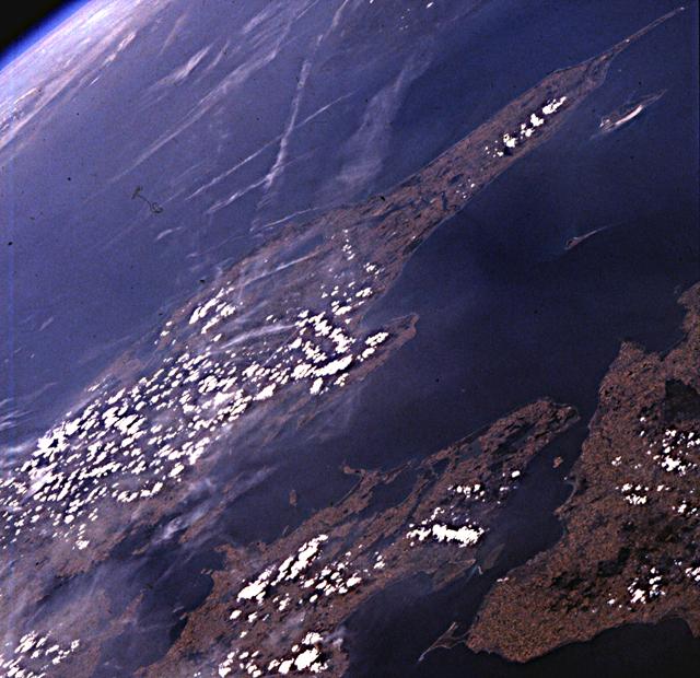
No GeoTIFF is available for this photo.Image Caption: Denmark. Splendid photograph of the peninsula of Jutland, the island of Sjaelland and parts of Mon,
Lolland and Fyn. Near the top of the view, the Skaggerak separates Norway and Denmark; in the
foreground, the Kattegat lies between Sweden and Denmark. Both glaciers and the rise of salt domes,
similar to those of the Texas (e.g., High Island, eastern Galveston Bay) and Louisiana coastal plain, have
contributed to the irregularity of the topography of Jutland.
