< ISS025-E-13115 >
| NASA Photo ID | ISS025-E-13115 |
| Focal Length | 400mm |
| Date taken | 2010.11.09 |
| Time taken | 06:41:09 GMT |
Resolutions offered for this image:
1000 x 634 pixels 540 x 342 pixels 720 x 480 pixels 4288 x 2929 pixels 640 x 437 pixels
1000 x 634 pixels 540 x 342 pixels 720 x 480 pixels 4288 x 2929 pixels 640 x 437 pixels


Spacecraft nadir point: 26.9° N, 83.1° E
Photo center point: 27.7° N, 85.3° E
Photo center point by machine learning: 27.70° N, 85.35° E
Photo center point: 27.7° N, 85.3° E
Photo center point by machine learning: 27.70° N, 85.35° E
Nadir to Photo Center: East
Spacecraft Altitude: 190 nautical miles (352km)

Camera: | Nikon D2Xs Electronic Still Camera |
Focal Length: | 400mm |
Camera Tilt: | 37 degrees |
Format: | 4288E: 4288 x 2848 pixel CMOS sensor, RGBG imager color filter |
Film Exposure: | |
| Additional Information | |
| Width | Height | Annotated | Cropped | Purpose | Links |
|---|---|---|---|---|---|
| 1000 pixels | 634 pixels | No | Yes | Earth From Space collection | Download Image |
| 540 pixels | 342 pixels | Yes | Yes | Earth From Space collection | Download Image |
| 720 pixels | 480 pixels | Yes | No | NASA's Earth Observatory web site | Download Image |
| 4288 pixels | 2929 pixels | No | No | Download Image | |
| 640 pixels | 437 pixels | No | No | Download Image |
Download Packaged File
Download a Google Earth KML for this Image
View photo footprint information
Download a GeoTIFF for this photo
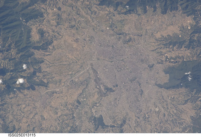
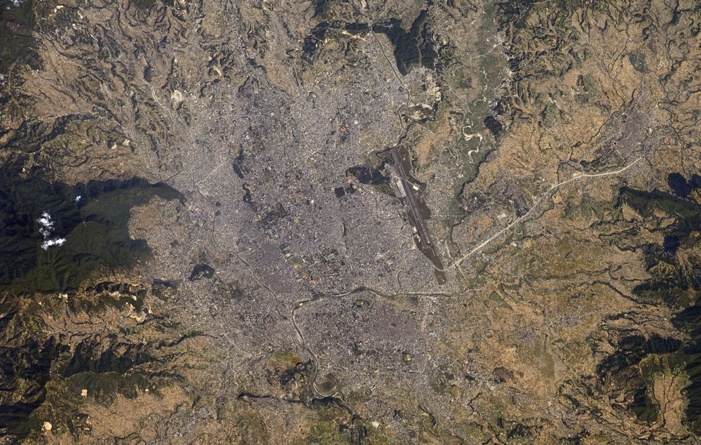
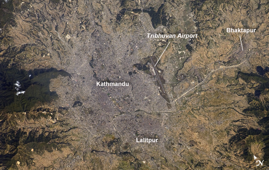
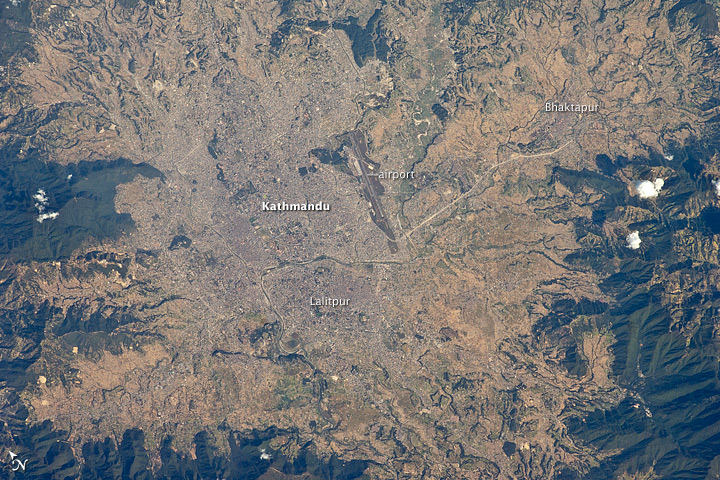
Image Caption: Kathmandu, Nepal
The capital and largest city of Nepal, Kathmandu, occupies much of the valley located near the center of the country. Nepal is home to much of the Himalaya mountain range between Tibet (China) to the north and India to the south. Geological and fossil evidence indicates that the Kathmandu Valley was covered by a large lake between approximately 2.8 million and 10,000 years ago. Paleo-Kathmandu Lake is thought to have drained in phases due to the drying of the regional climate; continuing mountain building--tectonic uplift and faulting--in the region; and the formation of an integrated drainage system, as river channels cut through previous rock ridge dams.
The green, vegetated slopes that ring the Kathmandu metro area (light gray, image center) include both forest reserves and national parks. The metropolitan area is relatively flat compared to the surrounding mountains. Tribhuvan International Airport, near the eastern margin of the city, is the only international airport in Nepal.
Archeological evidence suggests that the human development of Kathmandu, together with the nearby "sister cities" of Lalitpur and Bhaktapur, began almost 2,000 years ago. Today, Kathmandu and its sister cities form the governmental, cultural, and--as a main access point to the Himalayas for tourism--economic center of the country.
