ISS058-E-13106

| NASA Photo ID | ISS058-E-13106 |
| Focal Length | 50mm |
| Date taken | 2019.02.13 |
| Time taken | 10:54:27 GMT |
5011 x 3341 pixels 720 x 480 pixels 5568 x 3712 pixels 640 x 427 pixels
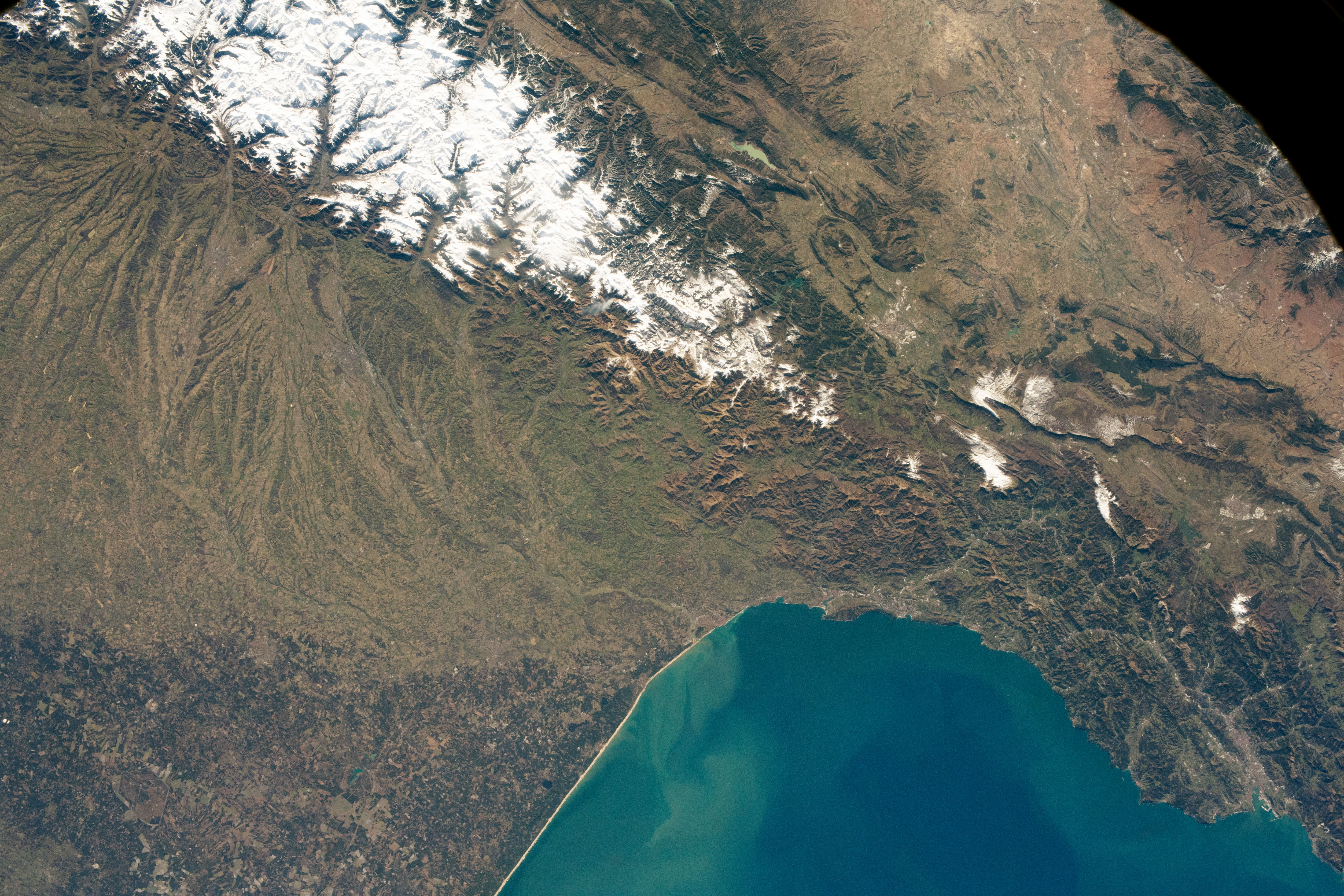

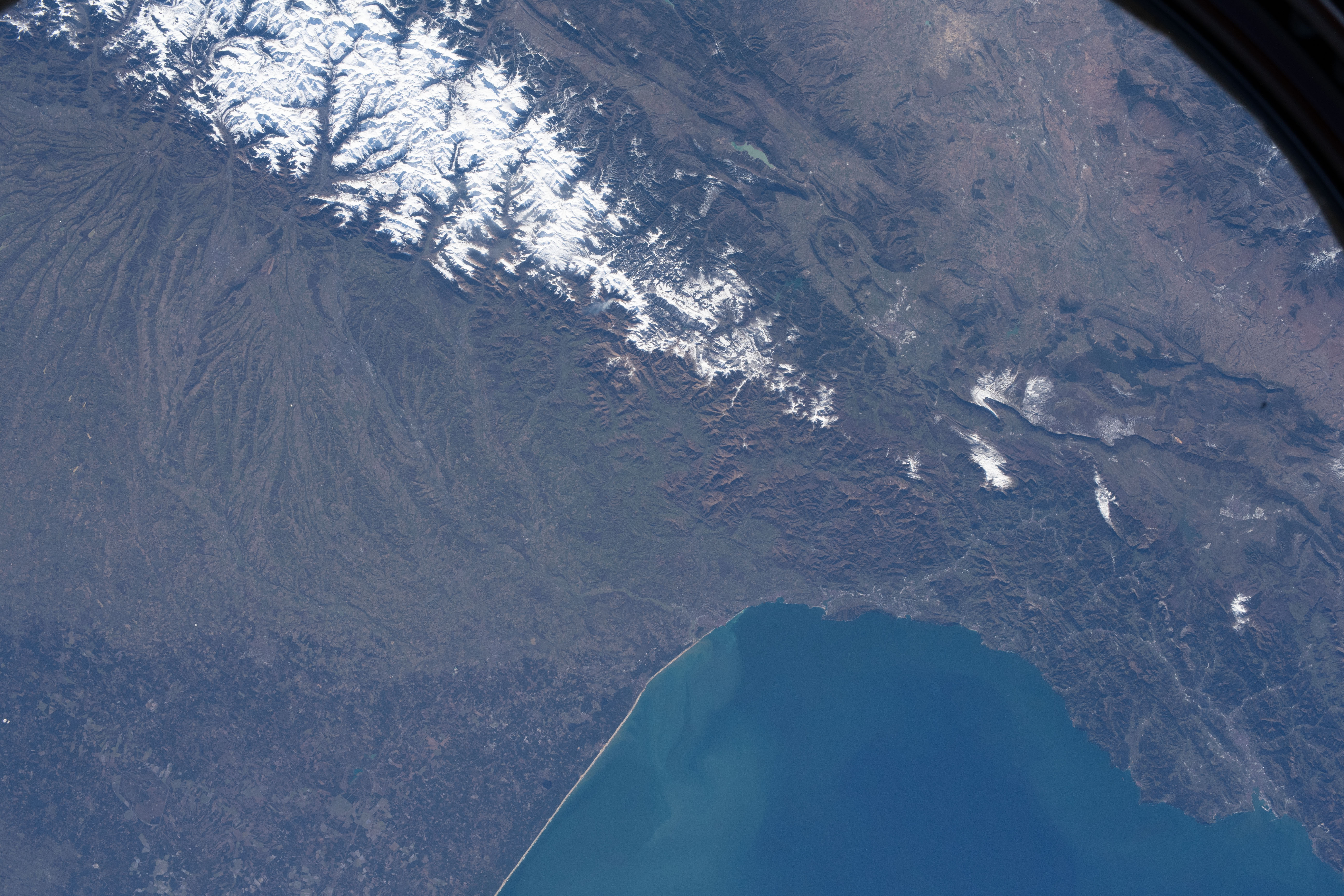


Photo center point: 43.0° N, 1.0° W
Photo center point by machine learning:
Country or Geographic Name: | FRANCE |
Features: | SPAIN, PYRENEES MTS., BAY OF BISCAY, PAMPLONA, SNOW |
| Features Found Using Machine Learning: | |
Cloud Cover Percentage: | 10 (1-10)% |
Sun Elevation Angle: | 30° |
Sun Azimuth: | 154° |
Camera: | Nikon D5 Electronic Still Camera |
Focal Length: | 50mm |
Camera Tilt: | 32 degrees |
Format: | 5568E: 5568 x 3712 pixel CMOS sensor, 35.9 x 23.9 mm, total pixels: 21.33 million, Nikon FX format |
Film Exposure: | |
| Additional Information | |
| Width | Height | Annotated | Cropped | Purpose | Links |
|---|---|---|---|---|---|
| 5011 pixels | 3341 pixels | No | No | NASA's Earth Observatory web site | Download Image |
| 720 pixels | 480 pixels | Yes | Yes | NASA's Earth Observatory web site | Download Image |
| 5568 pixels | 3712 pixels | No | No | Download Image | |
| 640 pixels | 427 pixels | No | No | Download Image |
An astronaut on the International Space Station (ISS) shot this photograph of the Pyrenees Mountains covered in snow on an early morning in February 2019.
The Pyrenees range stretches 430 kilometers (270 miles) from the Bay of Biscay in the Atlantic Ocean to the Mediterranean Sea, acting as a natural border between France and Spain. The central portion of the Pyrenees includes the highest summits of the range, with a maximum elevation of 3,404 meters (11,168 feet). It is also home to several small glaciers. The western Pyrenees typically receive greater precipitation than the eastern Pyrenees due to moisture blowing in from the Atlantic Ocean.
During the transition from winter to spring, glacial melt, snowmelt, and rainfall mobilize the sediment on the mountain slopes - a process that erodes the mountain peaks over geologic time. The sediment is carried down the slopes and carried further by rivers; some of that sediment is deposited into the Bay of Biscay.
A prominent feature of this region is the Lannemezan Megafan. This megafan started forming about 23 million years ago, when the region had a much wetter climate than today. Rivers cut into the mountain range and carried eroded sediment along the way. When those rivers reached the lower slopes at the base of the mountain, they spread out and deposited the sediments on the flat plains in a fan-shaped formation. The megafan is now abandoned, but still remains as a striking display of the fluvial history of the region.
