< SL4-52-13 >
| NASA Photo ID | SL4-52-13 |
| Focal Length | 152mm |
| Date taken | 1973.11.29 |
| Time taken | 18:56:55 GMT |

Cloud masks available for this image:
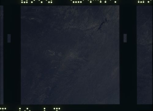
Spacecraft nadir point: 29.3° N, 100.0° W
Photo center point: 29.3° N, 100.0° W
Photo center point by machine learning:
Photo center point: 29.3° N, 100.0° W
Photo center point by machine learning:
Nadir to Photo Center:
Spacecraft Altitude: 239 nautical miles (443km)
Country or Geographic Name: | |
Features: | TEX., MEXICO (COAHUILA), DEL RIO, AMISTAD RES., SAN ANTONIO |
| Features Found Using Machine Learning: | |
Cloud Cover Percentage: | 0 (no clouds present) |
Sun Elevation Angle: | ° |
Sun Azimuth: | ° |
Camera: | Skylab Multispectral (S190A) |
Focal Length: | 152mm |
Camera Tilt: | 0 degrees |
Format: | SO356: Unknown SkyLab |
Film Exposure: | |
| Additional Information | |
| Width | Height | Annotated | Cropped | Purpose | Links |
|---|---|---|---|---|---|
| 6830 pixels | 4937 pixels | No | No | Download Image | |
| 500 pixels | 361 pixels | No | No | Download Image |
Download Packaged File
Download a Google Earth KML for this Image
View photo footprint information
No GeoTIFF is available for this photo.Image Caption: Southern edge of the Edwards Plateau, Balcones Escarpment. Rio Grande from Amistad Reservoir almost to Laredo, Balcones Escarpment from Del Rio to Lake Medina. Beginning of construction of Interstate 10 across the Plateau through Junction.
