< ISS026-E-12788 >
| NASA Photo ID | ISS026-E-12788 |
| Focal Length | 180mm |
| Date taken | 2010.12.26 |
| Time taken | 08:58:31 GMT |
Cloud masks available for this image:
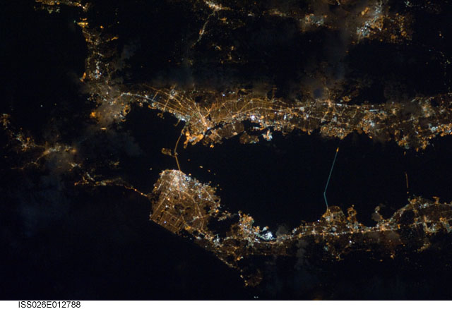
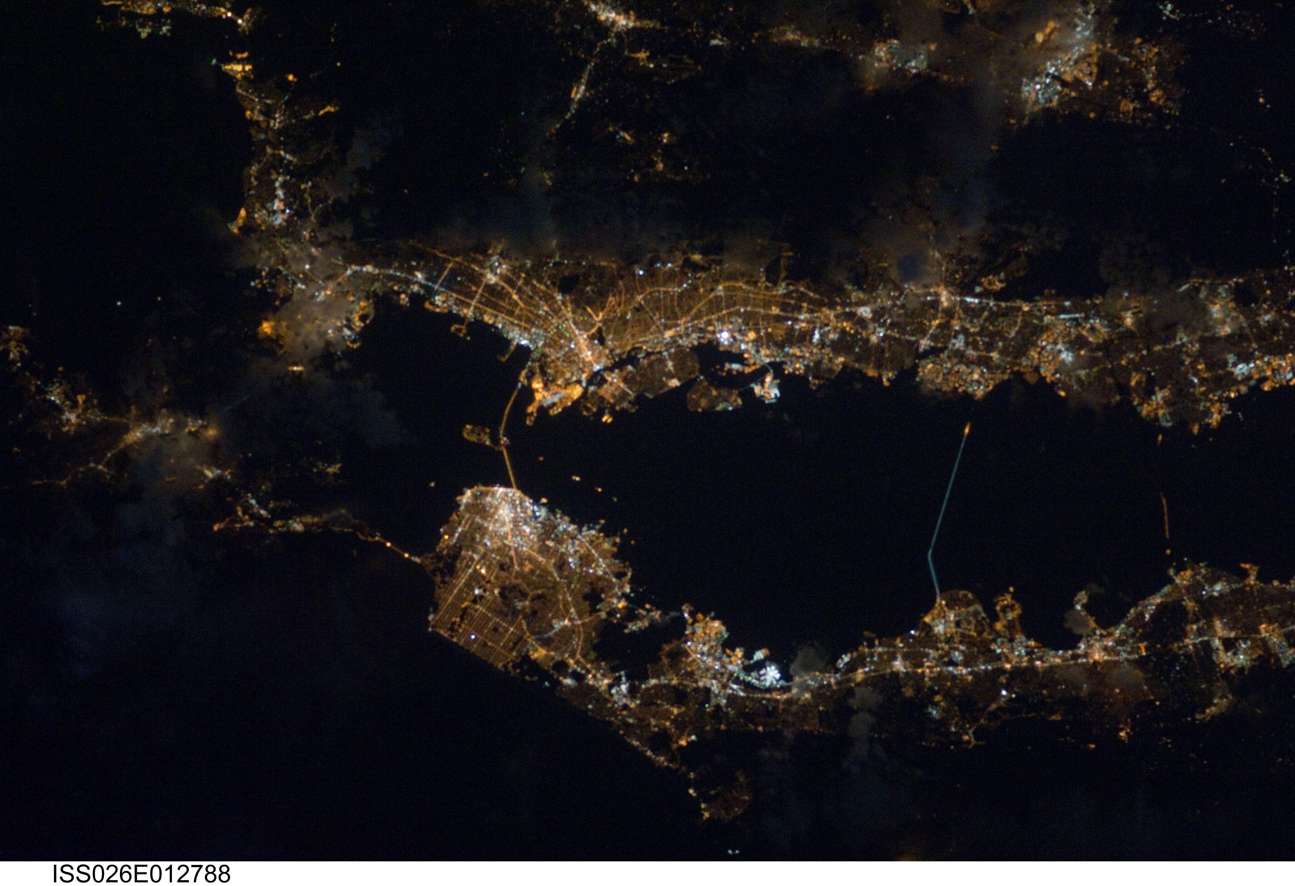
Spacecraft nadir point: 38.0° N, 120.5° W
Photo center point: 37.8° N, 122.3° W
Photo center point by machine learning: 37.75° N, 122.30° W
Photo center point: 37.8° N, 122.3° W
Photo center point by machine learning: 37.75° N, 122.30° W
Nadir to Photo Center: West
Spacecraft Altitude: 187 nautical miles (346km)

Country or Geographic Name: | USA-CALIFORNIA |
Features: | SAN FRANCISCO AT NIGHT |
| Features Found Using Machine Learning: | |
Cloud Cover Percentage: | 10 (1-10)% |
Sun Elevation Angle: | -71° |
Sun Azimuth: | 44° |
Camera: | Nikon D3S Electronic Still Camera |
Focal Length: | 180mm |
Camera Tilt: | 30 degrees |
Format: | 4256E: 4256 x 2832 pixel CMOS sensor, 36.0mm x 23.9mm, total pixels: 12.87 million, Nikon FX format |
Film Exposure: | |
| Additional Information | |
| Width | Height | Annotated | Cropped | Purpose | Links |
|---|---|---|---|---|---|
| 4256 pixels | 2913 pixels | No | No | Download Image | |
| 640 pixels | 438 pixels | No | No | Download Image |
Download Packaged File
Download a Google Earth KML for this Image
View photo footprint information
Download a GeoTIFF for this photo
Image Caption: ISS026-E-012788 (26 Dec. 2010) --- Though dark clouds limit the visibility of much of the eastern side (top of frame) of California's Bay Area, lights expose most of the region's highly populated areas. From 220 miles above Earth, the photo was recorded with a still camera equipped with a 180-mm lens on Dec. 26 by one of the crew members onboard the Earth-orbiting International Space Station.
