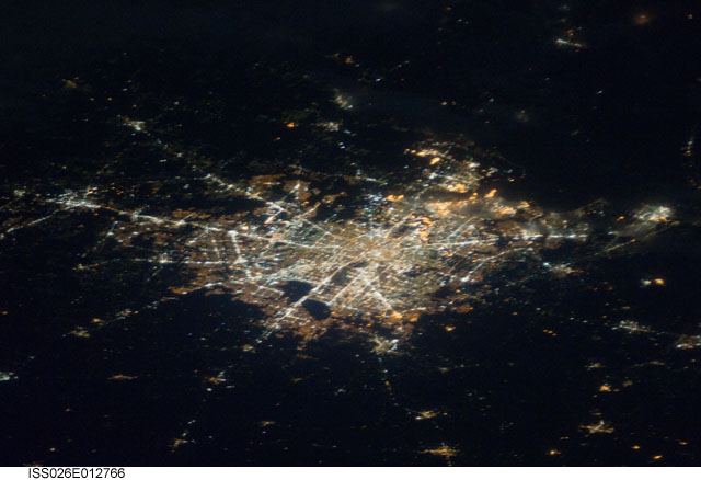
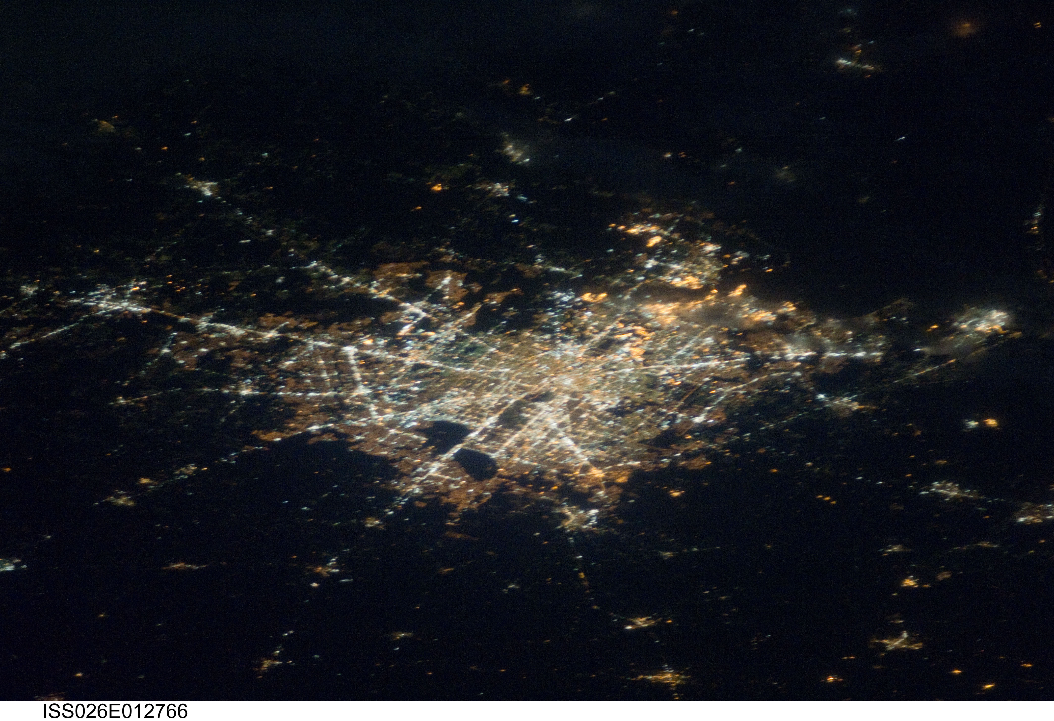
< ISS026-E-12766 >
| NASA Photo ID | ISS026-E-12766 |
| Focal Length | 180mm |
| Date taken | 2010.12.26 |
| Time taken | 07:29:18 GMT |
Cloud masks available for this image:
Spacecraft nadir point: 32.0° N, 89.4° W
Photo center point:
Photo center point by machine learning:
Photo center point:
Photo center point by machine learning:
Nadir to Photo Center:
Spacecraft Altitude: 187 nautical miles (346km)
Country or Geographic Name: | |
Features: | |
| Features Found Using Machine Learning: | |
Cloud Cover Percentage: | |
Sun Elevation Angle: | -68° |
Sun Azimuth: | 73° |
Camera: | NIKON D3S S/N: 2007934 |
Focal Length: | 180mm |
Camera Tilt: | |
Format: | |
Film Exposure: | |
| Additional Information | |
| Width | Height | Annotated | Cropped | Purpose | Links |
|---|---|---|---|---|---|
| 4256 pixels | 2913 pixels | No | No | Download Image | |
| 640 pixels | 438 pixels | No | No | Download Image |
Download Packaged File
Download a Google Earth KML for this Image
View photo footprint information
No GeoTIFF is available for this photo.Image Caption: ISS026-E-012766 (26 Dec. 2010) --- From 220 miles above Earth, one of the Expedition 26 crew members aboard the International Space Station took this picture of the Houston metropolitan area with a still camera equipped with a 180-mm lens. The view is from the west-southwest looking north-northeast. Bush International Airport is in the upper left part of the frame. Downtown is very near center.
