< ISS061-E-123196 >

| NASA Photo ID | ISS061-E-123196 |
| Focal Length | 210mm |
| Date taken | 2020.01.11 |
| Time taken | 00:28:37 GMT |
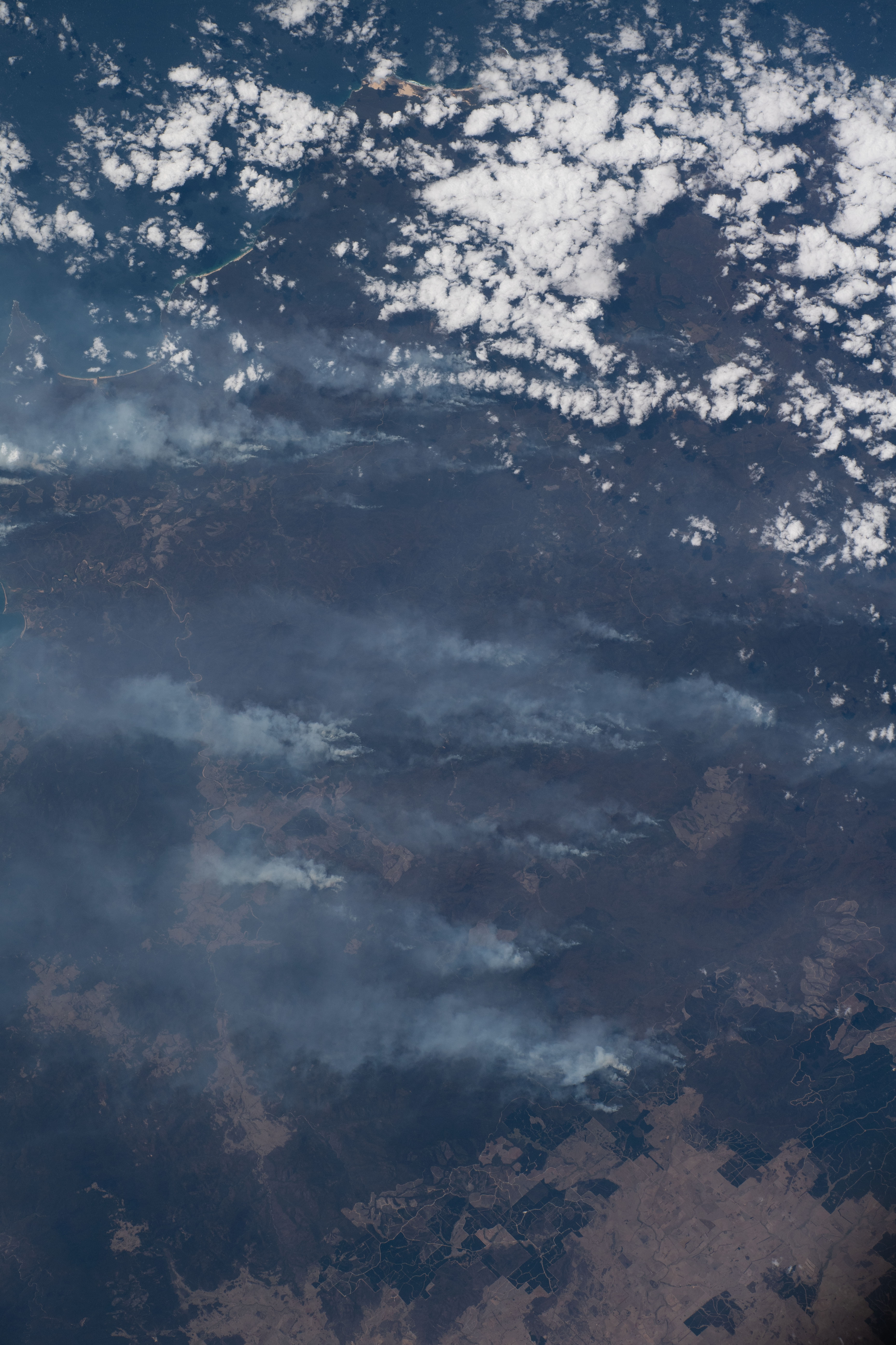

Spacecraft nadir point: 35.1° S, 147.6° E
Photo center point: 37.2° S, 149.6° E
Photo center point by machine learning:
Photo center point: 37.2° S, 149.6° E
Photo center point by machine learning:
Nadir to Photo Center: Southeast
Spacecraft Altitude: 228 nautical miles (422km)
Country or Geographic Name: | AUSTRALIA-NSW |
Features: | SMOKE PLUMES, FIRES, GREEN CAPE, PACIFIC OCEAN, NUNGATTA |
| Features Found Using Machine Learning: | |
Cloud Cover Percentage: | 25 (11-25)% |
Sun Elevation Angle: | 63° |
Sun Azimuth: | 68° |
Camera: | Nikon D5 Electronic Still Camera |
Focal Length: | 210mm |
Camera Tilt: | 37 degrees |
Format: | 5568E: 5568 x 3712 pixel CMOS sensor, 35.9 x 23.9 mm, total pixels: 21.33 million, Nikon FX format |
Film Exposure: | |
| Additional Information | |
| Width | Height | Annotated | Cropped | Purpose | Links |
|---|---|---|---|---|---|
| 3712 pixels | 5568 pixels | No | No | Download Image | |
| 427 pixels | 640 pixels | No | No | Download Image |
Download Packaged File
Download a Google Earth KML for this Image
View photo footprint information
No GeoTIFF is available for this photo.Georeferenced by human interaction - exported 2020-01-23-224140-UTC
An explanation of the georeference file(s) above
Image Caption: none
