< ISS026-E-12284 >
| NASA Photo ID | ISS026-E-12284 |
| Focal Length | 180mm |
| Date taken | 2010.12.23 |
| Time taken | 07:42:59 GMT |

Cloud masks available for this image:
Spacecraft nadir point: 42.4° N, 90.9° W
Photo center point:
Photo center point by machine learning:
Photo center point:
Photo center point by machine learning:
Nadir to Photo Center:
Spacecraft Altitude: 187 nautical miles (346km)
Country or Geographic Name: | |
Features: | |
| Features Found Using Machine Learning: | CHICAGO |
Cloud Cover Percentage: | |
Sun Elevation Angle: | -62° |
Sun Azimuth: | 56° |
Camera: | NIKON D3S S/N: 2007934 |
Focal Length: | 180mm |
Camera Tilt: | |
Format: | |
Film Exposure: | |
| Additional Information | |
| Width | Height | Annotated | Cropped | Purpose | Links |
|---|---|---|---|---|---|
| 4256 pixels | 2913 pixels | No | No | Download Image | |
| 640 pixels | 438 pixels | No | No | Download Image |
Download Packaged File
Download a Google Earth KML for this Image
View photo footprint information
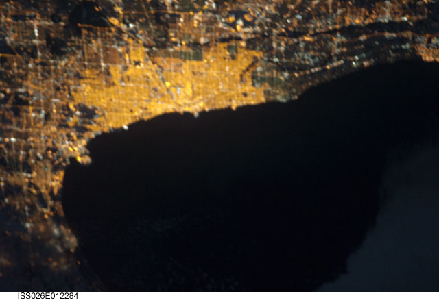
No GeoTIFF is available for this photo.Image Caption: ISS026-E-012284 (23 Dec. 2010) --- From 220 miles above Earth, one of the Expedition 26 crew members aboard the International Space Station recorded this night image of the Chicago metropolitan area and part of Lake Michigan, using a still camera equipped with a 180-mm lens.
