< ISS041-E-11814 >
| NASA Photo ID | ISS041-E-11814 |
| Focal Length | 60mm |
| Date taken | 2014.09.16 |
| Time taken | 15:28:04 GMT |
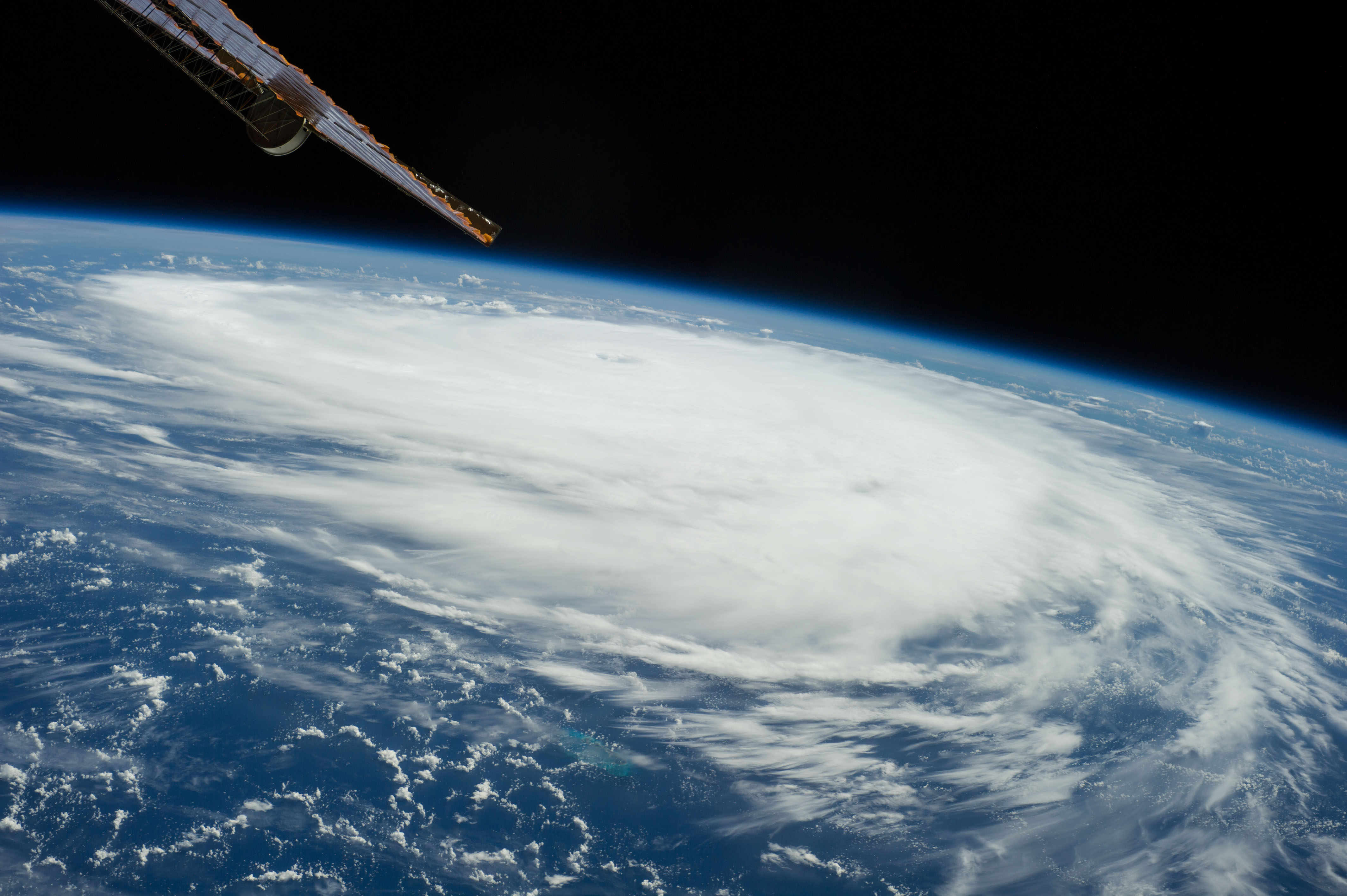
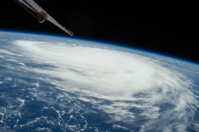
Spacecraft nadir point: 31.7° N, 70.3° W
Photo center point:
Photo center point by machine learning:
Photo center point:
Photo center point by machine learning:
Nadir to Photo Center:
Spacecraft Altitude: 222 nautical miles (411km)
Country or Geographic Name: | |
Features: | |
| Features Found Using Machine Learning: | PAN- |
Cloud Cover Percentage: | 61 (51-75)% |
Sun Elevation Angle: | 57° |
Sun Azimuth: | 148° |
Camera: | NIKON D3S S/N: 2008337 |
Focal Length: | 60mm |
Camera Tilt: | |
Format: | |
Film Exposure: | |
| Additional Information | |
| Width | Height | Annotated | Cropped | Purpose | Links |
|---|---|---|---|---|---|
| 4256 pixels | 2832 pixels | No | No | Download Image | |
| 640 pixels | 426 pixels | No | No | Download Image |
Download Packaged File
Download a Google Earth KML for this Image
View photo footprint information
No GeoTIFF is available for this photo.Image Caption: ISS041-E-011814 (16 Sept. 2014) --- Though having been upgraded from a tropical storm to a Category 2 hurricane, the Atlantic-borne Edouard thus far has avoided land interests as it reached maximum sustained winds of 105 miles per hout, churning in ocean waters several hundred miles southeast of Bermuda. The Expedition 41 crew members onboard the International Space Station photographed and distributed a series of images via station-to-ground downlinks and via social media. This photo was taken at 15:29:04 GMT on Sept. 16, 2014. Though it had well-defined eye at this juncture, the eye does not show clearly in this image, as it does in others.
