< ISS012-E-11654 >

| NASA Photo ID | ISS012-E-11654 |
| Focal Length | 180mm |
| Date taken | 2005.12.11 |
| Time taken | 08:08:40 GMT |
1000 x 663 pixels 540 x 358 pixels 540 x 405 pixels 1520 x 1008 pixels 639 x 435 pixels
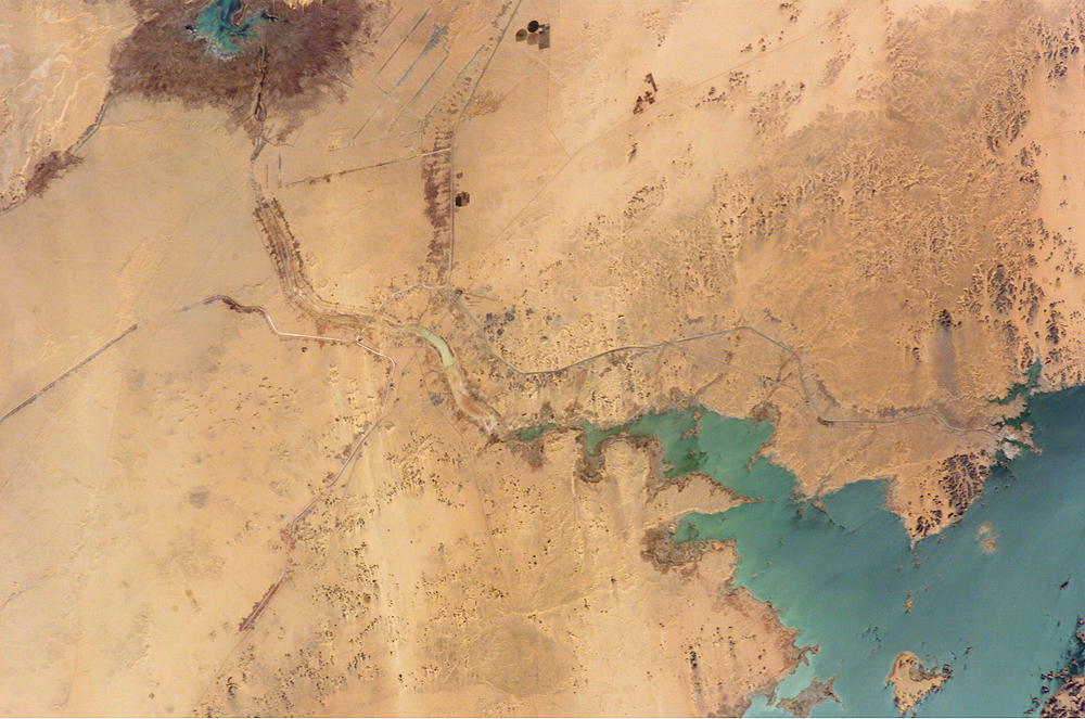
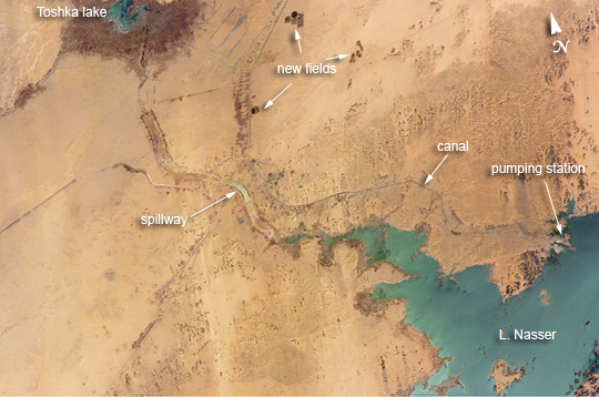
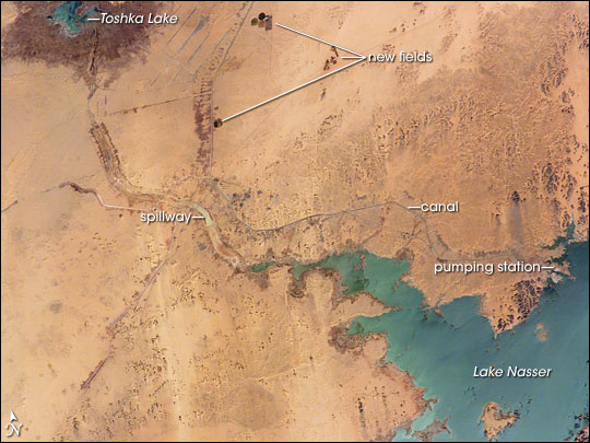
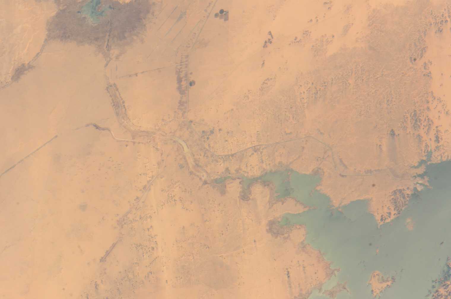


Photo center point: 22.5° N, 31.5° E
Photo center point by machine learning:
Country or Geographic Name: | EGYPT |
Features: | TOSHKA CANAL, CENTER PIVOTS |
| Features Found Using Machine Learning: | |
Cloud Cover Percentage: | 10 (1-10)% |
Sun Elevation Angle: | 36° |
Sun Azimuth: | 149° |
Camera: | Kodak DCS760c Electronic Still Camera |
Focal Length: | 180mm |
Camera Tilt: | 43 degrees |
Format: | 3060E: 3060 x 2036 pixel CCD, RGBG array |
Film Exposure: | |
| Additional Information | |
| Width | Height | Annotated | Cropped | Purpose | Links |
|---|---|---|---|---|---|
| 1000 pixels | 663 pixels | No | Yes | Earth From Space collection | Download Image |
| 540 pixels | 358 pixels | Yes | Yes | Earth From Space collection | Download Image |
| 540 pixels | 405 pixels | Yes | Yes | NASA's Earth Observatory web site | Download Image |
| 1520 pixels | 1008 pixels | No | No | Not enhanced | Download Image |
| 639 pixels | 435 pixels | No | No | Download Image |
Cycles of flood and drought in the African Sahel are legendary, and they have provided the impetus for major waterworks on Africa's great rivers. The construction of the Aswan High Dam on the Nile River, creating Lake Nasser in the 1960s, is the biggest and most visible project. Heavy rains in the source regions of the Nile in the 1990s resulted in record water levels in Lake Nasser. The abundance of water facilitated the Egyptian government's promotion of another massive water distribution system called the New Valley. In 1997, Lake Nasser began flooding westward down a spillway into the Toshka depression in southern Egypt, creating four new lakes over the next few years.
Following the initial flooding, a pumping station and canal were constructed in 2000 to maintain water flow into the region, allowing for industrial and agricultural development in the desert. This view shows the completed Mubarek Pumping Station on Lake Nasser, the spillway that originally flooded the Toshka depression, the southern end of the first of the Toshka Lakes, part of the 50-kilometer-long main canal (the Sheikh Zayed Canal), side canals, and several new fields in the Egyptian desert northwest of Lake Nasser. Astronauts, cosmonauts, and space-based sensors have been monitoring these developments in Egypt since their inception in the late 1990s. The New Valley's Toshka Lakes, and the new developments surrounding them, represent one of the most visible and rapid man-made changes on the Earth's surface.
