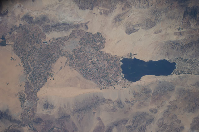
< ISS040-E-114379 >
| NASA Photo ID | ISS040-E-114379 |
| Focal Length | 80mm |
| Date taken | 2014.08.31 |
| Time taken | 16:57:28 GMT |
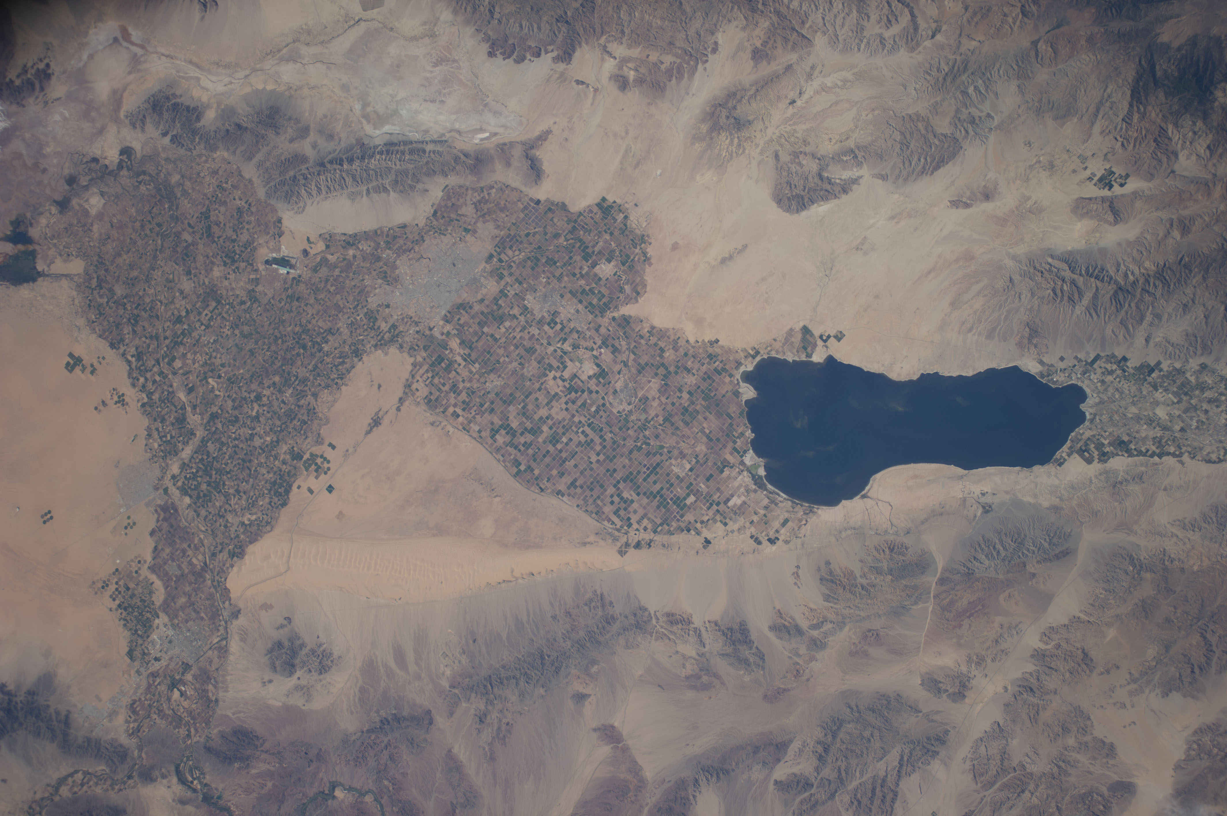


Spacecraft nadir point: 35.2° N, 115.2° W
Photo center point:
Photo center point by machine learning:
Photo center point:
Photo center point by machine learning:
Nadir to Photo Center:
Spacecraft Altitude: 221 nautical miles (409km)
Country or Geographic Name: | |
Features: | |
| Features Found Using Machine Learning: | |
Cloud Cover Percentage: | 1 (1-10)% |
Sun Elevation Angle: | 44° |
Sun Azimuth: | 115° |
Camera: | NIKON D3S S/N: 2007945 |
Focal Length: | 80mm |
Camera Tilt: | |
Format: | |
Film Exposure: | |
| Additional Information | |
| Width | Height | Annotated | Cropped | Purpose | Links |
|---|---|---|---|---|---|
| 4256 pixels | 2832 pixels | No | No | Download Image | |
| 640 pixels | 426 pixels | No | No | Download Image |
Download Packaged File
Download a Google Earth KML for this Image
View photo footprint information
No GeoTIFF is available for this photo.Image Caption: ISS040-E-114379 (31 Aug. 2014) --- One of the Expedition 40 crew members aboard the Earth-orbiting International Space Station, flying at an altitude of approximately 225 nautical miles, photographed this image of California's Salton Sea on Aug. 31, 2014. The body of water is actually a shallow, saline, endorheic rift lake located directly on the San Andreas Fault, predominantly in the Imperial and Coachella Valleys.
