< STS037-152-114 >
| NASA Photo ID | STS037-152-114 |
| Focal Length | 250mm |
| Date taken | 1991.04.07 |
| Time taken | 05:36:39 GMT |

Cloud masks available for this image:
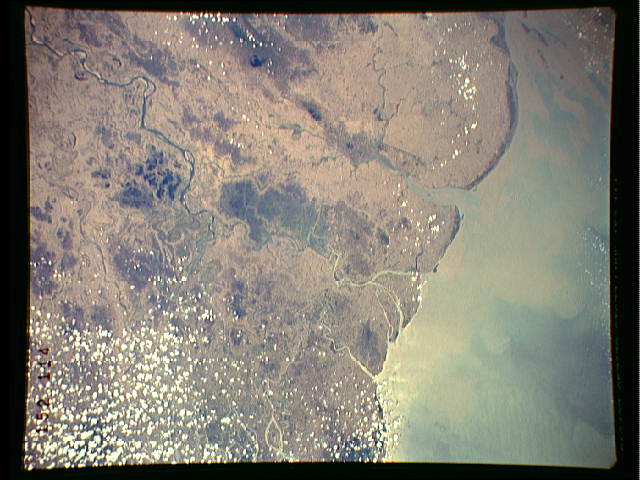
Spacecraft nadir point: 16.3° N, 95.7° E
Photo center point: 16.5° N, 96.0° E
Photo center point by machine learning:
Photo center point: 16.5° N, 96.0° E
Photo center point by machine learning:
Nadir to Photo Center: Northeast
Spacecraft Altitude: 245 nautical miles (454km)
Country or Geographic Name: | MYANMAR (BURMA) |
Features: | IRRAWADDY RIVER DELTA |
| Features Found Using Machine Learning: | |
Cloud Cover Percentage: | 15 (11-25)% |
Sun Elevation Angle: | 80° |
Sun Azimuth: | 176° |
Camera: | Linhof |
Focal Length: | 250mm |
Camera Tilt: | 5 degrees |
Format: | QX868: Kodak, natural color positive, Ektachrome QX868(5017 emulsion), ASA 64, thin base |
Film Exposure: | Normal |
| Additional Information | |
| Width | Height | Annotated | Cropped | Purpose | Links |
|---|---|---|---|---|---|
| 640 pixels | 480 pixels | No | No | ISD 1 | Download Image |
| 2201 pixels | 2804 pixels | No | No | Download Image |
Download Packaged File
Download a Google Earth KML for this Image
View photo footprint information
No GeoTIFF is available for this photo.Image Caption: none
