< STS037-151-113 >
| NASA Photo ID | STS037-151-113 |
| Focal Length | 250mm |
| Date taken | 1991.04.06 |
| Time taken | 04:43:56 GMT |
Resolutions offered for this image:
640 x 480 pixels
640 x 480 pixels
Cloud masks available for this image:
Spacecraft nadir point: 12.6° N, 125.3° E
Photo center point: 14.5° N, 121.0° E
Photo center point by machine learning:
Photo center point: 14.5° N, 121.0° E
Photo center point by machine learning:
Nadir to Photo Center: West
Spacecraft Altitude: 244 nautical miles (452km)Body: Earth
Country or Geographic Name: | PHILIPPINES |
Features: | LUZON-MANILLA BAY |
| Features Found Using Machine Learning: | |
Cloud Cover Percentage: | 25 (11-25)% |
Sun Elevation Angle: | 73° |
Sun Azimuth: | 249° |
Camera: | Linhof |
Focal Length: | 250mm |
Camera Tilt: | 49 degrees |
Format: | QX868: Kodak, natural color positive, Ektachrome QX868(5017 emulsion), ASA 64, thin base |
Film Exposure: | Normal |
| Additional Information | |
| Width | Height | Annotated | Cropped | Purpose | Links |
|---|---|---|---|---|---|
| 640 pixels | 480 pixels | No | No | ISD 1 | Download Image |
Download Packaged File
Download a Google Earth KML for this Image
View photo footprint information
No GeoTIFF is available for this photo.Image Caption:
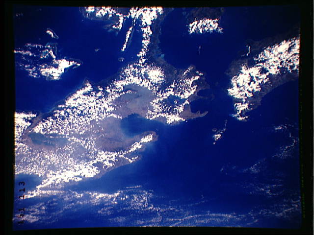
S37-151-113 Oblique photo of Luzon, Philippines Centered on Mani-
la Bay, the island of Corrigedor is obvious at the mouth of the
Bay midway between Bataan Peninsula (to the north ) and Taal Lake
(south). Taal , an active volcano erupted almost annually from
1965-1977, and became seismically active in early April. An in-
cipient eruption was expected. The large three-pronged lake west
of the city of Manila is Laguna de Bai, a large, water- filled
caldera and a fertile fishing area.
S37-151-113 Oblique photo of Luzon, Philippines Centered on Mani-
la Bay, the island of Corrigedor is obvious at the mouth of the
Bay midway between Bataan Peninsula (to the north ) and Taal Lake
(south). Taal , an active volcano erupted almost annually from
1965-1977, and became seismically active in early April. An in-
cipient eruption was expected. The large three-pronged lake west
of the city of Manila is Laguna de Bai, a large, water- filled
caldera and a fertile fishing area.

