< STS043-151-112 >
| NASA Photo ID | STS043-151-112 |
| Focal Length | 90mm |
| Date taken | 1991.08.09 |
| Time taken | 13:50:48 GMT |
Resolutions offered for this image:
640 x 480 pixels
640 x 480 pixels
Cloud masks available for this image:
Spacecraft nadir point: 20.3° S, 14.1° E
Photo center point: 21.5° S, 15.0° E
Photo center point by machine learning:
Photo center point: 21.5° S, 15.0° E
Photo center point by machine learning:
Nadir to Photo Center: Southeast
Spacecraft Altitude: 166 nautical miles (307km)
Country or Geographic Name: | NAMIBIA |
Features: | COASTBRANDBERG AREA |
| Features Found Using Machine Learning: | |
Cloud Cover Percentage: | 20 (11-25)% |
Sun Elevation Angle: | 36° |
Sun Azimuth: | 309° |
Camera: | Linhof |
Focal Length: | 90mm |
Camera Tilt: | 28 degrees |
Format: | QX868: Kodak, natural color positive, Ektachrome QX868(5017 emulsion), ASA 64, thin base |
Film Exposure: | Normal |
| Additional Information | |
| Width | Height | Annotated | Cropped | Purpose | Links |
|---|---|---|---|---|---|
| 640 pixels | 480 pixels | No | No | ISD 1 | Download Image |
Download Packaged File
Download a Google Earth KML for this Image
View photo footprint information
No GeoTIFF is available for this photo.Image Caption:
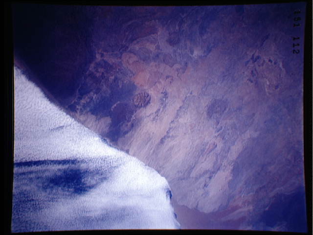
S43-151-112 - Namibia
The Brandburg, (round "plug") is the highest point in Namibia,
reaching 8,000 feet above sea level. Wind streaks in the coastal
desert are aligned NE-SW, caused by sand storms that are fre-
quently seen on weather satellite imagery. Coastal stratus clouds
can penetrate 60km inland, providing much of the moisture in this
extremely arid land as fog droplets; actual rainfall may be less
than 1/4 inch per year for decades at a time. Linhof camera,
90mm lens, 9 August 1991, 13:51 GMT
The Brandburg Prominance, Namibia (21.5N, 15.0E) is a round basaltic plug and is the highest feature (over 8,000 ft) in the country. Wind streaks on the surface of the coastal desert, aligned northeast to southwest, are the result of frequent sand storms. Coastal stratus clouds provide most of the life supporting moisture as fog droplets in this arid land where annual rainfall may be less than a quarter of an inch for decades at a time.
