< ISS036-E-10646 >

| NASA Photo ID | ISS036-E-10646 |
| Focal Length | 400mm |
| Date taken | 2013.06.23 |
| Time taken | 10:23:15 GMT |
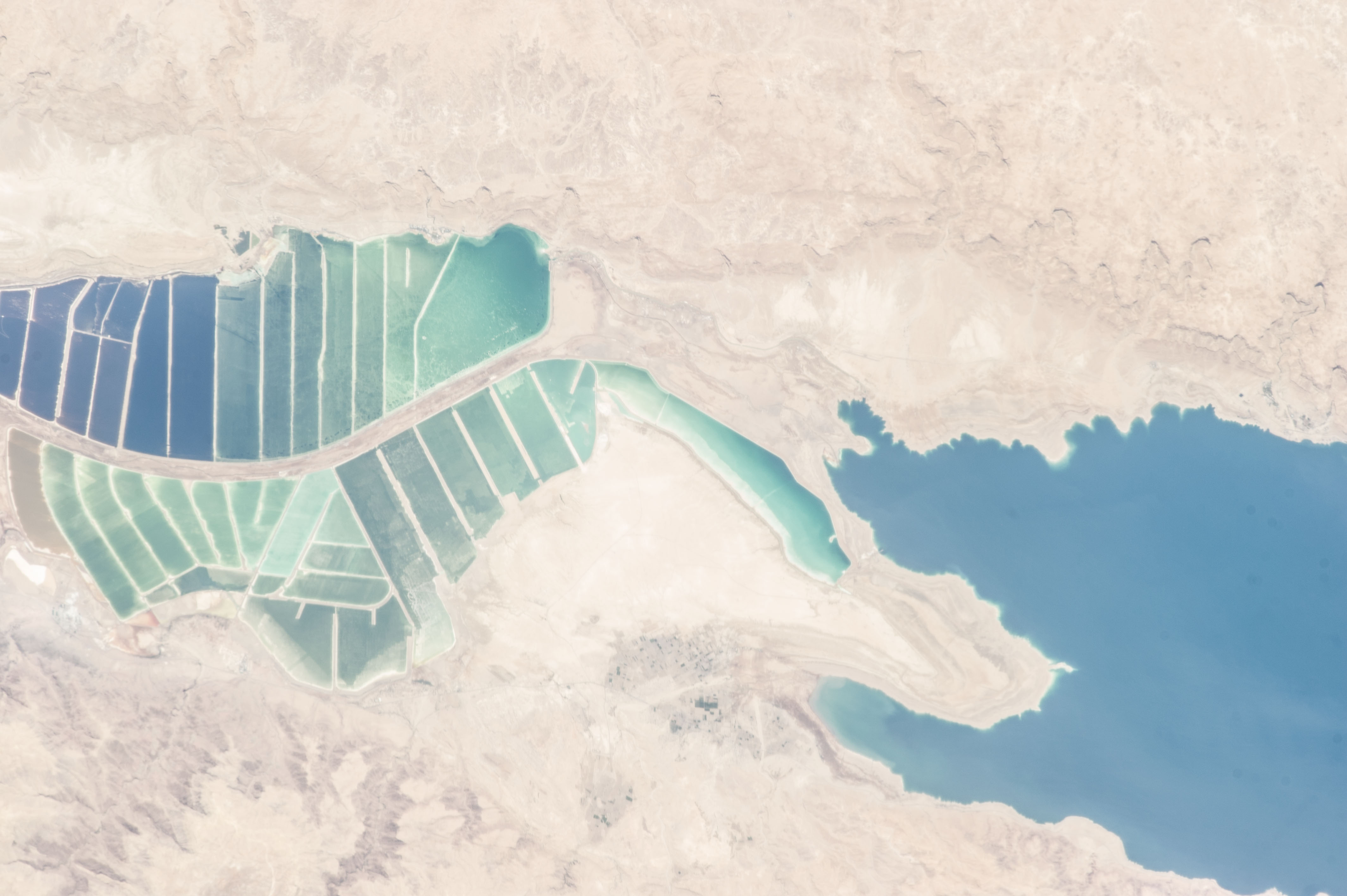


Spacecraft nadir point: 31.3° N, 38.4° E
Photo center point: 31.3° N, 35.4° E
Photo center point by machine learning: 31.27° N, 35.43° E
Photo center point: 31.3° N, 35.4° E
Photo center point by machine learning: 31.27° N, 35.43° E
Nadir to Photo Center: West
Spacecraft Altitude: 220 nautical miles (407km)

Country or Geographic Name: | JORDAN |
Features: | PUBLIC INPUTS (from public image detectives, not NASA): ISRAEL, JORDAN, DEAD SEA, SALT POOLS,THE DEAD SEA, AL MAZRAA, JORDAN; EIN BOKEK, ISRAEL,DEAD SEA, SALT EVAPORATION PANS, CAUSEWAY,DEAD SEA, ISRAEL, JORDAN,AL MAZRAA, DEAD SEA, SAFI, TAMAR REGIONAL COUNCIL,DEAD SEA, SAFI, AL MAZREA, TAMAR REGIONAL COUNCIL, 1994 TREATY LINE, ISRAEL-JORDAN BORDER, IRRIGATION,ISRAEL-JORDAN BORDER, DEAD SEA, AL MAZRAA,JORDAN-ISRAEL BORDER, EIN BOKEK, 31.27,35.43,AL MAZRAA JORDAN, EIN BOKEK ISRAEL, DEAD SEA, DEAD SEA WORKS, EVAPORATION PONDS,JORDAN RIVER |
| Features Found Using Machine Learning: | |
Cloud Cover Percentage: | 10 (1-10)% |
Sun Elevation Angle: | 76° |
Sun Azimuth: | 241° |
Camera: | Nikon D3S Electronic Still Camera |
Focal Length: | 400mm |
Camera Tilt: | 39 degrees |
Format: | 4256E: 4256 x 2832 pixel CMOS sensor, 36.0mm x 23.9mm, total pixels: 12.87 million, Nikon FX format |
Film Exposure: | |
| Additional Information | |
| Width | Height | Annotated | Cropped | Purpose | Links |
|---|---|---|---|---|---|
| 4256 pixels | 2832 pixels | No | No | Download Image | |
| 640 pixels | 426 pixels | No | No | Download Image |
Download Packaged File
Download a Google Earth KML for this Image
View photo footprint information
No GeoTIFF is available for this photo.Image Caption: none
