< ISS043-E-101832 >

| NASA Photo ID | ISS043-E-101832 |
| Focal Length | 1150mm |
| Date taken | 2015.04.12 |
| Time taken | 09:59:42 GMT |
Resolutions offered for this image:
1000 x 666 pixels 540 x 360 pixels 4928 x 3280 pixels 720 x 480 pixels 4928 x 3280 pixels 640 x 426 pixels
1000 x 666 pixels 540 x 360 pixels 4928 x 3280 pixels 720 x 480 pixels 4928 x 3280 pixels 640 x 426 pixels


Spacecraft nadir point: 20.2° S, 45.5° E
Photo center point: 19.7° S, 44.4° E
Photo center point by machine learning: 19.69° S, 44.44° E
Photo center point: 19.7° S, 44.4° E
Photo center point by machine learning: 19.69° S, 44.44° E
Nadir to Photo Center: West
Spacecraft Altitude: 219 nautical miles (406km)

Country or Geographic Name: | MADAGASCAR |
Features: | TSIRIBIHINA R. DELTA, FLOOD WATER |
| Features Found Using Machine Learning: | |
Cloud Cover Percentage: | 10 (1-10)% |
Sun Elevation Angle: | 58° |
Sun Azimuth: | 331° |
Camera: | Nikon D4 Electronic Still Camera |
Focal Length: | 1150mm |
Camera Tilt: | 18 degrees |
Format: | 4928E: 4928 x 3280 pixel CMOS sensor, 36.0mm x 23.9mm, total pixels: 16.6 million, Nikon FX format |
Film Exposure: | |
| Additional Information | |
| Width | Height | Annotated | Cropped | Purpose | Links |
|---|---|---|---|---|---|
| 1000 pixels | 666 pixels | No | No | Earth From Space collection | Download Image |
| 540 pixels | 360 pixels | Yes | No | Earth From Space collection | Download Image |
| 4928 pixels | 3280 pixels | No | No | NASA's Earth Observatory web site | Download Image |
| 720 pixels | 480 pixels | Yes | No | NASA's Earth Observatory web site | Download Image |
| 4928 pixels | 3280 pixels | No | No | Download Image | |
| 640 pixels | 426 pixels | No | No | Download Image |
Download Packaged File
Download a Google Earth KML for this Image
View photo footprint information
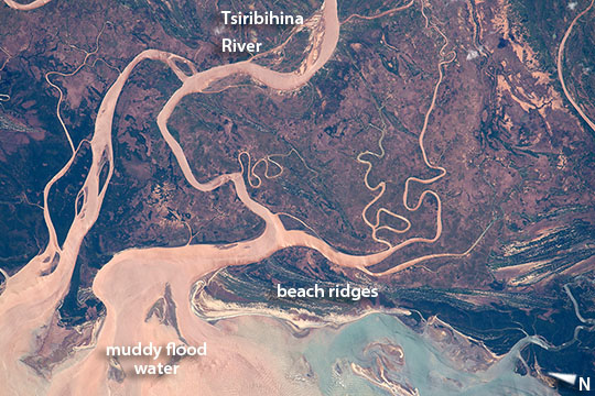
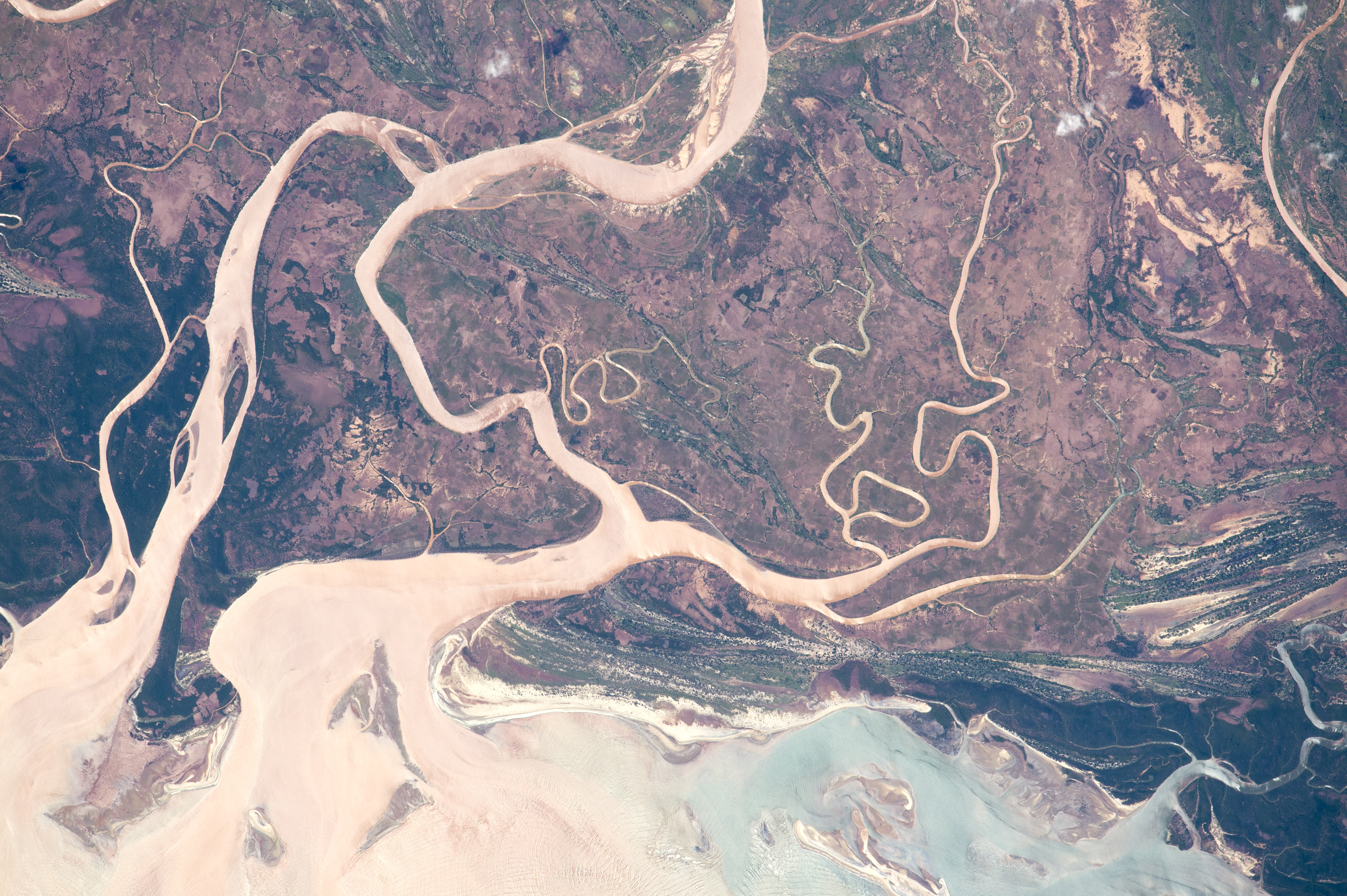
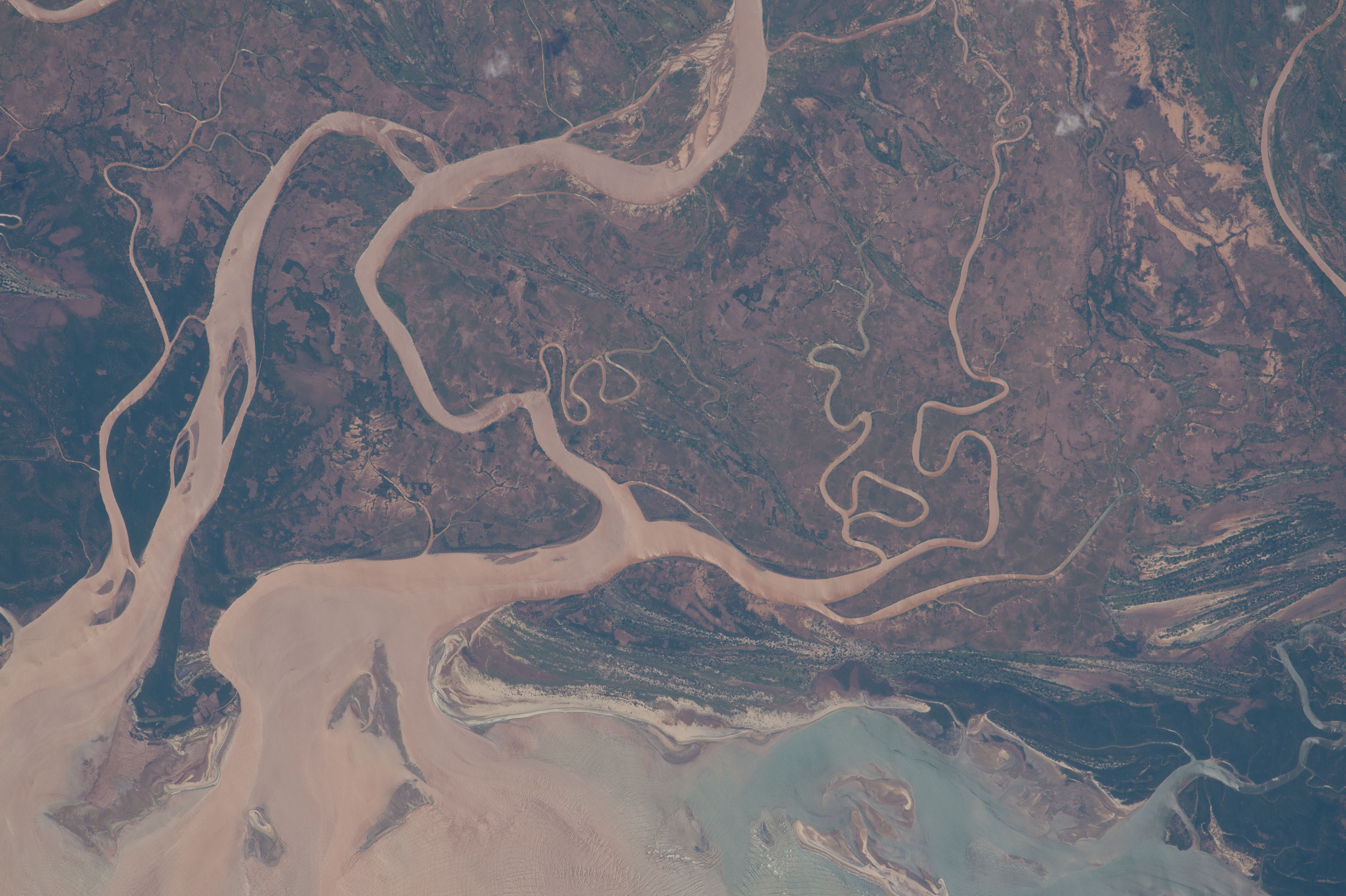
No GeoTIFF is available for this photo.Image Caption: Tsiribihina River, Madagascar
Astronauts aboard the International Space Station took this image of muddy floodwaters and distributary channels in the northern sector of the Tsiribihina River delta on Madagascar's west coast. Delta distributaries have two morphologies, large and relatively straight, and the small, highly contorted channels between. Brown sediment from recent heavy rains reaches the sea where it is swept slowly north by local ocean currents (image lower left), with clearer blue water visible lower right. Over thousands of years sediment supplied by the river is shaped by waves along the shoreline into beach ridges--which appear as numerous parallel lines (image lower center and image right). Each line represents a prior coastline on this geologically fast-changing coast, with the oldest coastline lying furthest inland.
Four cyclones have hit Madagascar already by mid April, 2015. Heavier floods than those seen here followed a mid-January storm and affected not only the 50 km (31 mi) shoreline of the delta but also the lower 75 km (47 mi) of the river.
