< ISS024-E-10162 >

| NASA Photo ID | ISS024-E-10162 |
| Focal Length | 180mm |
| Date taken | 2010.07.31 |
| Time taken | 10:47:22 GMT |
Resolutions offered for this image:
1000 x 689 pixels 540 x 372 pixels 720 x 480 pixels 4288 x 2929 pixels 640 x 437 pixels
1000 x 689 pixels 540 x 372 pixels 720 x 480 pixels 4288 x 2929 pixels 640 x 437 pixels


Spacecraft nadir point: 41.9° N, 28.3° E
Photo center point: 40.8° N, 29.9° E
Photo center point by machine learning:
Photo center point: 40.8° N, 29.9° E
Photo center point by machine learning:
Nadir to Photo Center: Southeast
Spacecraft Altitude: 187 nautical miles (346km)
Country or Geographic Name: | TURKEY |
Features: | GULF OF IZMIT, IZMIT, GOLCUK, BAHCECIK |
| Features Found Using Machine Learning: | |
Cloud Cover Percentage: | 10 (1-10)% |
Sun Elevation Angle: | 65° |
Sun Azimuth: | 200° |
Camera: | Nikon D2Xs Electronic Still Camera |
Focal Length: | 180mm |
Camera Tilt: | 32 degrees |
Format: | 4288E: 4288 x 2848 pixel CMOS sensor, RGBG imager color filter |
Film Exposure: | |
| Additional Information | |
| Width | Height | Annotated | Cropped | Purpose | Links |
|---|---|---|---|---|---|
| 1000 pixels | 689 pixels | No | Yes | Earth From Space collection | Download Image |
| 540 pixels | 372 pixels | Yes | Yes | Earth From Space collection | Download Image |
| 720 pixels | 480 pixels | Yes | Yes | NASA's Earth Observatory web site | Download Image |
| 4288 pixels | 2929 pixels | No | No | Download Image | |
| 640 pixels | 437 pixels | No | No | Download Image |
Download Packaged File
Download a Google Earth KML for this Image
View photo footprint information
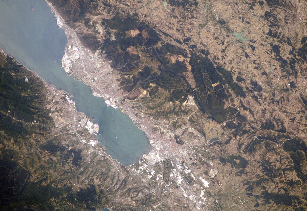
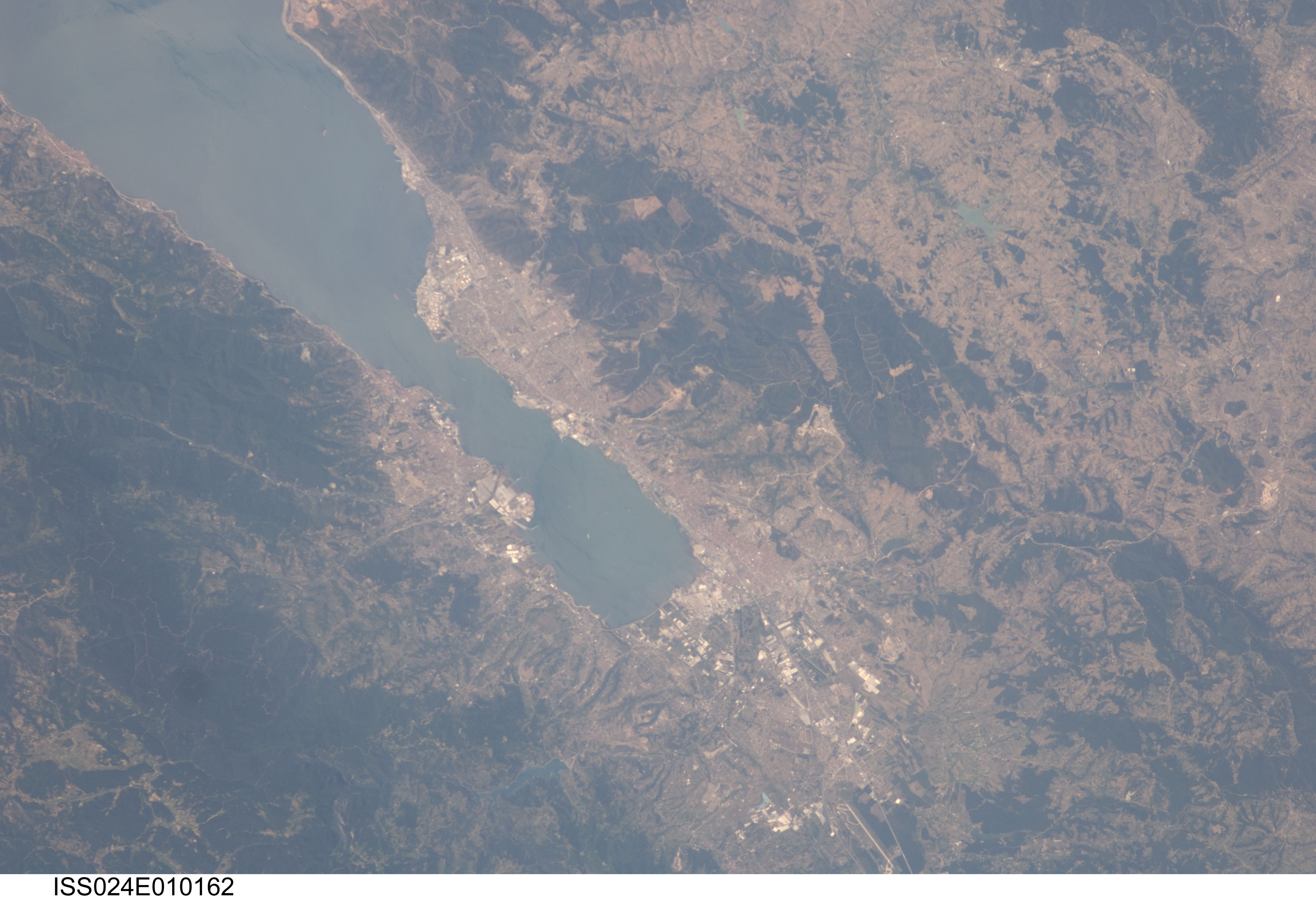
No GeoTIFF is available for this photo.Image Caption: Gulf of Izmit, Turkey
One of the most industrialized areas of Turkey lies at the eastern edge of the Sea of Marmara, at the end of the Gulf of Izmit. The long, narrow waterway provides ship access to the cities of Izmit and Golcuk. This astronaut photograph highlights the metropolitan area of Izmit along the northern and eastern shores. Commercial and industrial centers--including petroleum refineries and automobile factories--are recognizable by large structures with white rooftops. The city of Izmit, then known as Nicomedia, was part of the Roman Empire and served as its easternmost capital before Constantinople (modern-day Istanbul) assumed that role in 330 AD. Izmit is located approximately 83 kilometers (52 miles) to the east-southeast of Istanbul.
The smaller city of Golcuk on the southern shoreline of the Gulf is the location of a Turkish naval facility and another automobile factory. Both urban areas are built primarily on flat lowlands adjacent to the Gulf, with green vegetation marking highland areas to the north of Izmit and south of Golcuk. Both the Izmit and Golcuk areas were severely damaged by a magnitude-7.4 earthquake on August 17, 1999, that resulted in over 17,000 fatalities. The earthquake occurred along the North Anatolian strike-slip fault that extends roughly east-west beneath the Gulf of Izmit.
